Enhancing Pavement Assessments with Reality Data Capture Technology Maintaining the integrity of our roadways is essential for safe and efficient transportation. Pavement assessments are a critical part of this maintenance process, helping to...
Understanding Digital Surface Models, Digital Terrain Models, and Digital Elevation Models
Understanding Digital Surface Models, Digital Terrain Models, and Digital Elevation Models Elevation data is critical for a wide range of applications in various fields. It plays a key role in helping us better understand and manage the Earth’s...
Unleashing Potential: The Expanding Horizons of Drone Pilot Opportunities
Unleashing Potential: The Expanding Horizons of Drone Pilot Opportunities The drone industry is experiencing an exhilarating phase of evolution driven by technological advancements and an increasing demand for diverse applications. From...
Navigating the Skies: The Essential Guide to Drone Safety in Work Zones
Navigating the Skies: The Essential Guide to Drone Safety in Work Zones As drones continue to significantly enhance professional settings, understanding the intricacies of flying these high-tech devices amidst the bustling environment of work zones has never been more...
The Changing Face of Urban Planning: LiDAR and Future Cityscapes
The Changing Face of Urban Planning: LiDAR and Future Cityscapes Urban planning and sustainable city development are paramount in our rapidly expanding world. As cities expand and evolve, innovative technologies such as LiDAR (Light Detection and...
Drones in Mapping and Surveying
Drones in Surveying and Mapping Land surveying and mapping are closely related fields often used together to create accurate and reliable maps of the Earth's surface. Land surveying provides the foundational data and measurements, while mapping uses that data to show...
8 Drone Industry Trends, 1 New FAA Rule for 2023
8 Drone Industry Trends, 1 New FAA Rule for 2023 In recent years, the drone industry has grown rapidly. Anyone who uses drones and understands their benefits should stay on top of new trends and uses. According to statistics from Global Market Insights, Inc., a...
When Accuracy Matters
When Accuracy Matters Whether relative or absolute, accuracy can vary greatly In the world of drone mapping, accuracy is either relative or absolute. Both are essential in determining measurement accuracy, but other factors will dictate how much is needed. Intended...
Will Drones Take Over my Job?
Will Drones Take Over my Job? How drones can actually offer more opportunities The day has come. We have flying cars. OK, ok, so maybe not flying cars, but all we have to do is push a button, and our cars can drive us to and from destinations without having to put a...
The Drones We Use
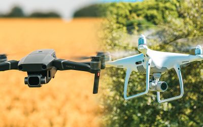
The Drones We Use Check out what drones are in the FlyGuys fleet Without a doubt, DJI drones are the most popular in the industry, with a market share of about 80%. Not only were they the first on the scene, but they continually modify and upgrade their existing...

