Emergency Drone Disaster Relief
Drones for Emergency Response Services & Insurance Claims
FlyGuys provides aerial drone services for emergency response teams, insurance assessments, and hazard mitigation. Our drone pilots are located nationwide for quick dispatch to safe and secure areas after a disaster. Our drones can access hard-to-reach areas that help emergency personnel assess the situation to create a plan of action. Insurance companies can also benefit from drone services to evaluate damage claims and make more accurate policies.
Maximizing Yield, Avoiding Waste & Increasing the Bottom Line
In agriculture, growers must cut costs while maximizing the land’s economic production. Elements like weather patterns and land movement can present a major challenge, especially over hundreds or thousands of acres of land with different ecologies, assets, and environmental obstacles. Agriculture drone services help growers apply Precision Agriculture techniques for better crop and livestock management. Drones provide farming photography and video data, covering large land areas quickly to pinpoint where actions are needed. Drones deliver real-time feedback on soil, plant, moisture, and topography to maximize yield, avoid waste, and increase the bottom line.
Nationwide Emergency Drone Services
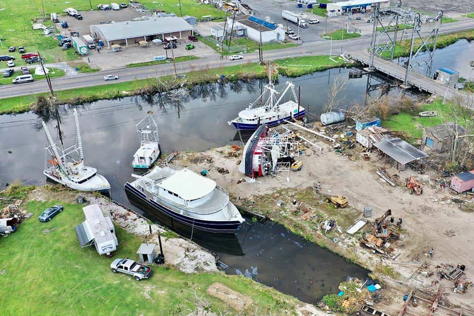
Aerial drone services have the potential to revolutionize disaster response by providing a more comprehensive picture of what is happening on the ground. When time is crucial, and the environment is hostile, drones provide a quick and safe method for emergency response teams to assess immediate danger. In addition, drones can be used by insurance companies to evaluate damage.
Additionally, aerial data gathered by drones can be leveraged for pre-incident and post-disaster planning, helping recovery teams and insurance providers mitigate high costs and tragedies before they happen. Drones are a cost-effective tool for rapidly gathering data-driven insights that keep people safe, regardless of environmental factors.
Hazard Mitigation
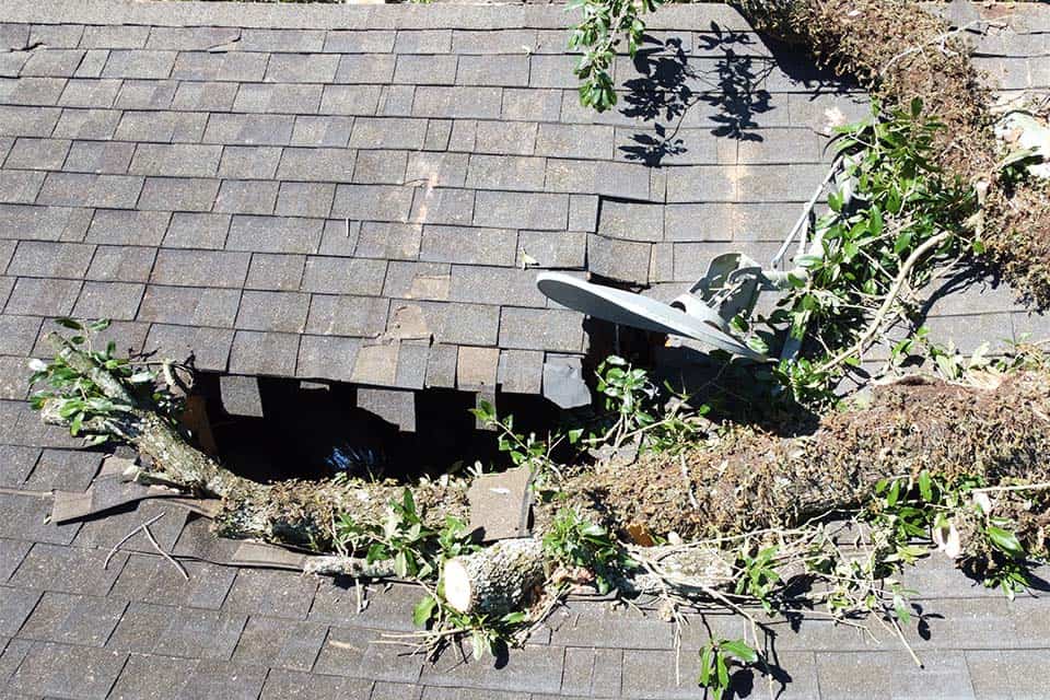
Drones can help prevent destruction or damage from future natural disaster events. Aerial images captured by a drone before a disaster occurs are beneficial in assessing potential pre-event deficiencies that could be mitigated before the event. For instance, fortifying buildings and making them more storm or disaster-resistant, wind-retrofitting buildings, roof enhancements or reporting existing damage that would only be made worse by a disaster.
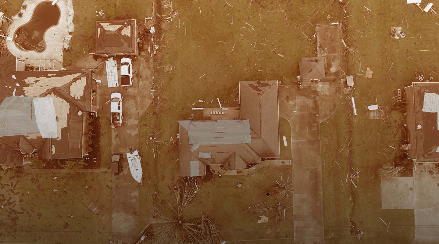
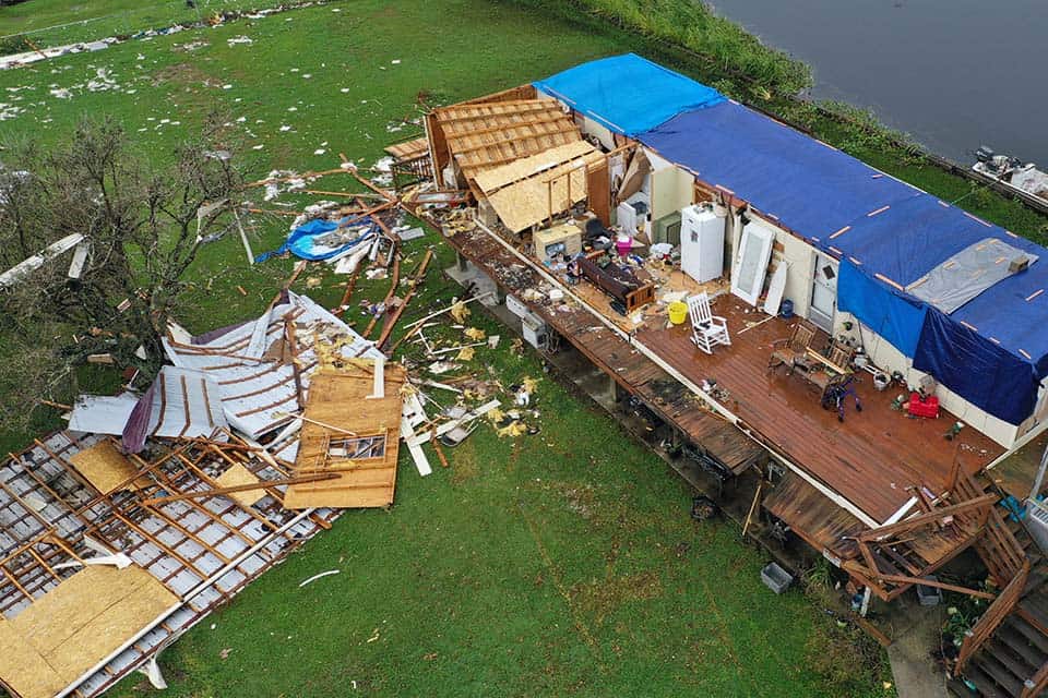
Rebuilding & Recovery
The ability to quickly and safely gather aerial imagery of disaster areas after a storm or other event has occurred is becoming increasingly non-negotiable.
Drones can be used to survey damage and provide information about what areas are safe, which ones need further assessment or repair, and which ones may be too damaged to rebuild at all. This information helps relief organizations prioritize their efforts and identify where additional resources are needed most.
In post-disaster damage assessments, drones can be used to estimate debris quantities and show proof of specific damage.
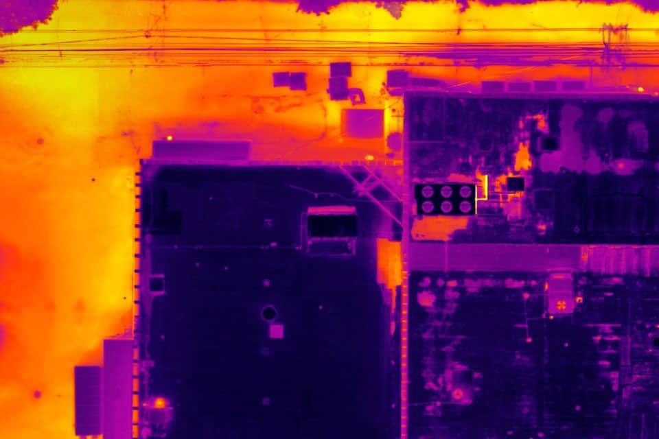
Infrared & Thermal Sensors for Hazard Mitigation
Drones offer a convenient and efficient way to measure stockpiles, as they can quickly and easily cover large areas and collect data from various angles. This can be especially useful for stockpiles located in hard-to-reach or hazardous areas, as it allows measurements to be taken without humans needing to access these areas.There are multiple ways that drones can be used to measure stockpiles, but these are the most common.
Drones can also help track and prevent wildfires (especially prevalent in California) by using thermal sensors to detect high-risk areas and hot spot areas.
Collecting drone data at disaster sites is one of the most effective ways to mitigate disasters in the future. Conducting pre-incident evaluations and collecting comprehensive insights leads to more robust action plans and recovery plans.
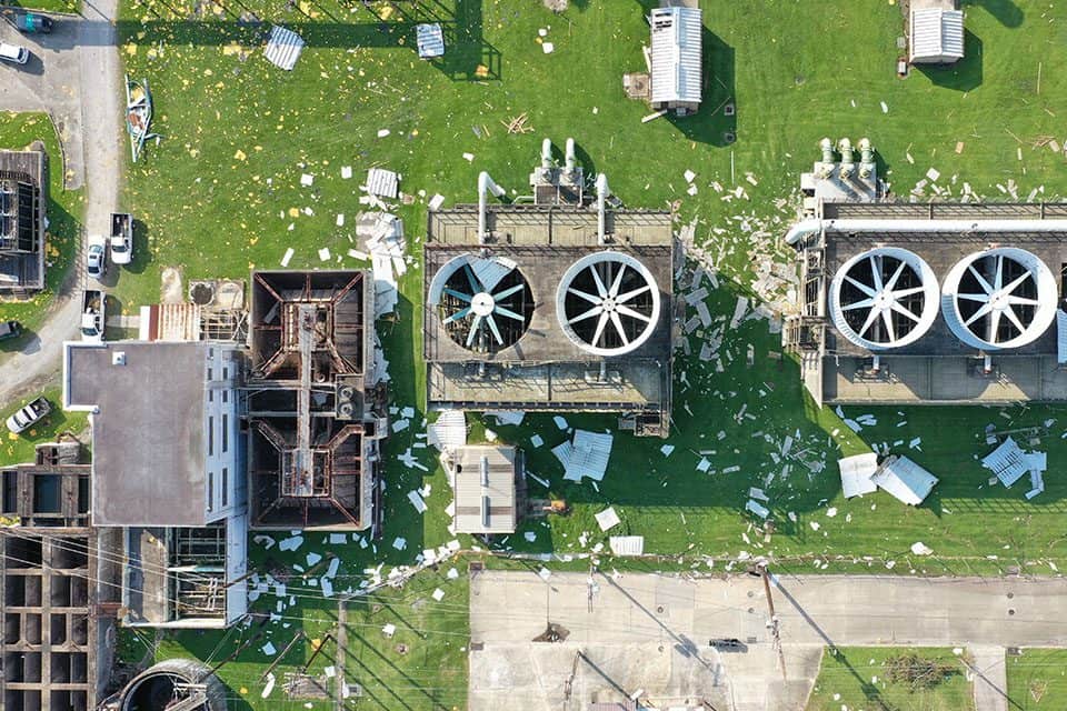
Comprehensive infrastructure assessments
Drones conduct comprehensive damage assessments of infrastructure, transport systems, communication relays and other critical systems after a disaster. High-resolution photos aid in identifying and prioritizing efforts to reconstruct affected areas.
Safe monitoring of disaster sites
In the aftermath of a disaster, safety risks increase in damaged areas. Drones can monitor these hazardous areas and report on recovery and rebuilding efforts.
Insurance & Damage Assessments
Insurance agencies can use drones for risk assessment, calculate informed policy rates, determine the extent of claims and provide quicker claims processing.
Insurance claims after a disaster
Drones provide a birds-eye view of damage caused by natural disasters. This allows insurers to assess the extent of the damage faster than they could with an on-site inspection. In addition, drones can provide this service without endangering workers. This is especially critical in areas where there are still safety concerns after a natural disaster or where it’s difficult for workers to access remote areas.
Calculate informed policy rates
Agents can use drones to inspect homes before issuing home insurance policies. This allows insurance companies to offer more customized policies based on individual homes’ needs rather than having one-size-fits-all policies that don’t account for each homeowner’s unique situation.
Insurers can also use drones to collect data about a structure or area to determine if there are any risks associated with the property, including potential flooding risks or fire hazards caused by faulty wiring in wiring systems.
Quick claims processing
Insurance agencies and policyholders benefit from a quicker settlement from claims processing because drones can access disaster areas sooner than an adjuster can.
Hard-to-reach damaged areas
Drones allow adjusters to see damage to structures that may otherwise be impossible to get to or see from the ground. This saves time and money, eliminating sending the adjuster to the site multiple times.
Streamlined, quick and safe assessments
Drones can help adjusters perform assessments more quickly and with more robust data, all without setting foot in a hazard zone.
Pre-incident evaluations for rate setting
Insurance companies can use drones to analyze areas and determine if they are at a greater risk of disaster, allowing them to create more informed guidelines for coverage.
The Insurance of a Qualified Partner
Don’t be flooded by damage claims after the storm hits. Contact FlyGuys today to request a quote or learn more about our aerial drone services for emergency situations and insurance companies.
Get A Quote
Take Your Project To New Heights
Whether the project takes us to a major metropolitan city, a mid-sized town, or a rural area far away from civilization, we’re ready to deploy FAA-certified pilots and follow stringent safety measures. Connect with FlyGuys for a quote, and let’s explore the right solution for you.
Please note that we are currently unable to assist in the search for missing pets. This limitation is due to the specific challenges and regulations associated with using drones for such purposes.