LiDAR for Mining Site Management
UAV LiDAR technology plays a key role in modern mining operations
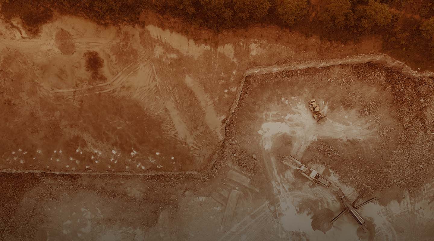
From evaluating land for opportunities to creating models of open-pit mines, UAV LiDAR technology plays a key role in modern mining operations. With our nationwide network of experienced, licensed pilots and project managers, mining companies are working with FlyGuys to get key data while lowering costs, improving efficiency, and increasing safety at mining sites.
Using LiDAR in Mine Mapping and Surveying
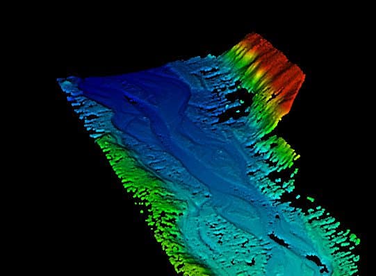
LiDAR (Light Detection and Ranging) is a method of measuring and examining the surface of an open pit mine or a pre-mining location using LiDAR sensors attached to drones. Lasers continually scan the surface, measuring the time it takes for the light to bounce off the earth and back to the sensor. Combined with GPS information, this data is used to create a point cloud of elevation points across the area, which licensed professionals can then use to create accurate, high-resolution elevation models and 3D maps.
Using LiDAR in Mine Mapping and Surveying
LiDAR (Light Detection and Ranging) is a method of measuring and examining the surface of an open pit mine or a pre-mining location using LiDAR sensors attached to drones. Lasers continually scan the surface, measuring the time it takes for the light to bounce off the earth and back to the sensor. Combined with GPS information, this data is used to create a point cloud of elevation points across the area, which licensed professionals can then use to create accurate, high-resolution elevation models and 3D maps.
How LiDAR Improves Mining Operations
Licensed professionals can use the LiDAR collected at every stage of a mining project, from inspecting and surveying the area and planning operations to creating a plan for returning the land back to a natural state at the project’s conclusion.
Increasing Safety
Mines and mining operations are often located in remote locations with challenging terrain, including steep embankments and unstable ground foundation. Using drones to gather data keeps your team away from dangerous areas and provides essential safety data.
Increase Speed of Data Collection
If a future mining site is covered in vegetation, it can make data collection challenging. However, LiDAR technology is able to successfully scan these areas in a short period of time. Additionally, using drones with LiDAR increases data collection times for mining sites, especially those that span over a large area.
Minimize Costs and Maximize Revenue
Not only is LiDAR an efficient way to gather in-depth data, it also can help reduce time and labor costs. Organizations see long-term returns through volumetrics data as provided by LiDAR drones used to convey more precise estimates of production and output.
Why Choose FlyGuys for Your Mining Company
At FlyGuys, we leverage a nationwide network of licensed, professional drone pilots. All of our pilots all have FAA Part 107 Certification.
With the capacity to scan up to 700 acres per day, we can tackle any type of mining project to gather critical data using multiple sensor options:
Riegl Sensor
has a relative accuracy spec of up to 15 mm and a scan speed of up to 100,000 scans per section, ideal for licensed professionals in need of high-precision data.
Green Valley Scanner
is a cost-effective option with a relative accuracy spec of 10 cm or less.
Get A Quote
Take Your Project To New Heights
Whether the project takes us to a major metropolitan city, a mid-sized town, or a rural area far away from civilization, we’re ready to deploy FAA-certified pilots and follow stringent safety measures. Connect with FlyGuys for a quote, and let’s explore the right solution for you.
Please note that we are currently unable to assist in the search for missing pets. This limitation is due to the specific challenges and regulations associated with using drones for such purposes.