Agriculture Drone Services
Smarter Crop Insights from Above
FlyGuys delivers nationwide drone services that help agricultural operations monitor crop health, evaluate irrigation, and support precision agriculture—so you can optimize inputs and reduce costs with confidence.
Precision Agriculture Starts with Better Data
Managing large agricultural operations means balancing rising costs, variable conditions, and complex land characteristics. Drone data helps bring clarity to that complexity.
FlyGuys’ agriculture drone services support precision agriculture by capturing high-resolution aerial data across large areas—quickly and efficiently. From crop and soil conditions to moisture patterns and field variability, drone insights help identify where action is needed so you can optimize inputs, reduce waste, and improve overall yield.
Data-Driven Decisions Across Every Acre
Modern farming requires accurate, timely insights to manage inputs, reduce waste, and maximize yield. FlyGuys’ agriculture drone services support precision agriculture by delivering high-resolution aerial data that helps growers make informed decisions across every stage of the growing cycle.
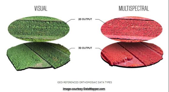
Using aerial imagery, thermal data, and multispectral imaging, data collection allows farmers to quickly scout fields, identify variability, and focus attention where it matters most, without the limitations of ground-level checks.
With FlyGuys agriculture drone services, growers can:
- Improve crop yields by monitoring plant health, growth patterns, and field variability
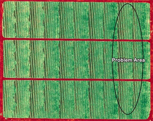
- Detect issues early, including crop stress, disease, pest pressure, and irrigation inefficiencies, using tools like NDVI and other vegetation indices
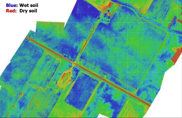
- Analyze soil and field conditions, including moisture distribution and fertility indicators, to support smarter irrigation and nutrient management
- Leverage topographical, thermal, and multispectral mapping to assess crop performance with greater accuracy across large acreage
- Plan planting and field operations more efficiently using detailed terrain and surface data
- Optimize irrigation strategies by identifying drainage patterns, elevation changes, and moisture inconsistencies
FlyGuys connects you with FAA-certified, deployment-ready drone pilots nationwide who are experienced in capturing reliable agricultural data at scale. The result is actionable insight that supports precision agriculture and helps drive stronger land performance and profitability.
Turn Field Data into a Better Harvest.
Field Data That Powers Agricultural AI
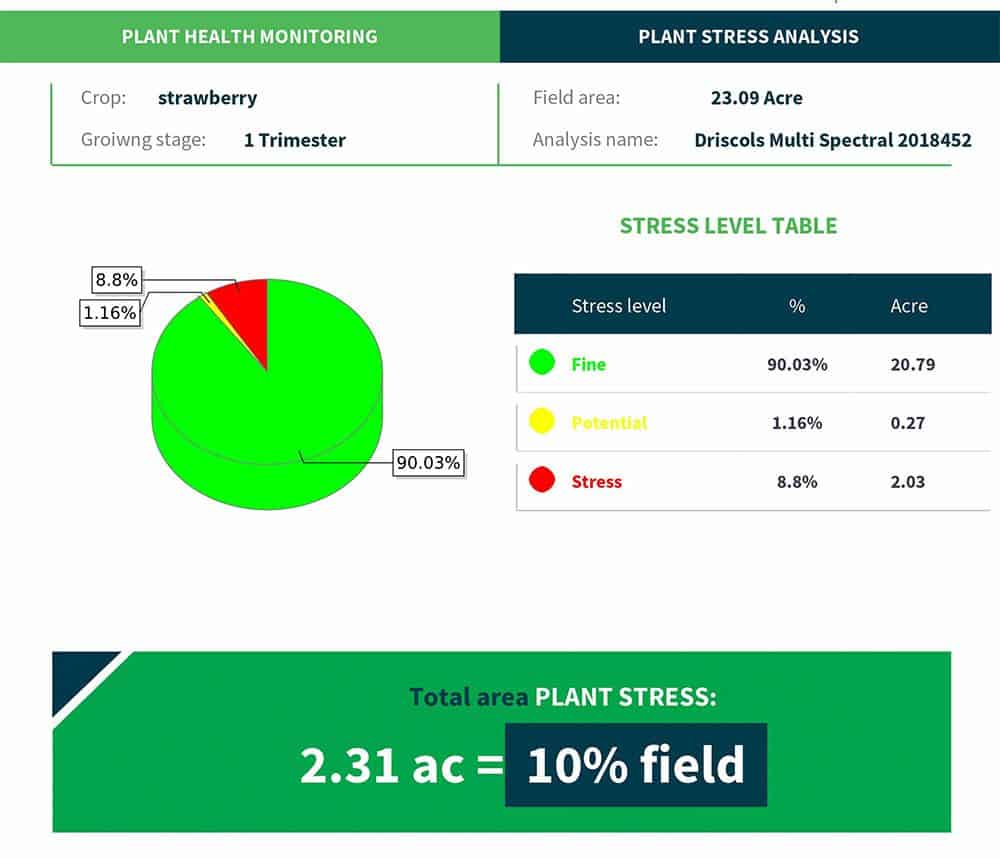
FlyGuys delivers drone-captured agricultural data in formats designed to integrate seamlessly with AI and analytics platforms. Our custom reporting bridges the gap between data collection and insight generation, giving ag-tech partners reliable, structured inputs they can build on.
Through high-resolution imagery and multispectral datasets, FlyGuys supports:
- Plant health and stress identification at the field and sub-field level
- Quantified variability metrics (e.g., percentage of affected acreage)
- Consistent, repeatable datasets suitable for model training and validation
Example output:
- Plant stress detected across 10% of the field (2.31 acres), indicating potential water or nutrient imbalance.
FlyGuys focuses on delivering clean, scalable datasets, empowering AI SaaS platforms to apply their own analytics, recommendations, and automation workflows on top of accurate aerial data.
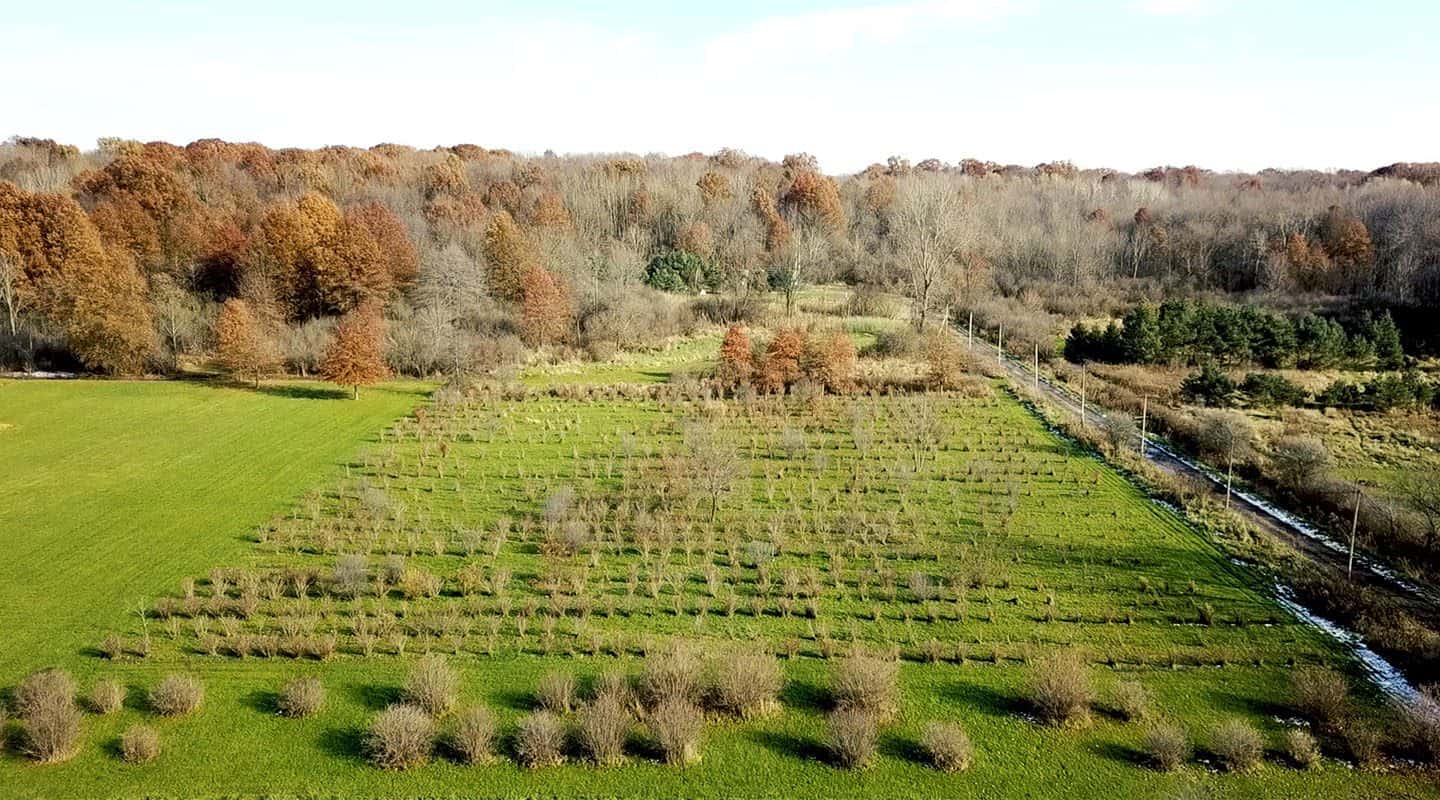
Forest and Land Stewardship
Private owners and public organizations in charge of large swaths of wild forest or rural land can leverage aerial drone photos.
FlyGuys drone pilots are FAA-certified, insured, and experienced in capturing the information you need to better manage your land.
Contact us to learn how we can assist stewardship with actionable data.
With aerial drone photography, land stewards can:
- Formulate an effective land management plan that considers boundaries, forest stands, wood species, biodiversity, and more.
- Create fully comprehensive maps of parcels, ensuring every acre is included in the land management plan.
- Predict and mitigate disasters such as forest fires, landslides, and ecological disease by gathering visual data otherwise unobtainable by ground-level or naked-eye assessments.
- Gather marketing photos and video for land to be sold.
- Conduct due diligence for aid program applications such as the Forest Stewardship Program, the Landowner Assistance Program, or USDA assistance programs.
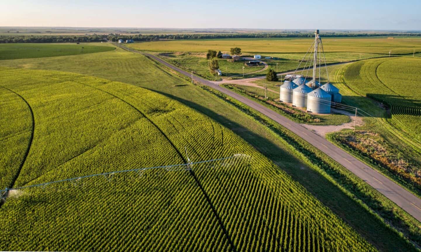
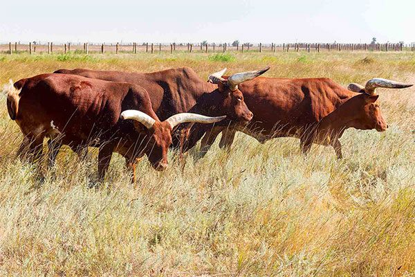
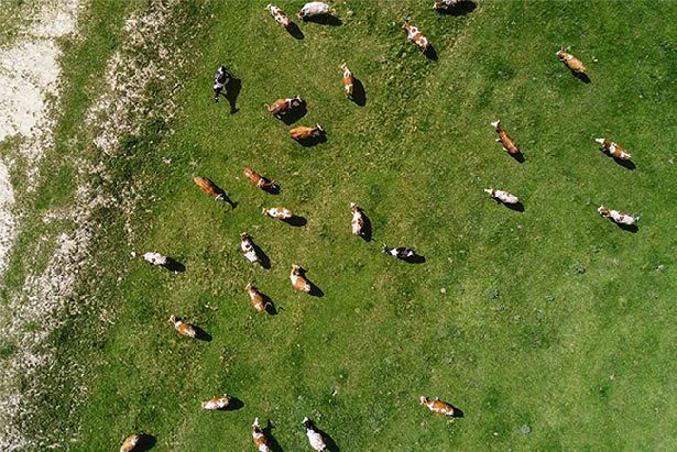
Livestock Management
Producers, ranchers, and cattle herders often use drone aerial photography services to implement precision ranching strategies. Aerial footage captures data that helps maximize land resources and the producer’s efficiency, ensuring a more robust herd, new cost savings, and smarter business decisions based on reliable data.
With aerial drone photography, producers can:
- Take a comprehensive inventory of resources, locating the best areas for drinking water and creating a superior grazing management plan.
- Monitor fencing and pen conditions, saving time and the fuel required to monitor by ATV or automobile.
- Check for damage after severe weather, saving time and protecting ranch hands from precarious situations.
- Perform periodic inspections for counting or locating missing livestock and related tasks. Use infrared imaging day or night to quickly locate animals.
Get A Quote
Take Your Project To New Heights
No matter where your project is located, FlyGuys connects you with certified, FAA-compliant drone pilots ready to capture the data you need—quickly, safely, and reliably.
Request a quote today and let our team match you with the right drone solution for your project.
Please note that we are currently unable to assist in the search for missing pets. This limitation is due to the specific challenges and regulations associated with using drones for such purposes.