Drones in Surveying and Mapping
Land surveying and mapping are closely related fields often used together to create accurate and reliable maps of the Earth’s surface. Land surveying provides the foundational data and measurements, while mapping uses that data to show visual representations of the land’s features and characteristics.
Drones for Land Surveying
Land surveying provides the foundation for mapping by providing accurate measurements and data about the land’s physical features, such as its boundaries, elevation and contours. Surveying also helps to identify and map the location of natural and man-made features, such as rivers, roads, buildings and other infrastructure.
In recent years, drones have become increasingly popular for land surveying. With their ability to capture high-resolution imagery and cover large areas quickly, drones offer numerous benefits over traditional surveying methods.
Drones for Mapping
Mapping is time-sensitive because geographical features constantly change due to environmental factors and urban development. Therefore mapping needs to be conducted frequently to deliver the most accurate information.
Traditionally, mapping was done by people on foot or using manned aircraft like airplanes or helicopters. The process was time-consuming and often involved a lot of manual labor. With the advent of drone technology, mapping has become faster, more efficient and more accurate. Moreover, the advanced technology of LiDAR and thermal sensors contribute to even greater mapping capabilities.
Advantages of Using Drones for Mapping & Land Surveying
Accuracy and Precision
One of the primary advantages of using drones for land surveying is the accuracy and precision they offer. Traditional surveying methods often involve physically measuring points on the ground with instruments such as a total station or a theodolite. This process can be time-consuming and usually requires multiple people. In contrast, drones equipped with high-quality cameras and GPS systems can accurately and precisely capture data from above, reducing the need for physical measurements and minimizing the potential for human error.
Speed and Efficiency
Drones are incredibly efficient when surveying large areas. Traditional surveying methods often require surveyors to traverse the entire area being surveyed, which can be time-consuming and may require multiple surveying teams. On the other hand, drones can cover large areas quickly and with minimal human intervention. Surveyors can complete their work faster with this method, saving time and money.
Cost Savings
Drones for land surveying can also be cost-effective. Traditional surveying methods often require expensive equipment, and the labor cost can be high. By using drones, surveyors can reduce the need for specialized equipment and labor, leading to significant cost savings. Additionally, drones can survey hard-to-reach or dangerous areas, reducing the need for surveyors to put themselves in harm’s way, further reducing costs.
Flexibility
Drones can be flown at different heights and angles, allowing surveyors to capture data from multiple perspectives. This flexibility gives surveyors a better understanding of the terrain and can help identify potential issues or challenges that may need to be addressed. Additionally, drones can be equipped with various sensors, such as thermal imaging cameras, which can provide additional data to assist with surveying.
Environmental Impact
Traditional surveying methods can have a significant impact on the environment. Surveyors often need to access remote or sensitive areas, which can lead to environmental damage. Additionally, traditional surveying methods can be noisy and disruptive, impacting wildlife and nearby residents. Using drones, surveyors can reduce their environmental impact and minimize disruption to the surrounding area.
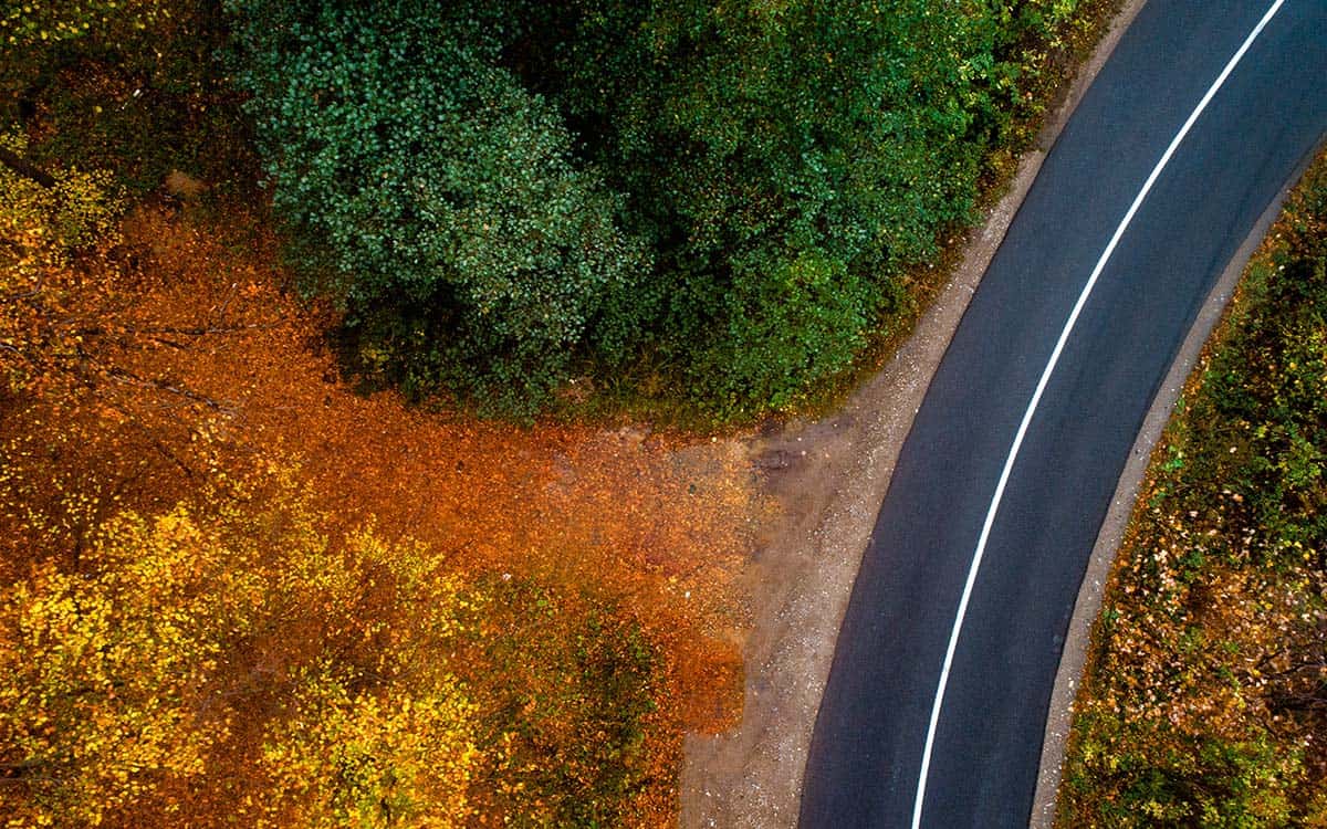
High-Resolution Imagery
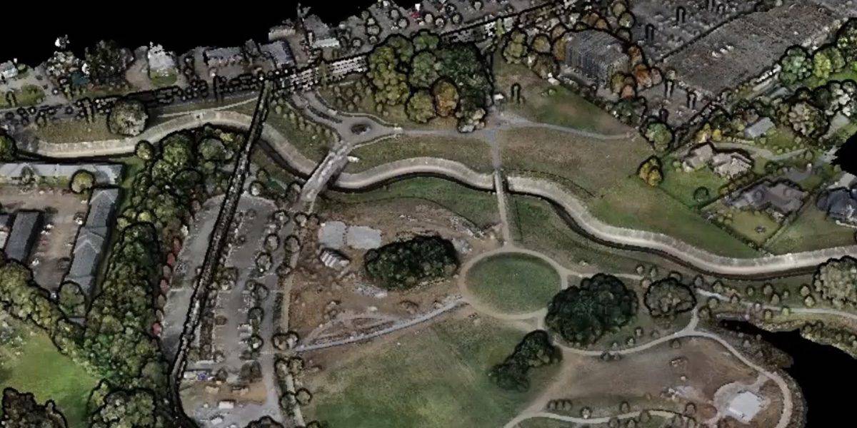
Drones have high-resolution cameras that capture detailed images of the Earth’s surface used to create 3D maps, topographic maps, and Orthomosaics with high levels of accuracy.
Mapping Out Your Next Drone Mapping Project
Using a drone for mapping requires careful planning and execution to ensure accurate and reliable data. Here are some steps that must be taken to use a drone for mapping:
- Determine the project requirements. Before starting a drone mapping project, it’s essential to determine the project’s objectives, including the area to be covered, the desired level of detail and the accuracy requirements.
- Choose the right equipment. Choose a drone capable of capturing the required level of detail and accuracy. The drone should also have a suitable camera and gimbal to ensure stable and clear images.
- Plan the flight path. The flight path should be carefully planned to ensure the drone captures overlapping images, allowing for the creation of accurate 3D maps and models.
- Check local regulations. Ensure you have the necessary permissions and approvals from the relevant authorities to operate a drone in the area, and follow local regulations and guidelines related to drone operation.
- Conduct a site survey. Before starting the drone mapping project, conduct a site survey to assess any potential obstacles, such as trees or power lines, and to identify any potential hazards that may interfere with the drone’s operation.
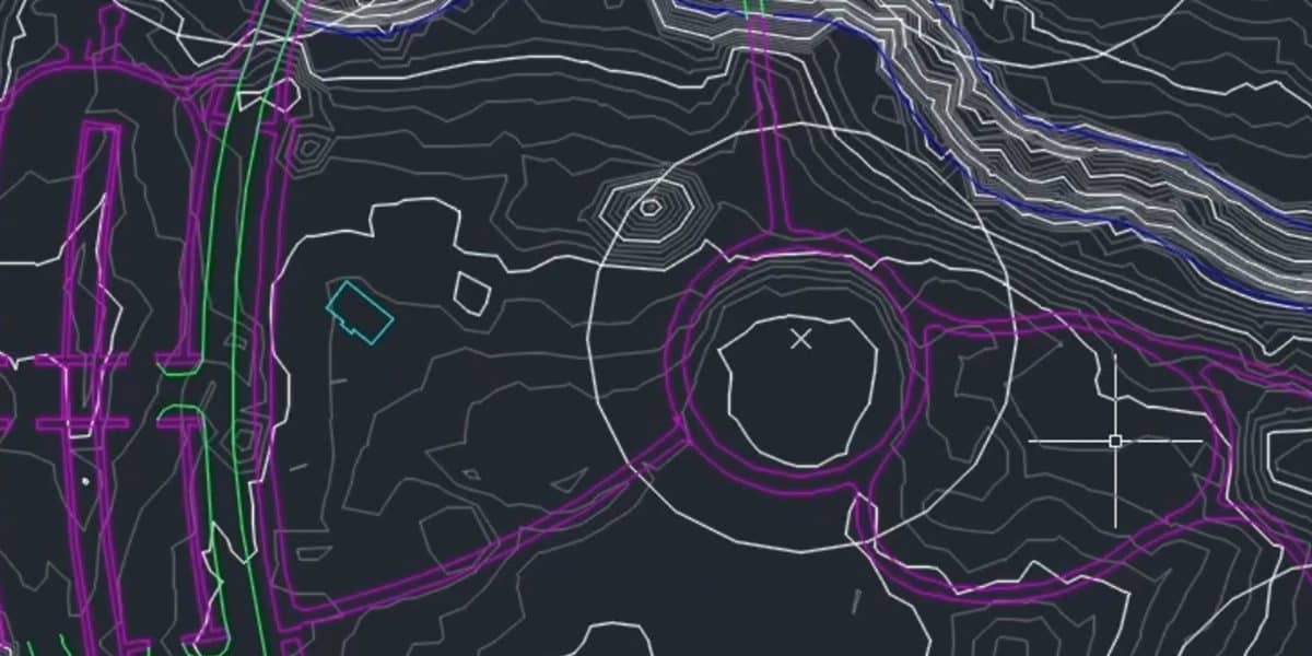
- Collect and process data. Collect the data by flying the drone along the pre-planned flight path. Once the data is collected, it must be processed using specialized software to create a 3D map or model.
- Analyze and interpret the data. Analyze and interpret the data to extract meaningful insights and information.
Fortunately, FlyGuys can help with each of these steps. FlyGuys will help you choose the right equipment, plan the flight path, check local regulations, conduct a site survey, and collect and process your data.
Drones have become a valuable tool for mapping and surveying the Earth’s surface. Their high-resolution imagery, cost-effectiveness, accessibility, speed, and efficiency make them ideal for a wide range of applications. As drone technology continues to improve we can expect to see their use in mapping and surveying become even more widespread.
Call FlyGuys today to schedule your drone mapping and land surveying today.