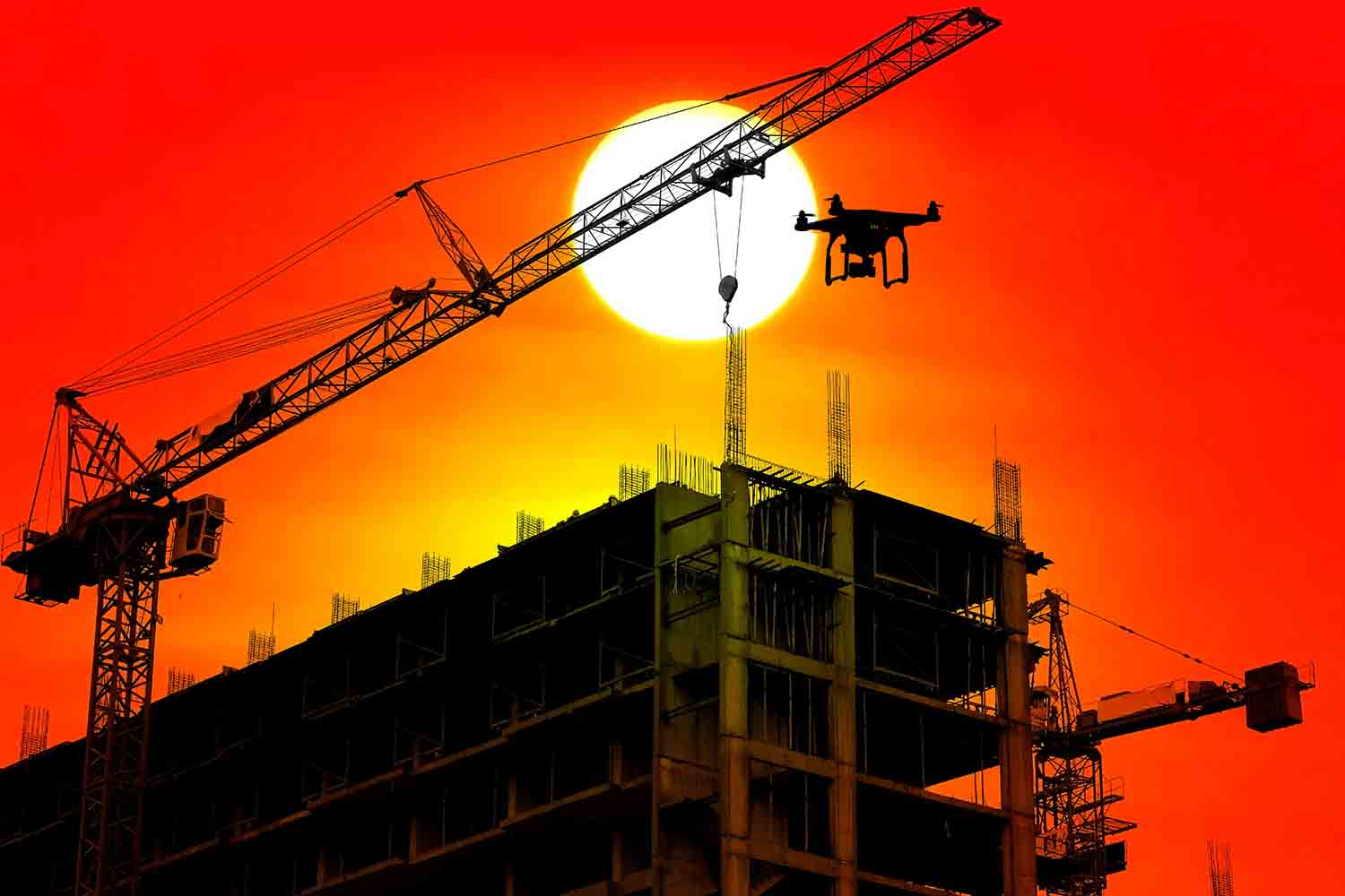
Drone Use in Construction
revolutionizing the construction industry
Typical construction projects run 80 percent over budget and 20 months behind schedule, costing construction companies and stakeholders millions of dollars.
Enter Drone Technology. Drones are revolutionizing the construction industry by saving time and money.
Saving Time & Money
Drones cover more area during inspections, collect and analyze real-time data and allow managers and stakeholders to access the data from anywhere in the world, increasing productivity and improving communication.
In fact, drones are becoming more of a norm on construction sites around the globe. They are another piece of equipment that should be a part of the process.
From pre-planning to groundbreaking to ribbon cutting, drones streamline workflows and keep all parties in direct control of construction progress.
Benefits of Drones in Construction
High-Resolution Visual Monitoring
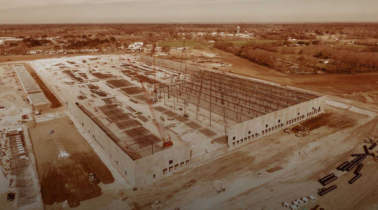
Construction sites rely heavily on visual monitoring. Drones provide digital aerial capture of any angle of a project with immediate analysis that can be used for progress monitoring and to make on-the-spot decisions. Real-time site management is crucial to staying on budget and within deadline. Aerial imaging provides better visibility and access to the site resulting in more accurate reporting, quality of work and improved management.
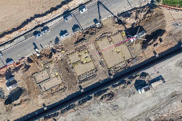
Improved Progress Monitoring
There is a lot of area to cover and many working parts on a construction site. Aerial footage from a drone can monitor progress, productivity and accountability. Drones allow managers to visually see why something may not be working or taking too long and to address problems before costing money or losing valuable time.
Transparency with Stakeholders
Improve communication with stakeholders by providing them with real-time footage of the progress of their investment, even when they cannot be on site. This keeps your clients happily in the loop and allows them to understand the progress visually.
Save Time and Money
Drones can work quicker and more efficiently than humans. This allows construction teams to increase productivity and complete projects faster. Construction companies, builders and investors save millions of dollars in labor costs and time spent on one site.
Centralized Communication with Internal Teams
Drone software makes it easy to share data collectively with internal teams such as designers, engineers, inspectors and workers. A centralized location to upload and store data allows access for anyone to check on progress, address problems and use for future reference to improve productivity.
Increase Safety
Construction sites are full of safety hazards, and injury rates are 71 percent higher than in any other industry. Drones drastically decrease the risk of injuries by eliminating the need for employees to conduct inspections in hard-to-reach or dangerous areas. Drone inspections can collect information from anywhere on site, regardless of the circumstances. For instance, after rain, inspections are necessary; however, manual inspections are dangerous due to slick and slippery situations. The inspection is either postponed, or the employee is put at risk. Both scenarios cost time and money. Drone inspections eliminate this issue.
Drone Applications in Construction
Aerial photography provides a constant and high-quality visual of your construction site, and many deliverables construction professionals need for any project. Drones streamline all your data to create the resources you need to meet your unique goals.
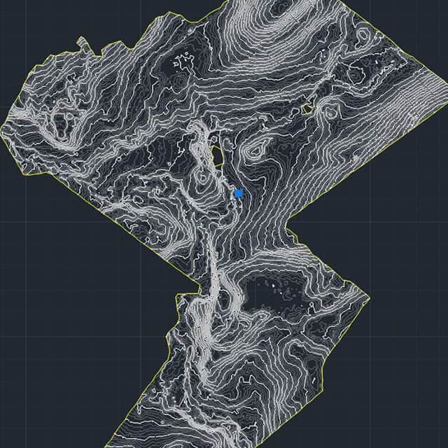
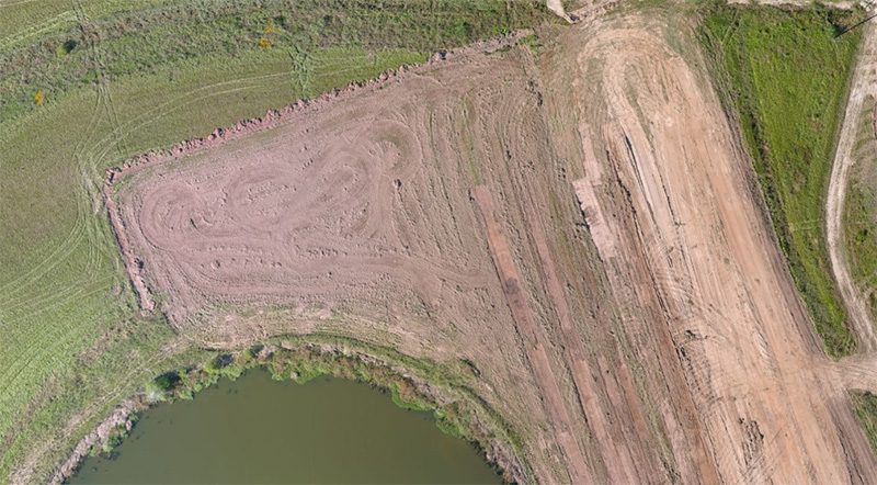
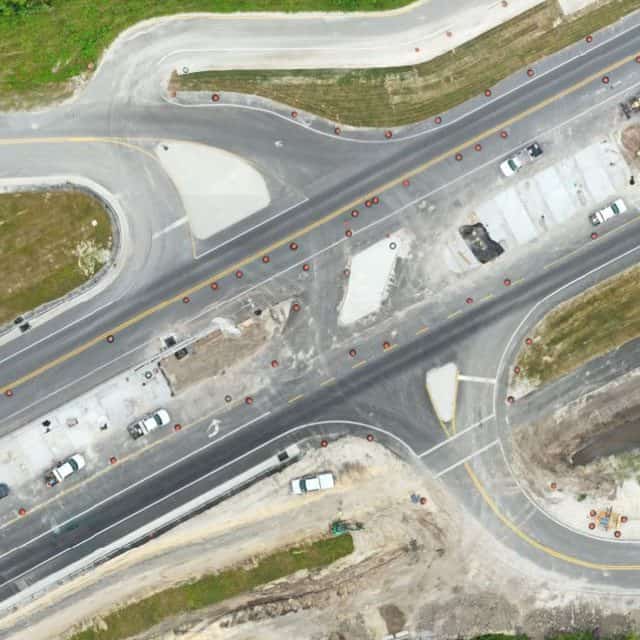
Topographic Mapping
Creating a topographic map isn’t always cost- or time-effective. However, a drone can rapidly collect data over large areas to produce a map that reveals terrain details for better construction planning. For coastal restoration projects, we can scan the area and transform the data into precise topographic maps to calculate the volume of deposited material, speeding up the surveying process while reducing time and cost.
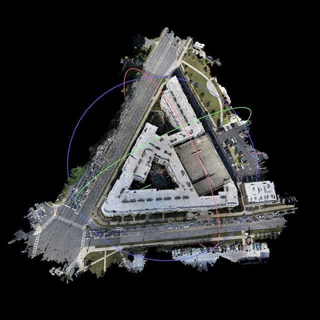
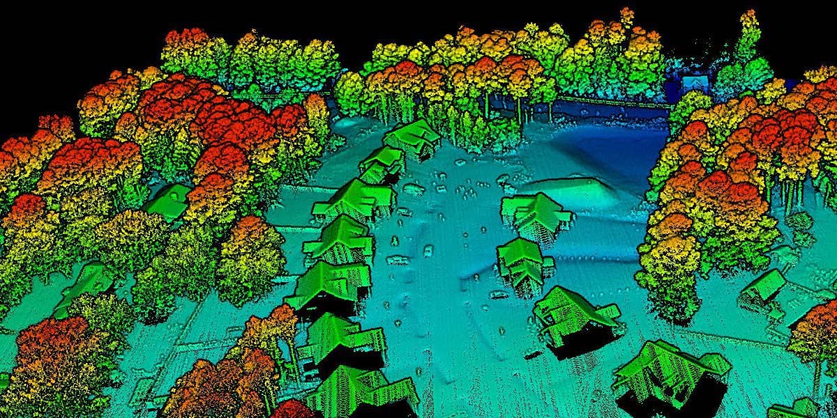
3D Modeling
High-resolution aerial images can create 3D models to help the crew determine challenges and identify potential flaws in the design, preventing waste of resources. 3D models can also keep the team on track with the original design blueprint and show clients what the finished project will look like.
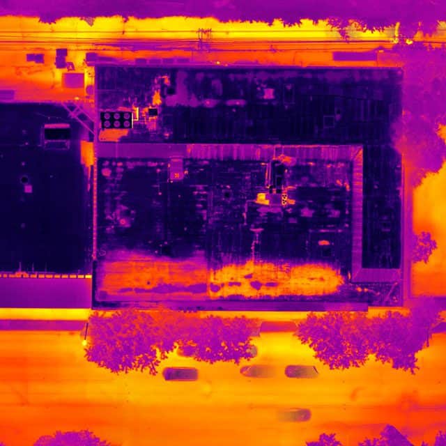
Thermal and Multispectral Imaging
Detect infrared radiation before significant problems occur, costing setbacks in time and money. Create precise mapping for construction sites for more efficient productivity and less waste or materials.
Inspections
Drone inspections are safer and more efficient than manual inspections. The drone collects accurate aerial imagery and data and is quickly sent to decision-makers who can address problems immediately or access the data for future assessments.
Marketing and Advertising
Beautiful drone aerial photography provides professional material for marketing photos and videos. Digitally share your project with prospective buyers and advertise your work through any promotional platform.
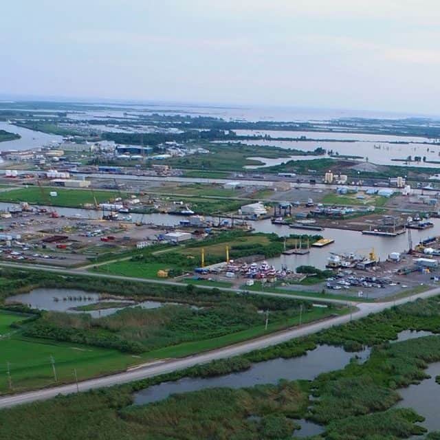
Dredging Projects
In addition to construction drone services, we also work with local governments and private contractors for dredging projects before land restoration and real estate development to provide critical data in less time.
From groundbreaking to ribbon cutting
FlyGuys is your construction drone services provider
Pre-Plan
Find the ideal location for your construction project before design starts to prevent future land issues.
Keep Clients in the Loop
Keep clients happy throughout the process of the project by keeping them in the loop with real-time progress. Let clients see how their investment is coming along.
Share Data in Real Time
Drone services allow you to share live data collection with internal teams and interested parties to make better business decisions and address problems on the spot.
Safety
Increase safety on site for inspectors and employees. Reduce work-related injuries and decrease the cost of liabilities.
Progress Monitoring
View the progress of your project from anywhere at any time with construction site aerial imagery. Address problems immediately, ensure progress is following schedule, make decisions to improve procedures and monitor equipment and employees.
Accountability
Assess productivity of crew and keep track of lost and damaged equipment.
Communication
Streamline communication between investors, staff, engineers, designers, architects and management. Access data from a centralized database.
Invoicing
Improve invoicing accuracy by storing all data from start to finish and spending less time calculating costs at the end of a project.
Bids
Our highly detailed construction site aerial photography and data enable the delivery of a more precise and accurate bid package with fewer exclusions due to unknown variables.
Make Your Company More Competitive
Drone data collection is more accurate and detailed than manual collection. Set your company apart with the newest technology in the industry and help keep investors’ costs down.
Sectors of Construction we work with
- Residential
- Non-residential
- Infrastructure
- Engineering
- Industrial
- Commercial
Other Uses for Drones in Construction
Even more ways drones can help on your construction site:
- Equipment tracking
- Volumetrics
- Security Surveillance
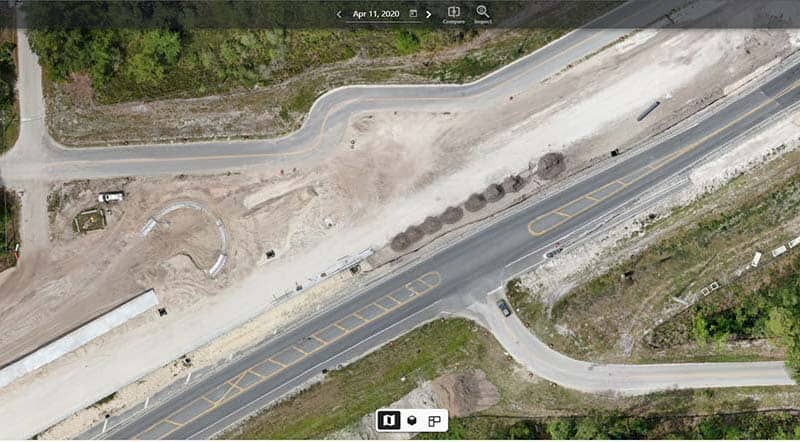
Drone Construction Progress Monitoring
From groundbreaking to opening day, monitoring the progress of your construction project is critical to keeping investors informed, spotting potential problems, and staying on time and within budget. For larger undertakings, such as sprawling infrastructure projects or multi-building complexes, drone construction progress monitoring is an efficient and cost-effective way to stay on top of your next project.
Using Drones for Construction Project Monitoring
Historically, most aerial views of construction sites were obtained through helicopter photography. This method has proven to be time-consuming, expensive, and inefficient, and as a result, the use of unmanned aerial vehicles (UAVs), or drones, is rapidly gaining popularity as a highly-effective alternative method of construction monitoring.
Drones controlled by an experienced pilot can be flown high above the job site, sending real-time information to the engineers and project managers on the ground. At the same time, UAVs collect high-resolution images that can then be used by licensed surveyors and mappers to create 3D models. Crucially, drones can fly close to the construction area, providing close-up shots of multiple areas around the jobsite.
Construction Monitoring Uses
Construction companies & developers have used drone construction progress monitoring for:
- Regularly tracking development and progress.
- Creating 360° views of the job site.
- Conducting comprehensive safety inspections and quality assurance to ensure safety and compliance with building codes.
- Turning data into 3D models to provide investors with a realistic look at the project.
- Creating CAD overlays to ensure the project is aligning with design plans.
- Keeping track of job site inventory.
- Proactively identifying areas where structural integrity may be a concern.
Benefits of Drone Construction Progress Monitoring
Improve Stakeholder Communication
Aerial photography provides investors with a comprehensive view of the jobsite, from planning to completion.
Save Time
Our drone teams can scan up to 700 acres in a single day, providing teams with accurate information in a short timeframe.
Save Money
Drones can be launched at a fraction of the cost of using a helicopter or other aerial methods, keeping construction projects within budget and on-time.
Reduce Safety Risks
In addition to being a safer method of recording data, drone construction inspections promote safety on the job site by identifying critical safety issues and preventing jobsite injuries.
Regular Information and Data
Regular and frequent progress scans allow project managers to more accurately determine and update timelines as well as find areas of the project that are behind schedule. Project leaders will also have more opportunities to share up-to-date details with investors and developers, keeping them well-informed and confident in the project.
Drone Services for Architecture & Engineering
Drone data is driving an ongoing transformation of the architecture and civil engineering industries, increasing productivity and improving site safety. FlyGuys leverages a nationwide network of FAA-licensed and insured pilots and experienced project managers working together to provide clients with high-quality deliverables for architectural and engineering needs.
Drones provide architects and engineers with an unprecedented level of detail and accuracy. From surveying and mapping to monitoring construction progress and inspecting structures, drones are revolutionizing how we plan, design and build our cities and infrastructure.
Drone Applications in Engineering and Architecture
Ground Quality Assessments
Using thermal and multispectral imaging, we provide clients with the data necessary to analyze the soil and ground quality before construction and conduct environmental impact assessments.
Site Inspections
Once construction gets underway, we can capture video and images that allow careful inspection of every aspect of the building site to ensure safety and code compliance without the danger of sending workers on manual inspections.
Project Monitoring and Oversight
Our pilots capture both broad aerial images and up-close, highly detailed images to monitor progress on the job site. Our progress monitoring services allow projects to identify issues quickly, determine delays, and share information with shareholders or government agencies.
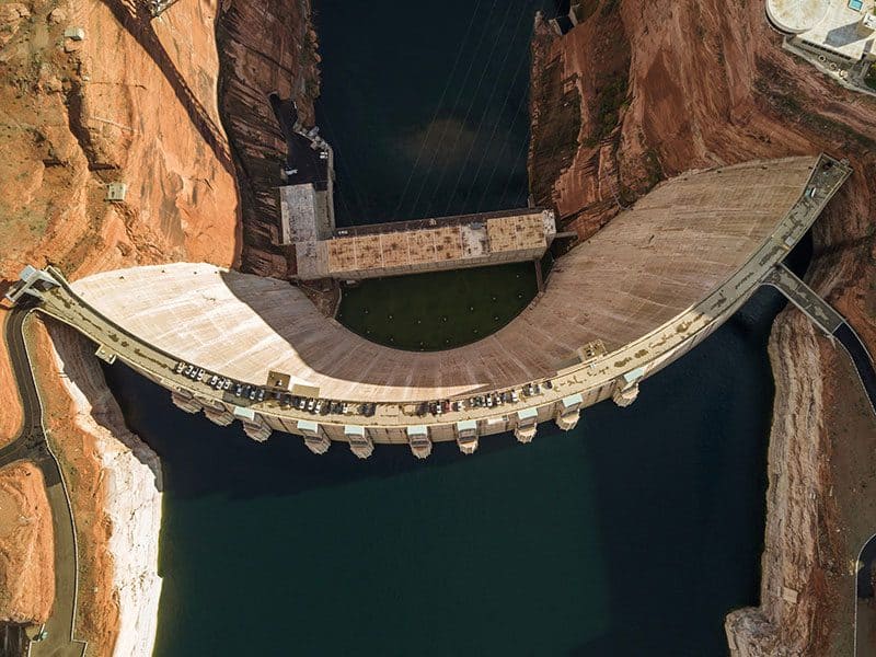
Creating Digital Twins
Many assets such, as highways, roads, dams, and bridges, can benefit from having a digital twin (a real-time digital counterpart of a physical object). Our drones can capture the necessary datasets to help create digital twins, helping engineering firms and owners monitor their assets.
Drone Services for Architecture
The architecture industry has always been driven by innovation and technology. Since the advent of drone technology, architects have utilized aerial photography and videography to gather precise information about a site’s topography and landscape, monitor construction progress, and improve site analysis. Drones can perform tasks that would have been too time-consuming or dangerous for human workers.
Site Analysis and Surveys
One of the most crucial tasks in architecture is site analysis. Before planning construction, architects need to know about a site’s topography, soil composition and the surrounding environment. Drone services can provide an efficient and accurate way to gather this information. Using drones, architects can capture high-resolution aerial images and 3D maps of the site. This data can create topographical maps, elevation maps and digital terrain models (DTMs) that aid site planning, design and construction.
Drone Services for Engineering
The architecture industry has always been driven by innovation and technology. Since the advent of drone technology, architects have utilized aerial photography and videography to gather precise information about a site’s topography and landscape, monitor construction progress, and improve site analysis. Drones can perform tasks that would have been too time-consuming or dangerous for human workers.
Surveying and Mapping
Drones can capture high-resolution aerial images and create 3D models of the terrain, which can help engineers to plan and design infrastructure projects, such as roads, bridges, and railways.
Construction Site Monitoring
Drones can provide real-time information about the progress of a project. Drones can capture images and videos of construction sites, which can help engineers identify potential safety hazards and address issues before they become problems.
Inspections
Drones can inspect infrastructures like bridges, dams, and power lines. Drones can capture high-resolution images and videos, which can be used to identify structural issues, defects, and other problems.
Environmental Monitoring
Drones can monitor the environment to help design sustainable infrastructure projects to minimize their impact on the environment.
Disaster Response
Drones capture images and videos of affected areas, which can help engineers to plan and prioritize their response efforts.
How UAVs Benefit Architecture & Engineering Projects
Advancing Site Safety
Worker safety is the highest priority of any project. Drones help ensure site safety by providing the data and images needed while allowing workers to stay on the ground. From area assessments to site inspections, FlyGuys collects comprehensive data without the danger of sending crews into hazardous areas.
Minimizing Costs
By keeping workers safe and the project on schedule, drones keep operating costs down without sacrificing the quality and accuracy of data. Drone data also provides the insight necessary to make informed decisions in project planning and track progress accurately and efficiently.
Increasing Productivity
For projects on a tight schedule, any delay can be disastrous. Drones save time by rapidly scanning large areas to collect data for safety and maintenance without shutting down the entire site.
Build a future with FlyGuys
FlyGuys has a nationwide network of FAA-certified, insured pilots ready to gather aerial data for your next project. From blueprints to groundbreaking to ribbon-cutting, FlyGuys can fly with you through each stage of your project to bring you high-quality, accurate details to ensure smooth workflow and successful outcomes.
Get A Quote
Take Your Project To New Heights
Whether the project takes us to a major metropolitan city, a mid-sized town, or a rural area far away from civilization, we’re ready to deploy FAA-certified pilots and follow stringent safety measures. Connect with FlyGuys for a quote, and let’s explore the right solution for you.
Please note that we are currently unable to assist in the search for missing pets. This limitation is due to the specific challenges and regulations associated with using drones for such purposes.