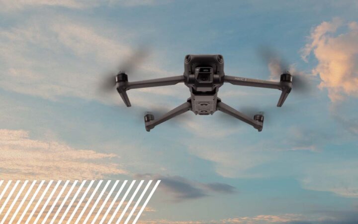
The Most Commonly Used Drones Today
A look at the most commonly used UAS platforms
Commercial drone work has consolidated around a relatively small group of platforms. Understanding which aircraft the industry actually flies and why is useful whether you are new to the field or evaluating your next purchase.
This is an overview of the platforms most commonly in service today across mapping, inspection, and survey work.
The Current Workhorses
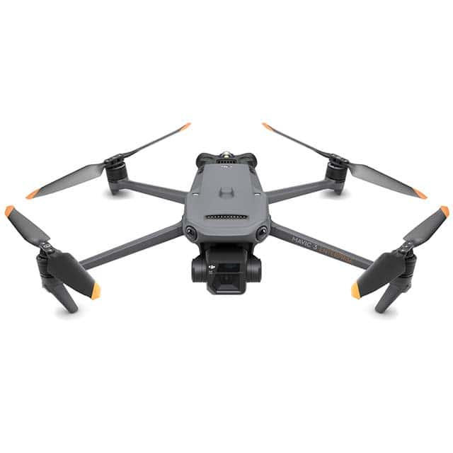
DJI Mavic 3 Enterprise (M3E)
Still one of the most widely flown mapping drones in the field. Compact, dependable, and capable of low GSD with strong global accuracy. Its 20MP 4/3 CMOS sensor and mechanical shutter are the reason so many operators keep one in the case.
Key features
- Mechanical shutter for distortion-free imagery
- RTK module for centimeter-level accuracy
- 20MP 4/3 CMOS wide camera
- Integrated flight planning
Commonly used for
- RGB mapping in construction, surveying, and environmental work
- Missions where portability matters
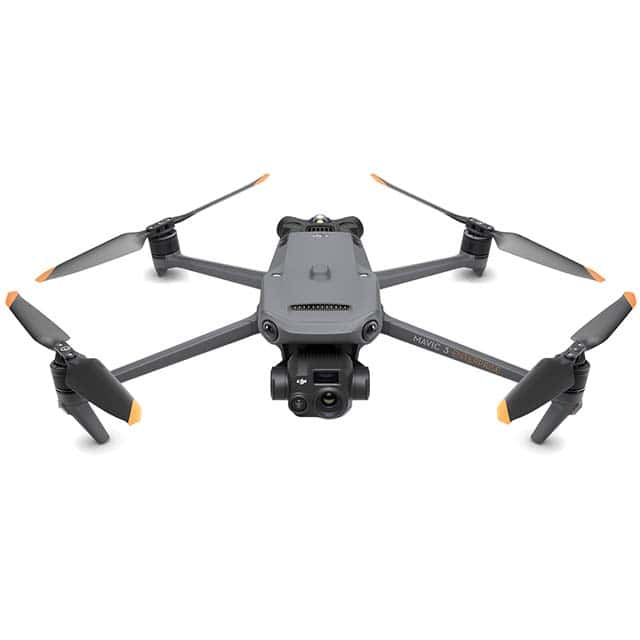
DJI Mavic 3 Thermal (M3T)
For jobs that need more than RGB. The M3T pairs a 48MP visual camera with a 640×512 thermal sensor, letting pilots switch between visual and thermal data on the same flight.
Key features
- Thermal imaging for heat detection and low-light operations
- Dual-sensor split-screen analysis
Commonly used for
- Renewable energy and telecom inspections
- Search and rescue, industrial asset checks
DJI Matrice 4 Series (M4E and M4T)
The Matrice 4 series is where much of the industry’s new capacity is going. It keeps the single-operator footprint of the Mavic line but adds meaningful gains in speed, sensing, and automation. The M4E is the mapping variant. The M4T adds thermal and a laser rangefinder.
Key features
- M4E: 20MP 4/3 CMOS wide, plus 48MP 3x medium tele and 48MP 7x tele
- M4T: 48MP 1/1.3 CMOS wide, 640×512 thermal with 1280×1024 super-resolution mode, 100m NIR auxiliary light
- Built-in RTK, GNSS anti-jamming, and vision-integrated positioning
- Up to 49 minutes of flight time and 21 m/s max speed
- Five-directional vision assist with six low-light fisheye lenses
- AI subject recognition, Smart 3D Capture, laser rangefinder (M4T, 1,800m)
Commonly used for
- Large-area photogrammetry and corridor mapping
- Complex vertical structure modeling
- Thermal inspection where higher resolution matters

M3E vs M4 Series: Where the Efficiency Gains Show Up
This is the comparison pilots ask about most. Both platforms produce quality data. The difference is how much ground gets covered per battery and how much rework gets avoided.
| Mavic 3 Enterprise Series | Matrice 4 Series | |
| Max flight time | ~45 min | up to 49 min |
| Max speed | 15 m/s | 21 m/s |
| Ascent speed | 6 m/s | 10 m/s |
| Shooting interval (mapping) | 0.7 sec | 0.5 sec |
| Oblique capture | 3-directional | 5-directional |
| Zoom range | up to 56x | up to 128x |
| Thermal resolution | 640×512 (M3T) | 640×512 native, 1280×1024 super-res (M4T) |
| Weight | 915 g | 1,219 g |
The practical takeaways:
- Oblique capture. Five-directional capture on the M4E collects the full oblique set in one pass instead of requiring extra passes, roughly a 40% efficiency improvement on mapping missions.
- Shot cadence. A 0.5-second interval versus 0.7 seconds allows faster transit speed at the same overlap, so fewer flight lines per site.
- Area per flight. The M4E covers up to 2.8 square kilometers in a single flight, which collapses multi-battery jobs into fewer sorties.
- Low light. The M4 series wide sensor pulls significantly more light than the M3T, extending usable capture windows at dawn, dusk, and under overcast conditions.
- Fewer aborts. Five-directional vision assist, terrain preloading, and GNSS anti-jamming reduce mission failures in cluttered or interference-heavy environments.
The tradeoff is weight and cost. The M3E remains the lighter, more affordable option and still delivers accurate deliverables. The M4 series simply gets more done per day.
DJI Matrice 300 / 350 / 400 RTK and Heavy-Lift Platforms
For payload flexibility, the Matrice heavy-lift line is still the standard. Unlike the fixed-camera Mavic and M4 aircraft, these accept swappable payloads, which makes them the common choice for LiDAR and specialized sensors.
Key features
- Interchangeable payloads including Zenmuse P1 (RGB mapping), Zenmuse H20T (thermal), and third-party LiDAR and multispectral sensors
- Up to 55 minutes of flight time
- Up to 65,535 waypoints per mission
Commonly used for
- LiDAR surveying
- Agricultural and multispectral assessments
- Thermal inspection at scale
- High-resolution orthomosaic mapping
The Matrice 350 RTK and the newer Matrice 400 continue this line for operators moving into heavier or longer-endurance work.

NDAA-Compliant Drones
No survey of today’s fleet is complete without compliance. A growing number of end clients cannot accept data captured on a DJI aircraft, regardless of quality.
NDAA-compliant drones exclude components and manufacturers restricted under U.S. law, which in practice means avoiding China-based suppliers for flight controllers, cameras, radios, and core electronics. The Blue UAS Cleared List is the Defense Innovation Unit’s vetted set of those platforms.
Where compliance is typically required
- Federal agencies: mandatory
- State and local government: frequently required by policy
- Public safety departments: a common baseline
- Utilities and critical infrastructure: increasingly standard
- Private enterprise: growing, often driven by internal risk policy
Compliant platforms in common use
| Manufacturer | Model | Typical use |
| Skydio | X10 / X10D | Utility, bridge, and structure inspection, visual and thermal |
| Wingtra | WingtraOne Gen II, WingtraRAY | Fixed-wing, large-area survey mapping |
| Inspired Flight | IF800, IF1200A | LiDAR and multi-sensor payload work |
| Freefly | Astro, Alta X | Mapping, thermal, heavy LiDAR lift |
| Parrot | ANAFI USA | Compact government and public safety imaging |
| AgEagle | eBee VISION, eBee TAC | Fixed-wing mapping and survey |
Current regulatory status. The December 2025 NDAA audit deadline passed without a federal agency completing a review of DJI, which triggered restrictions on new foreign-made models receiving FCC equipment authorization. Existing DJI aircraft remain legal to fly and are not grounded, but new model availability and long-term ecosystem support are open questions. The picture is still moving, so operators should verify current conditions before making purchasing decisions.
One important distinction: compliance is a sourcing standard, not a performance rating. A cleared platform is not automatically the right tool for a given mission, and a non-compliant platform is not automatically better. The aircraft has to match the deliverable first, then clear whatever requirements the end client carries.
Non-Enterprise Drones Still Fly Plenty of Missions
Enterprise aircraft handle the technical work, but Phantom, Mini, and consumer Mavic models still account for a real share of commercial flights. They cover marketing photography, real estate, progress documentation, and basic aerial capture, jobs that do not require survey-grade accuracy or specialized sensors.

The Takeaway
The commonly used fleet breaks into a few clear tiers: compact enterprise mapping platforms, heavy-lift multi-payload aircraft, compliant systems for restricted environments, and consumer drones for lighter visual work. Each tier exists because a category of missions demands it.
As sensors improve and regulation shifts, the specific model names will keep changing. The tiers are likely to stay where they are.