FlyGuys is the Online Marketplace for Data Seekers
FlyGuys is the online marketplace for reality data capture. We connect data seekers with our nationwide trusted network of data providers. Our scalable technology ensures every mission is executed with precision and consistently achieves deployment goals. With an unwavering commitment to operational excellence, we guarantee dependability, responsiveness, and a service-focused approach, ensuring data is captured and delivered promptly, exceeding customer expectations.
No mission is out of reach. We have data capturers locally everywhere.

REALITY DATA CAPTURE FOR ANY INDUSTRY
FlyGuys is an online reality data capturing company that offers nationwide drone services for data capture. Our mission is to capture and deliver quality data to data seekers across industries through a streamlined, efficient platform.

CONSTRUCTION

AGRICULTURE

INDUSTRIAL

ENERGY

ROOF INSPECTION
Technology and Software Partners
Reality data capture for all applications
FlyGuys captures and delivers high-quality, timely data for customizable goals. Our trusted network of data capturers is deployment-ready anywhere you are.
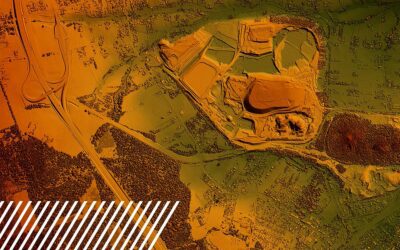
LiDAR
Many licensed surveyors and engineering firms across the US are turning to FlyGuys to help with their LiDAR drone services needs. Our expert services and best in class sensors can save you a significant amount of both time and money.
Progress Monitoring
Get the aerial vantage points on your assets and projects. Visual or thermal imaging, video or still images of hard to reach locations, expertly packaged and provided in immediately usable formats.
Aerial Imaging
Get the aerial vantage points on your assets and projects. Visual or thermal imaging and video or still images of hard to reach locations, expertly packaged provided in immediately usable formats.
Marketing & Media
Produce professional, broadcast-quality videos with or without drone footage. Infuse music, text, and animation to make a stunning and memorable video that delivers your core message.
Asset Inspection Services
Send a drone to places hazardous to human inspectors such as pitched roofs, industrial stacks, cell towers, wind turbines, hazardous waste sites, or emergency situations.
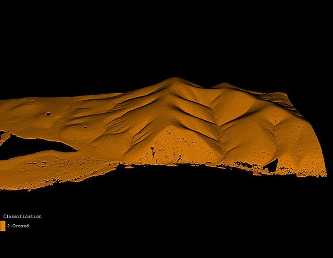
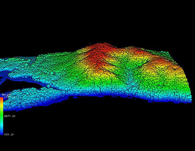
Premium Services: LiDAR
LiDAR technology offers unparalleled accuracy and detail in capturing physical environments. Some LiDAR deliverables are universally valuable across various industries, offering versatile applications and deliverables.
Do you have a data capture project we can help with?
LATEST NEWS & BLOG
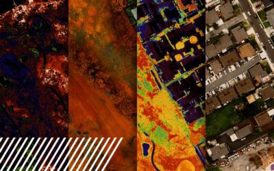
Unlocking the Potential of Multispectral Imaging and Reality Data Capture
Unlocking the Potential of Multispectral Imaging and Reality Data Capture What is Multispectral Imaging? Multispectral imaging is a powerful technology that simultaneously captures image data at specific wavelengths across the electromagnetic spectrum. Unlike...
Understanding Misconceptions About LiDAR Technology
Understanding Misconceptions About LiDAR Technology LiDAR (Light Detection and Ranging) technology has revolutionized geospatial data collection. However, several misconceptions surround its capabilities and applications. Read on to clarify these misconceptions and...

The Evolution of Reality Data Capture
The Evolution of Reality Data Capture Reality data capture, a term synonymous with the transformation of the way we collect and analyze data from the physical world, has made significant strides over the past few decades. Let’s explore the evolution of...