
The Evolution of Reality Data Capture
Reality data capture, a term synonymous with the transformation of the way we collect and analyze data from the physical world, has made significant strides over the past few decades. Let’s explore the evolution of this technology, from its rudimentary beginnings to the sophisticated systems that now serve myriad industries, helping them make informed decisions in real time.
The Early Days: Manual Methods and Initial Automation
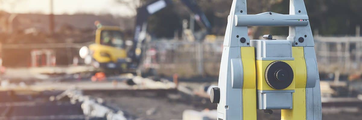
Initially, reality data capture was predominantly manual, involving physical surveys and hand-drawn maps. Surveyors used tape measures and theodolites in industries like construction to assess land. These methods were not only time-consuming but also prone to human error.
The introduction of automated tools marked the first significant evolution in reality data capture. Technologies such as GPS and laser scanners began to replace traditional tools, allowing for more precise and efficient data collection. This era also saw the emergence of early photogrammetry, where measurements were taken from photographs, streamlining processes in mapping and film.
Photogrammetry
Photogrammetry represents a foundational shift in how spatial data is collected and interpreted. Its core principle is the extraction of three-dimensional measurements from two-dimensional data, a concept that has dramatically enhanced capabilities in fields such as topographic mapping, architecture, engineering, manufacturing, quality control, police investigation, and geology.
The earliest documented use of photogrammetry dates back to the mid-19th century. In 1851, the Frenchman Aimé Laussedat, often called the “father of photogrammetry,” began experimenting with using photographic images to create topographic maps. Before Laussedat’s innovative application of photography, traditional surveying methods were the only option for generating these maps, which were often labor-intensive and time-consuming.
Laussedat’s work initially involved using terrestrial photographs—taken from the ground with cameras mounted on tripods—to measure and create maps. He pioneered the technique of reconstructing photographic images using a measuring table and established many foundational principles of photogrammetry. His methods provided a glimpse into the potential of photography in scientific surveying and mapping, setting the stage for future advancements.
The next significant advancement in photogrammetry came with the advent of aerial photography during the First World War. Aircraft equipped with cameras provided a new vantage point previously unattainable, offering extensive coverage and a unique perspective that ground-based photography could not achieve. This facilitated more detailed and expansive mapping projects, accelerating the use of photogrammetry across various scientific and military applications.
Today, photogrammetry has evolved significantly with the integration of advanced technologies such as drones, high-resolution digital cameras, and sophisticated software that can process images to create precise 3D models and maps. These advancements allow for rapid, accurate, and cost-effective data collection, making photogrammetry an invaluable tool in numerous industries that require detailed and accurate geographical information.
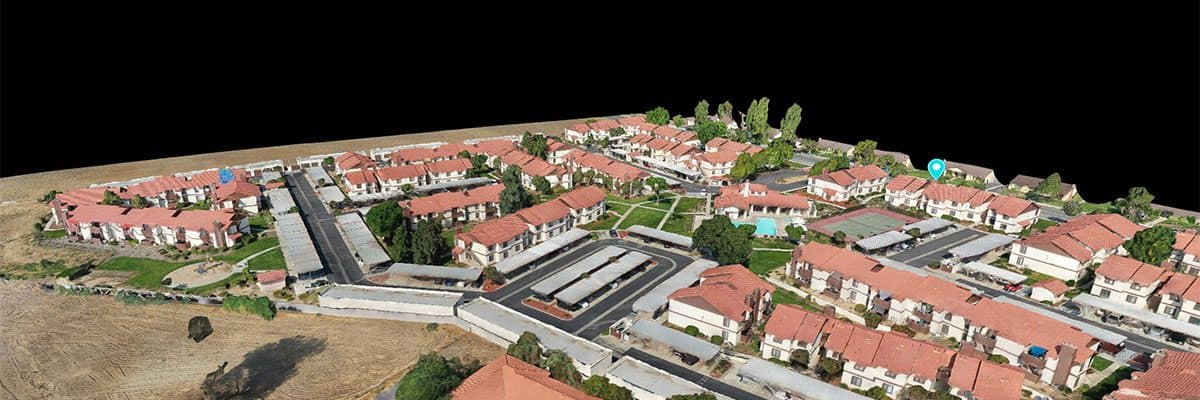
The Rise of 3D Scanning and Modeling
As computing power increased, so did the capabilities of reality data capture technologies. The late 20th and early 21st centuries introduced 3D scanning and modeling. These technologies could capture the dimensions and spatial relationships of objects and environments in much finer detail. This period heralded a new era for industries like architecture, engineering, and construction (AEC), which began to rely heavily on 3D models for planning, design, and maintenance.
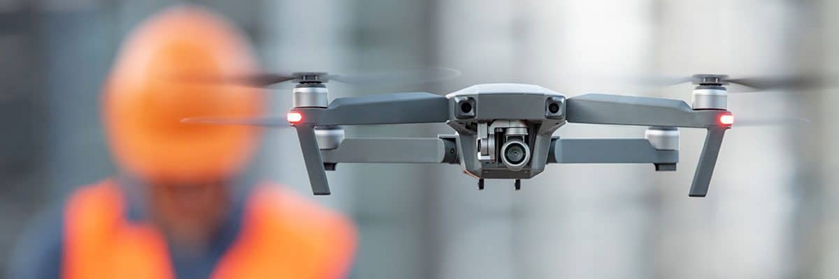
The Drone Revolution
The advent of drone technology brought a paradigm shift in data capture. Drones equipped with cameras, sensors, and GPS have allowed for collecting large amounts of data from areas that are difficult to access on foot or by manned vehicles. The aerial perspective drones provide is invaluable for applications such as agricultural mapping, disaster management, and large-scale infrastructure monitoring.
Versatility of Sensors and Cameras
Drones can be equipped with a variety of sensors and cameras depending on the specific needs of a project. Common payloads include:
- High-definition cameras for detailed visual inspection.
- Thermal cameras for detecting heat signatures.
- LiDAR sensors for generating precise topographical maps.
- Multispectral sensors for agricultural analysis.
This versatility makes drones incredibly powerful tools for collecting detailed environmental data, monitoring changes over time, and conducting surveys with unparalleled precision.
Applications Across Industries
Agriculture uses drones for crop monitoring, irrigation management, and soil health assessment through multispectral imaging. This technology allows farmers to observe the health of their crops at a granular level and make informed decisions that enhance productivity and sustainability.
Disaster management has also been revolutionized by drone technology. In the aftermath of natural disasters such as floods, earthquakes, and hurricanes, drones provide rapid assessment of affected areas, helping to map out damage, locate survivors, and plan effective responses. The aerial data drones capture is crucial for emergency services and disaster relief organizations to prioritize their efforts efficiently.
Furthermore, drones offer a safe and cost-effective alternative to traditional methods of infrastructure monitoring. They are used to inspect and monitor the condition of bridges, roads, power lines, and wind turbines. The ability to capture real-time images and generate 3D models helps identify potential maintenance issues before they become critical, thereby reducing downtime and repair costs.
Enhanced Data Processing with Advanced Software
The data captured by drones is processed using sophisticated software that can analyze images and generate detailed reports and visualizations. These tools allow for the creation of Orthomosaic maps, 3D models, and volumetric measurements. Advanced algorithms can further interpret the captured images to detect changes, classify materials, and even predict future conditions by integrating historical data.
Regulatory and Operational Considerations
The proliferation of drone technology in commercial applications has led to an evolving landscape of regulatory considerations. Various countries and regions have established specific guidelines and requirements for drone operations, focusing on safety, privacy, and airspace management. Operators must navigate these regulations and often obtain certifications or permissions to deploy drones for commercial data capturing.
Overall, the integration of drone technology into reality data capturing represents a significant leap forward in how data is gathered and utilized across various fields. The continued advancement of drone capabilities and the refinement of data processing technologies are likely to further expand this transformative tool’s potential applications and efficiencies.
Integration of AI and Machine Learning
The most recent advancement in the evolution of reality data capture is the incorporation of artificial intelligence (AI) and machine learning. These technologies empower the automated analysis of vast datasets that drones and sensors collect. AI algorithms can identify patterns, predict outcomes, and even make decisions based on real-time data. For instance, in agriculture, machine learning models can predict crop yields and detect plant diseases, enabling farmers to make better-informed decisions about crop management. Integrating AI and machine learning represents a significant step toward a connected and autonomous world where drones play a crucial role in data collection and analysis.
Looking ahead, the integration of reality data capture with other emerging technologies like the Internet of Things (IoT) and augmented reality (AR) holds the promise of even more incredible advancements. IoT devices could provide continuous streams of data from multiple sources, which, when combined with reality data capture, would offer unprecedented levels of insight and control over physical environments. This could revolutionize the way infrastructure is monitored and managed.
Augmented reality, on the other hand, could enhance the way data is visualized and interacted with, providing professionals in all fields with more intuitive and actionable insights from the data collected. Integrating drone technology with IoT and AR could reshape how we interact with and utilize data, opening up new possibilities and efficiencies in various industries.

The Evolution Continues
The evolution of reality data capture technologies is not just about technological advancement but fundamentally changing how industries operate, enhancing efficiency, accuracy, and safety. From manual measurements to AI-powered drones, reality data capture continues to evolve, becoming an indispensable part of the toolkit for industries ranging from construction to agriculture, emergency services, and beyond.
As this technology continues to develop, its potential applications expand, promising to revolutionize data collection and analysis in ways we are only beginning to imagine. The future of reality data capture is a fascinating frontier, one that holds the promise of transforming the very fabric of how we interact with and manage our physical world.