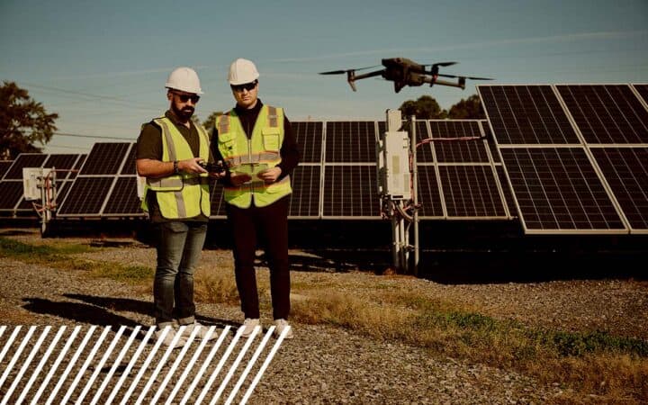
From Sky to Data: How FlyGuys Became a Reality Data Powerhouse
What started as a simple drone service company in 2018 has grown into something much bigger. FlyGuys is no longer just about flying drones—we’re about capturing reality and turning it into usable, powerful data.
Over the years, we’ve expanded from working with golf courses and construction companies to serving industries like oil and gas, agriculture, insurance, telecommunications, and even artificial intelligence. We’ve added groundbreaking technology like LiDAR, multispectral imaging, thermal inspections, and confined space drones. And let’s not forget the digital tools we’ve built to make it easier for our customers and pilots to connect and complete missions.
So how did we get here? Let’s take a trip through FlyGuys’ evolution and how we help businesses across industries turn aerial data into real-world solutions.
The Early Days: From Greens to City Streets
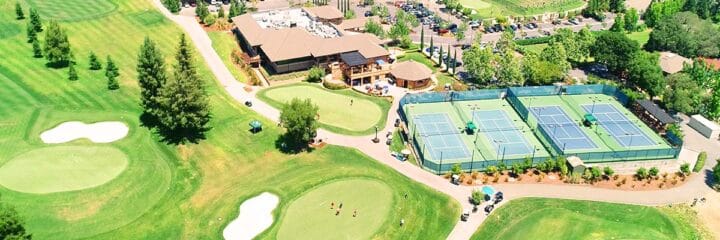
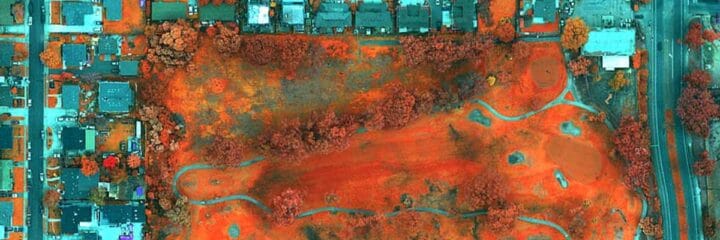
FlyGuys took off in 2018 with a focus on a few key industries: golf courses, construction, and city drainage projects. These were the first to realize the power of drones in capturing detailed, high-resolution data quickly and safely.
Golf courses used our services to map layouts, improve drainage, and maintain their greens more efficiently. No more guessing where problem areas were—drone data gave a clear aerial view of what needed attention.
Construction companies quickly saw the benefits too. Instead of relying on slow, manual surveys, they started using our drone data for site planning, progress tracking, and material measurements. This saved them time, money, and a lot of headaches.
Meanwhile, municipalities responsible for city drainage used drones to analyze stormwater runoff, identify problem areas, and improve flood prevention efforts. Traditional methods took weeks. Drone data did it in days.
Growing into New Industries in 2019
By 2019, it was clear that reality data was becoming a must-have in more industries than we ever expected. Companies started reaching out to us, and we actively sought out new markets. That’s when we expanded into oil and gas, telecommunications, utilities, and environmental monitoring.
Oil and gas companies needed pipeline inspections, flare stack monitoring, and site surveys—tasks that were dangerous and expensive when done manually. With drone data, they could inspect assets from above and detect potential issues before they became costly disasters.
Telecommunications companies needed a better way to inspect their cell towers. Instead of sending climbers up dangerous heights, they used our drone pilot network to get detailed imaging of their towers in minutes. This made maintenance faster, safer, and much more efficient.
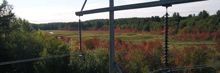
Utility companies, like power providers, started using drones to monitor power lines, substations, and infrastructure. Instead of shutting down entire grids for routine checks, they could now inspect from the sky with no downtime.
Environmental agencies jumped on board too, using drones to monitor forests, track erosion, and study wildlife habitats. Aerial data gave them a bigger picture—literally—of the landscapes they were trying to protect.
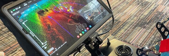
The Game-Changer: LiDAR Arrives in 2020
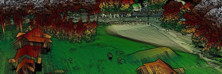
In June 2020, we stepped up our game by introducing LiDAR scanning to our list of services. This technology transformed the way we captured data. Instead of just taking pictures, LiDAR uses laser pulses to create precise 3D maps of terrain, structures, and landscapes.
Surveyors, engineers, and environmental scientists loved it. It helped with everything from road and bridge planning to topographic mapping and land development. LiDAR was a game-changer for construction, infrastructure, and conservation projects, providing hyper-accurate elevation data even through dense vegetation.
2023: Scaling Up, New Tech, and Smarter Solutions
By 2023, reality data wasn’t just a niche service—it was becoming an essential tool for industries like insurance and roofing inspections.
Insurance companies realized they could speed up claims processing after natural disasters by using drones to assess property damage instead of waiting for on-site adjusters.
Roofing inspections became safer and faster because drones could capture high-resolution images of roofs without requiring workers to climb onto them. This reduced risks and provided a more thorough assessment than traditional methods.
That same year, we introduced multispectral imaging for agriculture and thermal inspections for infrastructure.
Multispectral imaging allowed farmers to analyze crop health, water stress, and nutrient deficiencies. By capturing images across different light spectrums, they could detect problems that weren’t visible to the human eye. This helped them optimize crop yield and reduce losses.
Thermal inspections helped detect heat variations in buildings, electrical systems, and industrial equipment. Companies could now identify overheating components, insulation gaps, and electrical faults before they became safety hazards.
And because we were growing fast, we expanded our sales team to reach more customers nationwide. More industries were realizing they needed reality data, and we wanted to be there to help.
2024: Taking Reality Data to the Next Level
In 2024, we didn’t slow down. We added confined space drones, partnered with AI companies, and built digital tools that made reality data more accessible than ever.
Confined space drones allowed us to inspect tanks, tunnels, and industrial sites where human entry was risky or impossible. Instead of sending workers into dangerous environments, these drones provided clear, detailed imaging safely and efficiently.
At the same time, AI companies started knocking on our door, needing high-quality aerial data to train their machine-learning models. Whether for automated asset monitoring, geospatial analysis, or predictive maintenance, FlyGuys became a key partner in fueling AI with real-world data.
And to keep everything running smoothly, we built a pilot and customer portal that makes it easier than ever to track projects, get updates, and access data.
We also launched the FlyGuys Drone Pilot App, giving our nationwide network of pilots a streamlined way to manage missions, update job statuses, and upload deliverables in real-time.
The Future of FlyGuys and Reality Data
FlyGuys has come a long way from our early days of mapping golf courses. Today, we’re a nationwide online marketplace that helps industries turn aerial data into powerful, actionable insights.
With advances in AI, automation, and drone technology, the future of reality data capture is limitless. We’ll continue expanding our services, improving our technology, and pushing the boundaries of what’s possible.
If your business needs reality data, FlyGuys has the tools, technology, and expertise to help. Contact us today to see how we can help your next project.