Reimagining Risk: How Drones Are Reinventing the Insurance Landscape
In today’s insurance landscape, the quality of data captured from site inspections has become more critical than ever before. Insurance and loss-adjusting professionals worldwide rely on this data to provide crucial evidence supporting damage assessments. With national teams of adjusters and experts collaborating, accessibility and quick data availability across devices are paramount. Drones are revolutionizing the insurance industry, enabling informed underwriting decisions, streamlining claims adjustments, and providing valuable insights to evaluate risk.
Informing Underwriting Decisions
Drones help insurers gather detailed information about a property’s risks for more informed underwriting decisions, tailored coverage options, and accurate pricing. They enhance efficiency, minimize human error, and provide valuable data for informed choices, benefiting both insurers and policyholders.
Applications and Real-life Scenarios
Pre-Loss Inspection
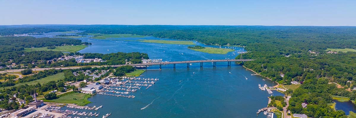
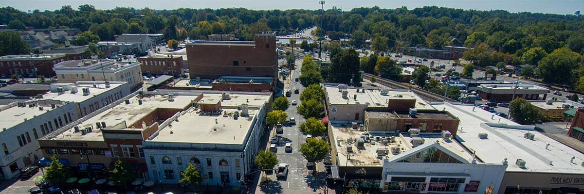
Before providing coverage, a pre-loss inspection enables insurers to assess a property’s condition, vulnerabilities, and potential risks. Drones with high-resolution cameras and advanced imaging capabilities offer a bird’s-eye view of properties, capturing detailed aerial imagery and data. This data includes information about the property’s physical characteristics, the surrounding environment, and potential hazards. Insurers can analyze this data remotely and accurately assess risks associated with the property, enabling them to tailor coverage options and pricing accordingly.

- Real-life scenario: An insurance company receives an application for property insurance on a coastal home. The insurer deploys a drone to conduct a pre-loss inspection to evaluate the risks associated with insuring the property. The drone captures imagery and data, revealing the proximity to the coastline, potential flood zones, and the property’s structural condition. This information allows the insurer to assess the risks accurately and determine appropriate coverage options and premiums for the property owner.
Property Measurements
Accurate property measurements are vital for proper valuation and coverage. Traditional methods are slow, error-prone, and require physical presence. Drones with advanced sensors and imaging tech can quickly measure dimensions, ensuring accurate valuation and coverage limits.
- Real-life scenario: An insurance company receives an application for commercial property insurance for a large warehouse. The insurer dispatches a drone equipped with LiDAR (Light Detection and Ranging) technology. The drone efficiently captures data on the building’s dimensions, including height, area, and volume. This accurate measurement data allows the insurer to provide precise coverage and appropriate premium rates based on the property’s unique characteristics.
Streamlining Claims Adjustments
Traditionally, on-site inspections for claims adjustments were time-consuming and cumbersome. By leveraging drone capabilities in claims adjustments, insurance professionals can streamline the assessment process, reduce costs, and provide policyholders with faster and more accurate settlements.
Applications and Real-Life Scenarios
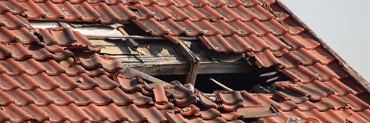
Roof Inspections and Other Damage Inspections
After severe weather, roof damage is a frequent problem. Manually inspecting it can be time-consuming and dangerous. Fortunately, drones with high-resolution cameras can efficiently capture detailed images of rooftops.
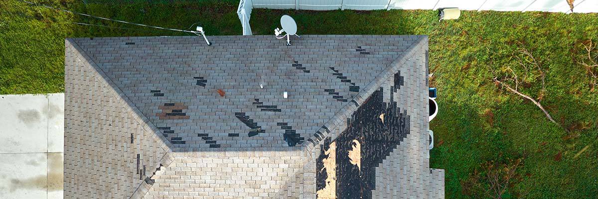
- Real-life scenario: An insurance company receives numerous roof damage claims after a hailstorm hits a neighborhood. By deploying drones, adjusters efficiently survey affected properties from an aerial view. The high-resolution imagery captured by the drones provides a clear picture of the damage, allowing adjusters to assess claims promptly and provide accurate settlements to policyholders.
Drones are not just for inspecting roofs. They can be used to evaluate different types of damage, such as structural damage to buildings, vehicle damage, or other property components. Drones provide visual data that can speed up claims adjustments and are versatile tools for assessing damage.
- Real-life scenario: In the aftermath of a natural disaster, such as a hurricane or flood, insurance companies face an influx of property damage claims. Instead of dispatching adjusters to each location, drones are deployed to conduct comprehensive inspections. By capturing detailed imagery and data, drones enable adjusters to assess damage without physically visiting each property. This streamlines the claims process, accelerates settlements, and ensures the efficient handling of multiple claims simultaneously.
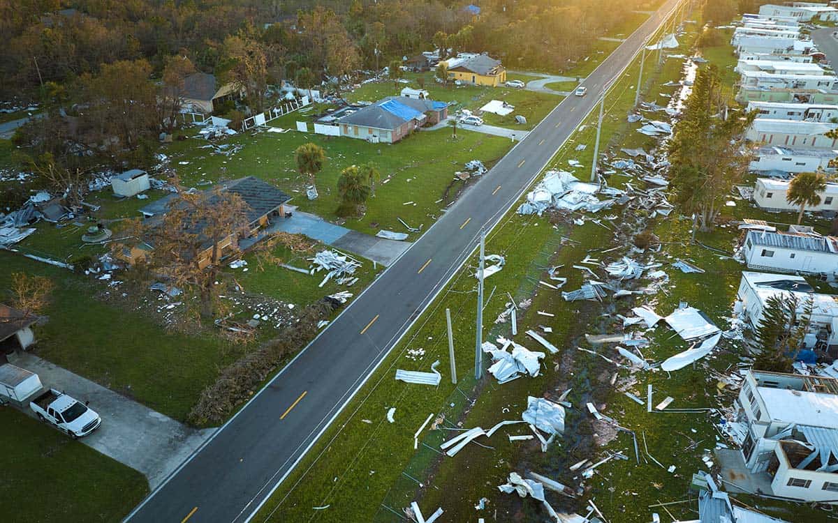
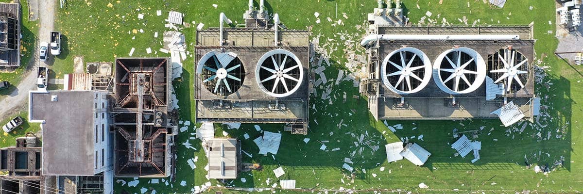
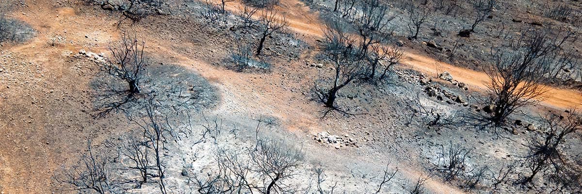
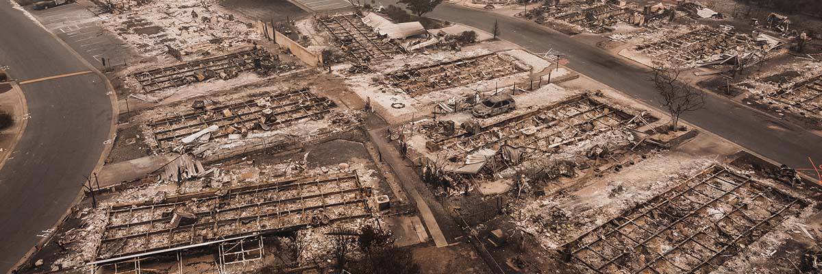
Widespread Damage Inspections
In situations where damage is widespread, such as a wildfire or an expansive industrial accident, assessing the impact over a large area can be a logistical challenge. Drones conduct wide-area surveys, capturing imagery that provides a comprehensive overview of the damage. This aerial perspective helps insurers understand the scope of the loss and make informed decisions regarding claim settlements.
Enhancing Risk Assessments
Drones help insurers assess risk and inspect properties more accurately and efficiently. This data allows for tailored coverage options, appropriate premiums, and proactive risk management, benefiting insurers and policyholders while stabilizing the industry.
Applications and Real-Life Scenarios
Risk Assessments
Insurers can use drones equipped with advanced imaging technology to get a bird’s-eye view of properties and their surroundings. This helps identify potential hazards and make well-informed coverage decisions.
- Real-life scenario: An insurance company is assessing the risk of insuring a warehouse located near a river. By deploying a drone, the insurer captures aerial imagery and data that reveals the property’s proximity to the water source. The drone also identifies potential flood zones, helping the insurer assess flood risk accurately. This information allows the insurer to tailor coverage options, such as offering flood insurance as an add-on or adjusting premiums to account for the specific risk associated with the property’s location.
Detailed Insurance Inspections
Drones provide detailed insurance inspections, accessing hard-to-reach areas to capture precise data. They help evaluate risks comprehensively by inspecting critical components like boilers, electrical systems, and roofs. This helps insurers identify potential weaknesses or maintenance issues that could increase property damage or accidents.
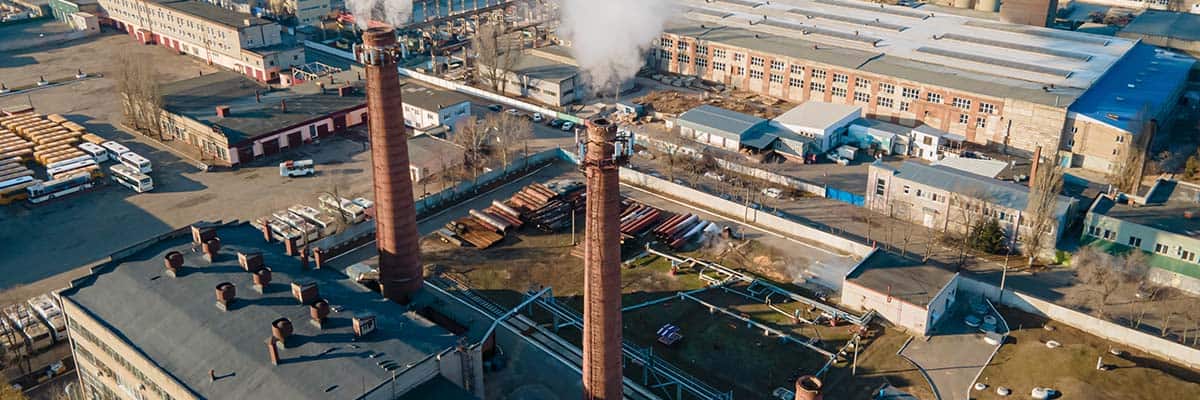
- Real-life scenario: An insurance company is assessing the risk of insuring a manufacturing facility with complex boiler systems. The insurer employs drones equipped with thermal imaging cameras that conduct detailed inspections of the boilers. The thermal imaging identifies potential anomalies in temperature patterns that could indicate issues such as leaks or malfunctioning parts. This data allows the insurer to evaluate the risk associated with the boilers accurately and tailor coverage options or recommend maintenance measures to mitigate potential risks.
Uncovering Fraudulent Activities
It is estimated that between 10% and 20% of insurance claims are fraudulent. Drones help insurance companies combat fraud by detecting fraudulent activities, investigating staged accidents, and verifying property damage. This minimizes financial losses and upholds insurance industry integrity.
Applications and Real-Life Scenarios
Investigating Staged Accidents
Drones with high-resolution cameras can capture real-time footage of accident scenes, helping insurers differentiate genuine accidents from staged ones and preventing fraudulent payouts.
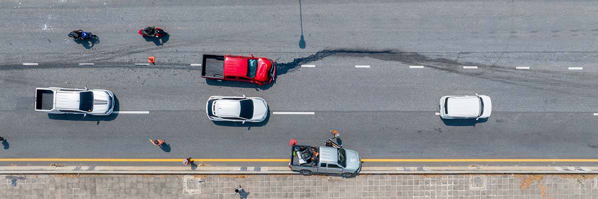
- Real-life scenario: A driver claims a severe collision occurred at an intersection, leading to significant vehicle damage. Suspecting possible fraud, the insurer dispatches a drone to the accident location. The drone captures aerial footage of the scene, providing a comprehensive view of the accident and its surroundings. This footage reveals inconsistencies and suspicious behavior that suggest the accident may have been staged. The evidence gathered by the drone helps the insurer counter fraudulent claims and protect against financial losses.
Verifying Property Damage
Insurance claims related to property damage are susceptible to fraudulent exaggeration or misrepresentation. Drones equipped with high-resolution cameras and sensors can capture detailed imagery of properties, allowing insurers to accurately verify the extent and cause of reported damages. This provides concrete evidence to identify instances of fraud and ensure that claims are settled accurately and fairly.
- Real-life scenario: A policyholder files a claim for significant property damage from a fire. To verify the extent of the damage and investigate potentially fraudulent claims, the insurer deploys a drone equipped with thermal imaging capabilities. The drone captures detailed thermal imagery of the property, revealing discrepancies between reported damage and actual heat signatures. This evidence collected by the drone helps the insurer identify fraudulent claims and take appropriate action to mitigate financial losses.
Proactive Surveillance
Insurers can use drones to prevent fraud by conducting proactive surveillance in high-risk regions. With real-time footage, they can detect suspicious activities at an early stage.
- Real-life scenario: An insurance company identifies a region with a high incidence of fraudulent property damage claims. The insurer employs drones with high-resolution cameras and video analytics to proactively monitor the area. The drones conduct regular aerial surveillance, capturing real-time footage of the properties in question. If any suspicious activities are observed, the insurer can take immediate action to investigate further and prevent fraudulent claims from being filed.
Accessibility and Efficiency
By using drones, adjusters and experts can work together from different parts of the country to easily access and quickly analyze data collected during site inspections. This makes communication and decision-making more efficient, allowing seamless collaboration among national teams using various devices.
Applications and Real-Life Scenarios
Real-Time Data Accessibility
Drones capture valuable data and imagery during site inspections, essential for risk assessment, claims processing, and decision-making. Drones ensure this data is accessible in real-time. Cloud-based storage and advanced data management systems allow adjusters and experts to access captured data remotely, anytime, and from anywhere. This real-time accessibility empowers nationwide teams to make timely and informed decisions, even when physically distant from the inspection site.
- Real-life scenario: An insurance company has a team of adjusters spread across different regions, each responsible for a specific territory. After a drone inspection is conducted on a property, the captured data and imagery are securely stored in the cloud. This allows all adjusters to access and review data simultaneously, regardless of geographical location. They can collaboratively analyze the information, discuss potential risks, and collectively determine the appropriate course of action. This real-time accessibility ensures efficient and seamless collaboration among the global team of adjusters.
Streamlined Communication and Collaboration
Drones improve communication and collaboration among teams. They eliminate physical distance and time constraints, making it easy for team members to share data through digital platforms. This facilitates effective communication and knowledge sharing, leading to more efficient discussions, quicker decision-making, and prompt action.
- Real-life scenario: A large insurance company has a specialized team of experts working together on complex claims that require input from various domains. After a drone inspection, the captured data is shared with team members instantly. The experts can remotely review the data, discuss their observations, and share insights and recommendations through virtual meetings or collaborative platforms. This streamlined communication allows the team to work together efficiently, leveraging each member’s expertise and ensuring comprehensive and well-informed decision-making.
Seamless Integration with Devices
Drones make data accessible across devices for adjusters and experts who can view captured data easily on laptops, tablets, or mobile devices.
- Real-life scenario: An adjuster is on-site at a property, conducting a physical inspection while collaborating with a team of experts in different time zones. The adjuster captures real-time drone imagery and data using a tablet. The captured data is instantly synchronized with the cloud storage, allowing remote experts to access and analyze it on their respective devices. This seamless integration ensures that all team members have the necessary information at their fingertips, facilitating efficient collaboration and informed decision-making.
From Heights to Insights
The insurance industry is witnessing a paradigm shift with the integration of drone technology. Drones are revolutionizing how insurers inform underwriting decisions, streamline claims adjustments, and gain valuable insights to evaluate risk. Insurance professionals can enhance their efficiency, accuracy, and customer satisfaction by harnessing the power of drones for pre-loss inspections, property measurements, roof damage inspections, wide area damage assessments, fraud monitoring, risk assessments, insurance inspections, and boiler inspections. With drones as their aerial allies, insurers can confidently navigate the evolving landscape of risk assessment, claims management, and fraud detection, ultimately propelling the industry to new heights of success.
Insuring the Future
The future of drone use in the insurance industry holds tremendous potential for further innovation and advancement. As regulations evolve and become more drone-friendly, insurance companies will be able to leverage drones on a larger scale, transforming the industry by providing faster, more accurate assessments, improving risk management strategies, and enhancing customer experiences. The future of drone use in insurance is undoubtedly set to soar to new heights, redefining industry practices and unlocking untapped potential.