Skip to content
FlyGuys
Menu
  • Drone Services

    Drone Services

    Improve Jobsite Safety, Minimize Costs & Increase Efficiency

    Drone Services
    • Premium Services
    • LiDAR
    • Aerial
    • Surveying & Mapping
    • Inspections
    • Consulting
    • Volumetrics
    • LiDAR
    • Surveyors And Mappers Hero Image
      Surveying & Mapping
  • Industries

    Industries We Serve

    Your Industry, Our Mission

    Industries
    • Agriculture
    • Cell Tower Inspections
    • Construction, Architecture, and Engineering
    • Emergency & Disaster
    • Energy
    • Industrial
    • Mining
    • Transmission & Distribution
    • Marketing
    • Other Industries
    • Other Industries Page Hero Image
      Other Industries
  • About

    About FlyGuys

    Pioneering Reality Data-Capturing Technology

    About
    • About
    • Team
    • How FlyGuys Works
    • News
    • Blog
    • fly guys team and ribbon cutting
      Team
    • Person holding drone remote
      How FlyGuys Works
  • Industry Insights
  • Case Studies
  • FAQ
  • Careers
  • Contact
  • Get a Quote
  • Be a Pilot
  • Industry Insights
  • Case Studies
  • FAQ
  • Careers
  • Contact
Revolutionizing Reality Capture With Navvis Vlx 2 Features, Benefits, And Industry Applications Header
Energy 5 min read

Introducing NavVis: Elevating Reality Data Capture with Cutting-Edge Technology

Continue Reading
Harnessing Reality Data Capture For The Renewable Energy Industry Header
Energy 6 min read

Harnessing Reality Data Capture for the Renewable Energy Industry

Continue Reading
Why Thermal Imaging Is Critical For Accurate Flare Stack Inspections Header
LiDAR 4 min read

Why Thermal Imaging is Critical for Accurate Flare Stack Inspections

Continue Reading
Selling Real Estate With Drone Services Header
Construction 6 min read

Selling Real Estate with Drone Services

Continue Reading
611c1b734d0ff
News 1 min read

FlyGuys Launches Platform to Connect Pilots With Customers

Continue Reading
How Reality Data Capture Helps Prepare For Disasters Header
Safety 5 min read

How Reality Data Capture Helps Prepare for Disasters

Continue Reading
Agriculture 1 min read

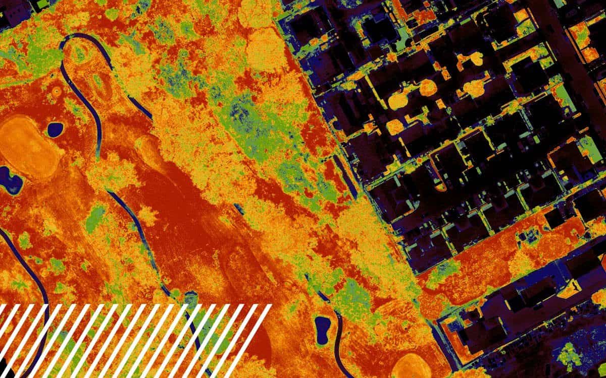
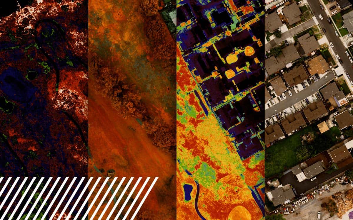
Understanding NDVI: Normalized Difference Vegetation Index

The Normalized Difference Vegetation Index (NDVI) is a metric derived from multispectral imaging, useful in assessing vegetation health.

Continue Reading
LiDAR 6 min read

Unlocking the Potential of Multispectral Imaging and Reality Data Capture

Explore the power of multispectral imaging in agriculture. Enhance crop health, disease prevention, and resource management.

Continue Reading
LiDAR 6 min read

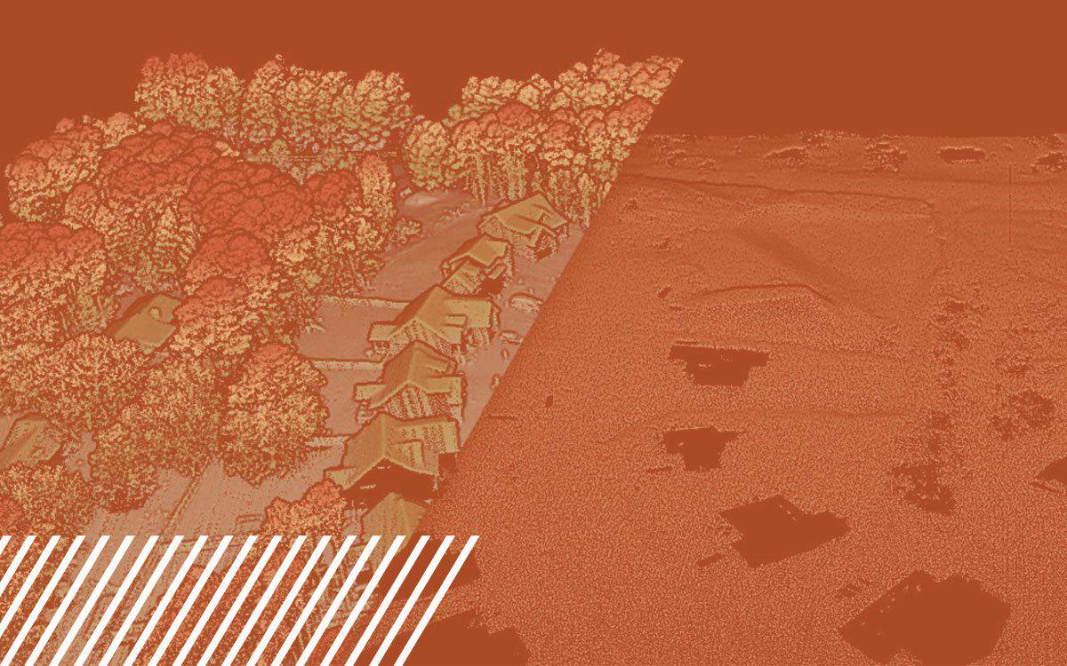
Understanding Misconceptions About LiDAR Technology

Discover the capabilities and limitations of LiDAR technology while dispelling common misconceptions about its various applications.

Continue Reading
Inspections 4 min read

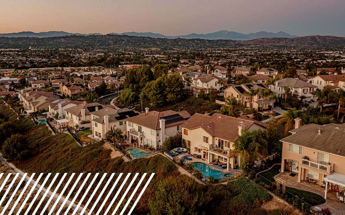
The Transformative Impact of Reality Data Capture in the Insurance Industry

How reality data capture is transforming the insurance industry through efficiency, accuracy, and saving time and cost.

Continue Reading
Pilots 6 min read

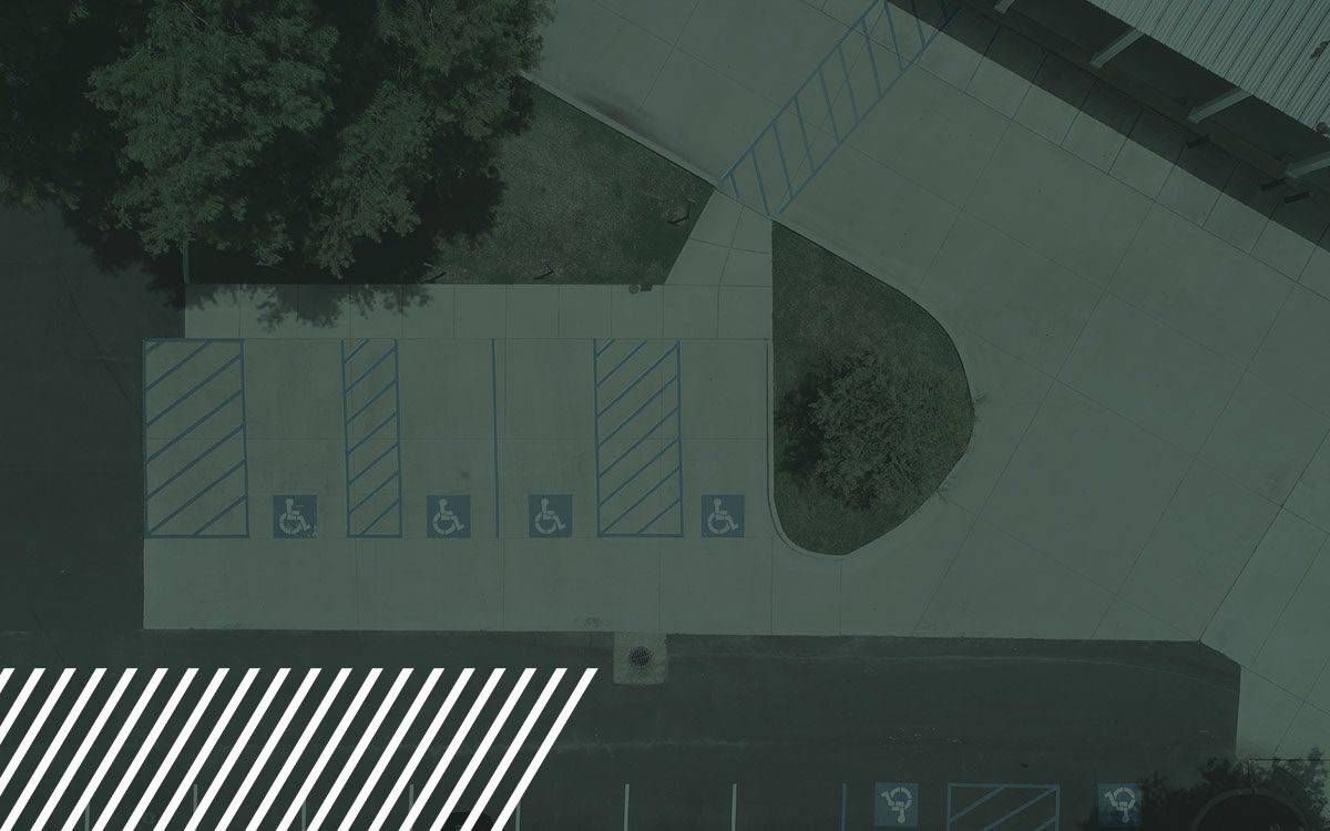
Enhancing Pavement Assessments with Reality Data Capture Technology

Transform pavement assessments with reality data capture technology. Learn how drones and LiDAR streamline road inspections, boosting safety and accuracy.

Continue Reading
Pilots 4 min read

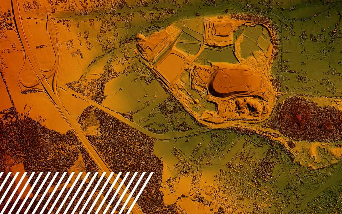
Understanding Digital Surface Models, Digital Terrain Models, and Digital Elevation Models

Discover the comprehensive guide to Digital Surface Models, Digital Terrain Models, and Digital Elevation Models.

Continue Reading
Page 3 of 11
  • « Newer
  • 1
  • 2
  • 3
  • 4
  • 5
  • 6
  • …
  • 10
  • 11
  • Older »
FlyGuys

FlyGuys 221 Jefferson Street
Lafayette, LA 70501

Phone:
1-888-837-0940
  • Get a Quote
  • Be a Pilot
  • Facebook
  • LinkedIn
  • YouTube
  • Instagram
  • X (Twitter)
  • About
    • Team
    • How FlyGuys Works
    • Careers
    • FAQ
    • News & Press Releases
    • Blog
    • Locations
    • Contact
  • Services
    • LiDAR
    • Aerial Imaging
    • Surveying & Mapping
    • Inspections
    • Consulting
    • Volumetrics
  • Industries
    • Agriculture
    • Cell Tower Inspections
    • Construction, Architecture, and Engineering
    • Emergency & Disaster
    • Energy
    • Industrial
    • Mining
    • Transmission & Distribution
    • Marketing
    • Other Industries

FlyGuys provides technology solutions and services for aerial data acquisition. FlyGuys is not a state-licensed professional engineering or land surveying firm, and its employees are not state-licensed professional engineers or land surveyors. All content on this website including text, graphics, images, and other material is intended for general information only. This content is not applicable to any specific context or condition. It is not a substitute for state-licensed professional engineering or land surveying services, or an offer to provide such services.

© 2025 FlyGuys

  • Privacy Policy
  • Terms & Conditions