
Why Telecommunications Companies Are Turning to LiDAR
As the telecommunications industry races to modernize infrastructure and roll out next-gen networks, the need for high-accuracy data capture has never been more critical. Whether it’s for planning fiber routes through rural terrain or placing new towers in dense urban zones, LiDAR is emerging as a game-changer.
But why are more telecom companies turning to this technology now?
“It’s simple,” says Luke Adams, telecom expert and Sales Account Executive at FlyGuys. “LiDAR is more reliable, more accurate, and it reduces human error. We’re seeing a clear shift from boots-on-the-ground inspections to drone-powered data collection.”
Let’s break down how LiDAR is transforming telecom workflows, making planning safer, faster, and more precise.
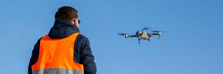
Manual Surveys Are Out. High-Precision LiDAR is In.
Traditional telecom surveys can be slow, risky, and expensive. Crews often need to climb towers, walk miles of terrain, or revisit sites multiple times just to collect the basics.
“Manual surveys take time and put people at risk,” Luke explains. “Drones with LiDAR eliminate those risks and cut down operational costs. Plus, we can deliver up-to-date 3D meshes of towers, poles, and terrain that traditional methods just can’t match.”
That means fewer site visits, less labor, and more reliable data, all without sacrificing detail.

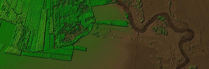
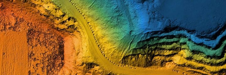
Powering Fiber Route Planning with Precision Terrain Models
When it comes to laying fiber, accuracy is everything. A small miscalculation can lead to massive costs, delays, or the need to reroute entire segments.
LiDAR helps telecom companies plan routes with unmatched accuracy, identifying slopes, potential vegetation hazards, and infrastructure obstacles like guardrails or signage.
“We recently mapped over 130 miles for a fiber route,” says Clay Sebesky, Sr. SAE and industry expert at FlyGuys. “LiDAR gave us the base layer plus imagery so the engineers could see where the poles are, how high they are, and what physical obstructions might be in the way.”

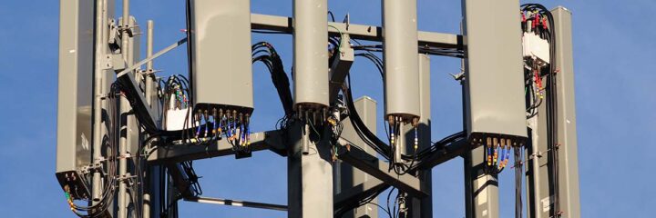
Smarter Tower Placement and Obstruction Analysis
Choosing where to install a new tower isn’t just about space—it’s about elevation, signal path, surrounding structures, and access to power.
LiDAR captures the data points engineers need: terrain elevation, tree heights, surrounding buildings, and even slope angles that could cause line sag.
“We can generate full 3D measurements of the area,” says Luke. “With GCPs and base stations in place, we can deliver ultra-precise data to help engineers plan for optimal coverage and safety.”
Faster, Scalable Inspections
One of LiDAR’s biggest advantages is how quickly and consistently it works. At FlyGuys, a single pilot can scan up to 6 miles in a day or perform dozens of pole inspections with detailed visuals.
“With drone pilots in a rhythm, we can double or triple the number of poles inspected in a day,” Luke shares. “And that’s not just photos. We’re talking about full LiDAR point clouds, orthomosaics, and elevation models.”
Once the data is captured, the workflow is streamlined:
- Planning: Site review, flight plans, FAA waivers.
- Capture: Drone flights with base stations and GCPs.
- Processing: Point cloud creation, data cleaning, stitching.
- QA/QC: Final quality review.
- Delivery: Formats like .LAS, DEM, DTM, DWG, and GeoTIFF.
LiDAR Isn’t Always the Answer, But It’s Often the Best Tool
There are situations where traditional RGB imagery might be more appropriate, such as close-up inspections of pole tops or purely visual asset checks.
“It depends on the outcome,” Clay emphasizes. “You have to start with the goal. If you just need photos, LiDAR might be overkill. But if you’re planning infrastructure, routing fiber, or creating a digital twin, LiDAR is the gold standard.”
In fact, many large tower companies are pushing for digitized asset libraries, complete with photogrammetry and LiDAR models, to help manage thousands of towers remotely.
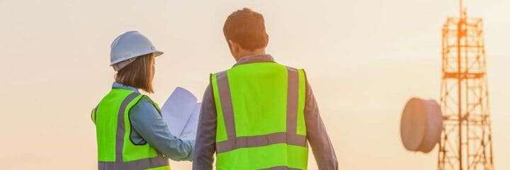
FlyGuys Makes It Easy for Telecom Teams to Scale
What makes FlyGuys different? It’s not just the tech, it’s the strategy.
“We don’t just fly drones,” Luke says. “We help clients get exactly what they need. That means understanding the end use of the data, tailoring the collection method, and delivering clean, usable files through professional drone services that are built to scale.”
Whether your project needs topographic maps, obstruction models, or equipment clearance reports, FlyGuys can build a data capture plan that’s fast, safe, and built to scale.
Thinking About LiDAR for Your Next Telecom Project? Start with the Goal.
Clay offers one final piece of advice:
“Don’t just use LiDAR for the sake of it. Think about the outcome you want, then work backward. That’s how you get the best results, and that’s what FlyGuys does really well.”
The Future of Telecom is Data-Driven
As telecom companies face pressure to expand networks, reduce downtime, and operate more efficiently, LiDAR is emerging as a critical tool in their toolkit.
With speed, precision, and safety on its side, it’s no surprise that more telecom teams are leaving manual inspections behind and flying forward with LiDAR.