When do I Need LiDAR?
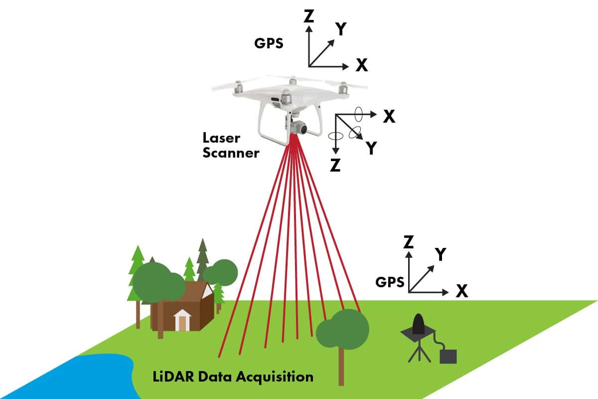
LiDAR (Light Detection and Ranging) is a remote sensing technology that measures the distance from a sensor to an object. A laser illuminates the target through light pulses which then return to the sensor, and the time it takes for the laser to return is calculated to determine the distance to the object.
Sounds pretty cool, huh? The uses of LiDAR technology aren’t totally new, but you may be surprised at some of its applications. LiDAR is evolving and new ways to put it to use are still being discovered.
Let’s see if your business can use this high-tech sensor.
Airborne LiDAR
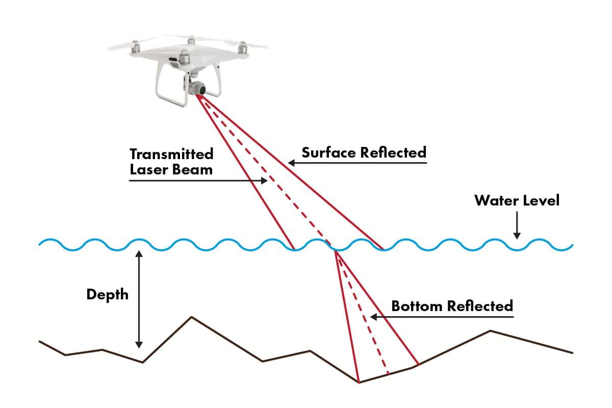
LiDAR sensors can be attached to a drone or helicopter to collect data in the form of point clouds (3D coordinate maps). Airborne LiDAR can further be described by general application; topographic LiDAR is used to map the land, and bathymetric LiDAR penetrates water to map and find measurements on the seafloor. Both types allow mapping professionals to explore natural and manufactured territories with accuracy and precision. In other words, LiDAR is used to examine the surface of the Earth.
What can LiDAR data do for you? There are various types of data that LiDAR technology can provide that save time and money while improving your workflow. Let’s take a look at a few:
Density Measurements
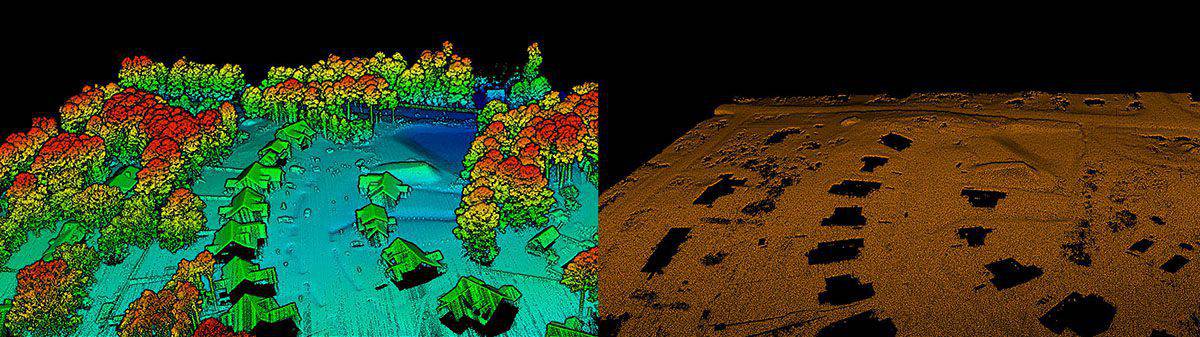
When dense trees cover an area, LiDAR sensors can reach the earth’s surface through tiny openings in the canopy, foliage, and plant life to detect depth data. LiDAR can accurately generate a topographical map of a forested area when manual mapping would be too time-consuming. LiDAR point cloud data can be converted to create high-precision 3D digital elevation models or DEM. Digital terrain models (DTM) represent bare ground surface, and digital surface models (DSM) include vegetation and building data.
Volumetrics
LiDAR sensors can track and measure material stockpiles. Automated, high-tech, and no-contact sensors are much more efficient and cost-effective than truckload counting, a walking wheel, or other means to calculate volume measurement. Likely more fun, too!
Contours
Users can create detailed contour maps with the highly accurate elevation data from LiDAR collection. This allows the user to view the vertical profile of the mapped environment. Ain’t no mountain high enough, ain’t no valley low enough for a LiDAR sensor!
Orthomosaic Mapping
An Orthomosaic represents a large area that is made up of aerial images that have been stitched together to produce measurements of topography, buildings, and infrastructure. These maps can be used to monitor changes in vegetation and landscape. Wonder what Georges Seurat could create with LiDAR?
Do I need LiDAR?
In today’s competitive world, becoming more efficient in business operations is lucrative and imperative for companies. Keeping up with technology to bring your business to the next level may entail using LiDAR technology. There are quite a few industries that benefit from LiDAR technology. Is yours one of them? Let’s find out.
Construction
Construction sites are naturally dangerous, so if you can reduce risks, why wouldn’t you? When planning a construction project, bare earth models, or DTM, are instrumental in assessing land stability. The digital models produced by LiDAR allow the removal of structures on the land to evaluate risks of landslide or sloping.
Agriculture
LiDAR in agriculture? You bet! LiDAR can even maximize your profits. The technology allows you to analyze data before you plant to predict crop yield more accurately. Density measurements and bare earth models can give you more insight into your fields and crops before and during crop season so you can prevent or determine crop damage. LiDAR can also measure areas of water accumulation to better plan irrigation.
Industrial
Cut through dust and poor visibility and monitor stockpile volume more accurately using geometric measurements conducted with LiDAR sensors. LiDAR helps maintain the inventory of bulk materials such as salt, lime, sand, and other commonly used materials in industrial applications.
Forestry
Not only can LiDAR be used to map the forest by measuring canopy height, but it can also be used to monitor fire patterns. Firefighters can use the technology to proactively plan fuel breaks which can help control forest fires. Smokey the Bear is breaking out his LiDAR sensor now!
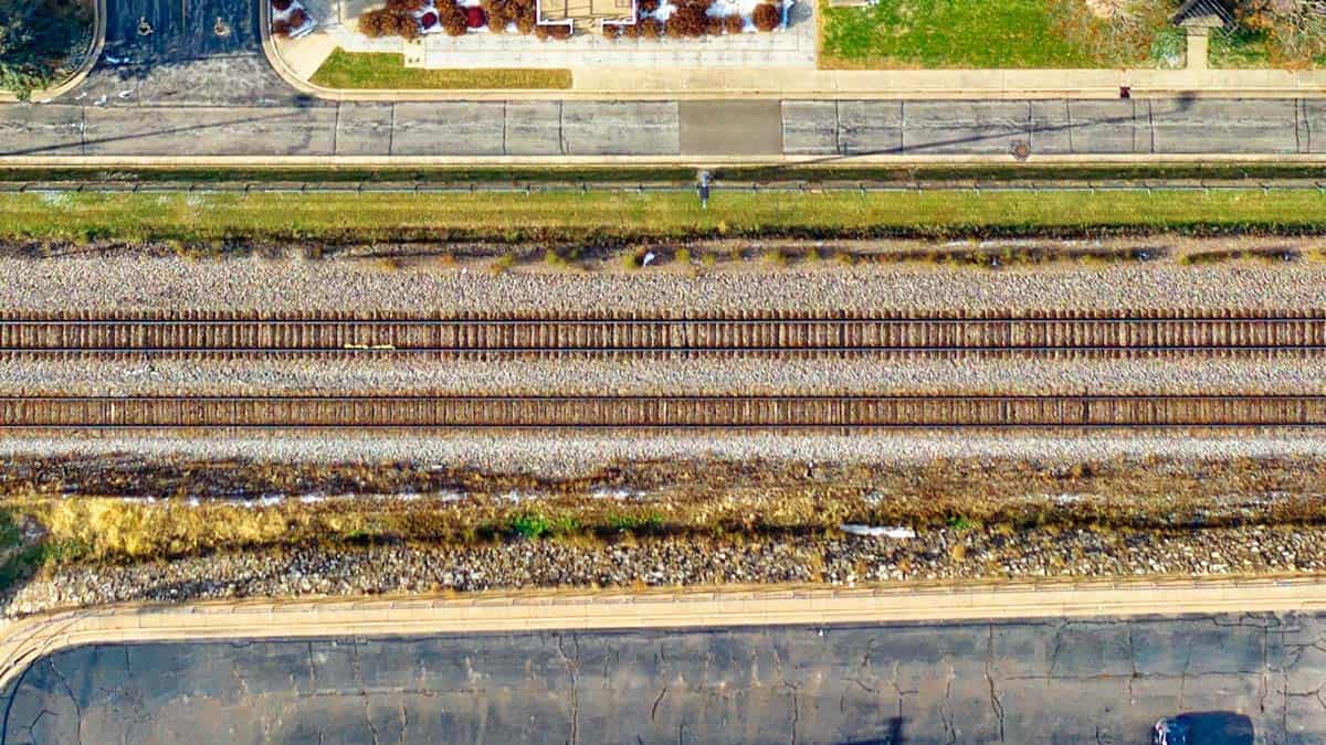
Railway Inspection
LiDAR gathers information in the form of point clouds or 3D coordinates. These coordinates can be used to analyze current railroad conditions, identify safety risks, and aid in planning new rail lines. All aboard! Next stop, LiDAR Land!
I DO need LiDAR!
If you think these uses and applications are cool, you haven’t seen anything yet! These few scenarios are just the tip of the iceberg for this ultramodern technology. There are so many ways LiDAR can be incorporated across industries, allowing companies to stay ahead in the game, maximize profits, improve safety, and offer clients the highest-quality deliverables and top-notch service.
Call FlyGuys today and see how LiDAR can improve your company.