Which Drone Inspection Services Work Best for Large Construction Projects?
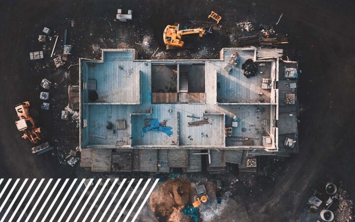
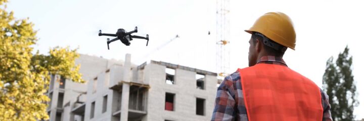
Large construction projects demand more than occasional site inspections. They require continuous visibility, precise data, and scalable solutions. As job sites expand into thousands of acres and timelines become more compressed, traditional inspection methods simply can’t keep up.
This is where unmanned aircraft system inspection services for construction have become essential.
But here’s the reality: not all drone services are created equal. The most effective strategy isn’t choosing one service; rather, it’s understanding which drone inspection solutions work best at each stage of a large construction project.
In this guide, we’ll break down the most valuable drone inspection services, when to use them, and how to build a system that drives better outcomes across your project lifecycle.

Why Drone Inspections Are Critical for Large Construction Projects
On large-scale construction sites, the margin for error is small, but the cost of mistakes is massive.
Project teams need accurate, up-to-date data to manage:
- Earthwork and grading progress
- Material movement and stockpile volumes
- Site conditions and safety risks
- Alignment between as-built conditions and design intent
Traditionally, this meant sending survey crews into the field to manually collect data point by point. On a 5,000- or 10,000-acre site, that process is not only time-consuming, it’s inefficient and often incomplete.
Drone inspection services solve this problem by delivering:
- Rapid, high-density data collection across entire sites
- Repeatable flights for consistent progress tracking
- Safer inspections without putting personnel at risk
The result is construction teams move from limited visibility to full-site intelligence.
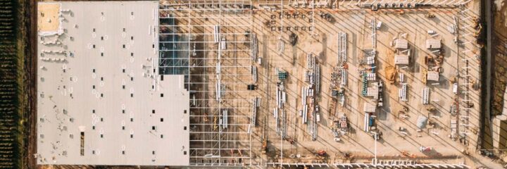
The Most Common Inspection Needs on Large Job Sites
Before choosing the right drone solution, it’s important to understand what large construction projects actually require.
The most common inspection needs include:
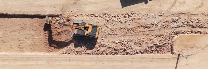
1. Cut and Fill Analysis
Accurate measurement of how much material has been moved is critical for:
- Cost tracking
- Contractor payments
- Subcontractor accountability
- Project forecasting
2. Earthwork and Dirt Tracking
Monitoring grading, excavation, and backfilling ensures work is progressing according to plan.
3. Continuous Site Surveying
Rather than one-time surveys, teams need ongoing updates to track changes across the project lifecycle.
4. Progress Monitoring
Stakeholders require visual and data-driven updates to understand:
- What’s been completed
- What’s behind schedule
- What needs attention
- What opportunity for advancing the timeline or logistics exist
Key takeaway:
Drone inspections are no longer just about capturing images. They’re about delivering real-time, actionable construction data at scale.
From Periodic Inspections to Continuous Monitoring
One of the biggest advancements in construction drone technology is the shift toward automated, continuous data capture.
Docked Drone Systems: A Game Changer
Docked drone systems allow for:
- Automated daily or scheduled flights
- Consistent tracking of site progress
- Monitoring of earthwork, stockpiles, and material movement
- Flights aligned with construction activities like:
- Trenching
- Pouring
- Backfilling
Some sites even use drones for hourly perimeter flights, adding a layer of security and oversight.
Why This Matters
Instead of waiting for weekly or monthly updates, project teams can:
- Identify issues earlier
- Make faster decisions
- Reduce costly rework
Continuous drone monitoring is quickly becoming one of the most valuable drone inspection services for large construction projects.

Drone vs. Plane: Choosing the Right Aerial Solution
While drones are powerful, they’re not always the most efficient tool, especially at extreme scale.
When to Use Drones
Drones are ideal for:
- High-accuracy mapping
- Detailed inspections
- Smaller to mid-size areas
- Frequent, repeatable flights
- Cost-effective deployment
Because drones fly lower, they produce:
- Denser point clouds
- Greater angle of attack, providing full digitization
- More precise data
When to Use Planes
For construction projects larger than 4,000 acres, fixed-wing, or manned options become the better solution.
Planes offer:
- Faster coverage of large areas
- Simplified airspace management
- Efficient monthly or periodic surveys
For example, a 5,000-acre site can be flown in about an hour using a plane, something that would take several days with drones.
The Best Approach: Combine Both
The most effective strategy is not choosing one over the other, but using:
- Drones for precision
- Planes for scale
This hybrid approach ensures both speed and accuracy. Read more about this strategy in our case study with Vertex Unmanned Solutions.
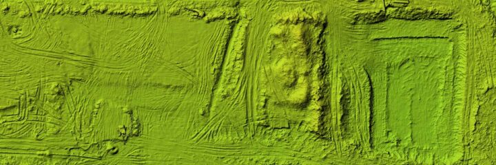
LiDAR vs. Photogrammetry: Which Drone Technology Works Best?
One of the most important decisions in drone inspections is choosing between LiDAR scanning and photogrammetry.
The right choice depends heavily on the stage of construction.
LiDAR Scanning: Best for Early-Stage Construction
LiDAR is most effective at the beginning of a project.
It excels when:
- The site still contains vegetation (trees, grass, brush)
- You need to identify true ground elevation with minimal access
- Accurate grading and planning are critical
LiDAR can penetrate vegetation and provide:
- Highly accurate terrain models
- Reliable data for earthwork planning
Photogrammetry: Best for Ongoing Construction
Once a site is cleared, photogrammetry becomes the go-to solution.
It is ideal for:
- Bare ground mapping
- Progress tracking
- Site visualization
- Generating orthomosaics and 3D models
Photogrammetry provides:
- High-resolution imagery
- Cost-effective, repeatable data collection
Key Insight
The most effective drone inspection strategy evolves with the project:
- Start with LiDAR for accurate ground data
- Transition to photogrammetry for ongoing monitoring
This lifecycle-based approach ensures maximum value at every stage.

The Most Valuable Drone Data Deliverables
Collecting data is only half the equation. The real value lies in how that data is used.
The most useful deliverables for construction teams include:
- Cut-fill models for earthwork analysis
- Orthomosaics (2D maps) for site overview
- 3D models and point clouds for detailed analysis
- Topographic contour maps for understanding terrain
Why Data Accessibility Matters
Modern construction teams need more than just data. They need shared, accessible insights.
That’s why integration is critical.
Leading drone inspection services now connect with platforms like:
- Procore
- Autodesk
- DroneDeploy
- Stitch 3D
These integrations allow:
- Project managers
- Field teams
- Executives
…to all access the same data in real time.
Bottom line:
The best drone inspection services deliver collaborative, actionable data, not isolated files.

Improving Safety and Reducing Costs with Drone Inspections
Beyond data, drones provide significant operational benefits.
Safety Improvements
- Reduce the need for workers in hazardous areas
- Eliminate reliance on scaffolding or lifts
- Minimize exposure to unstable terrain
Time Savings
- Large areas surveyed in hours instead of days
- Faster decision-making with real-time data
Cost Savings
- Reduced labor costs
- Fewer delays
- Less rework due to early issue detection
Key takeaway:
Drone inspections improve visibility and directly impact project profitability.

Why Integration with Surveyors Is Essential
Despite advancements in drone technology, traditional surveyors still play a critical role.
To ensure accuracy:
- Drone data must align with ground control points
- It should integrate with existing survey workflows
When properly integrated:
- Surveyors can validate drone data
- Teams gain confidence in measurements
- Data becomes more reliable for decision-making
Important insight:
Drone inspections don’t replace surveyors; rather, they amplify their capabilities at scale.
How to Choose the Right Drone Inspection Provider
Technology alone isn’t enough. The success of your drone inspection program depends heavily on your provider.
What to Look For
- Experience with large-scale construction projects
- Ability to scale across multiple locations
- Access to both drone and manned aircraft solutions
- Strong data processing and reporting capabilities
Operational Flexibility
The best providers offer:
- Internal professional pilots
- Command center operations
- Support for client-operated drones
Some projects even require:
- Dock installations
- Standby pilot support
Questions to Ask a Provider
- How do you ensure data accuracy and consistency?
- Can your solution scale as the project grows?
- How is data delivered and integrated into workflows?
- Do you offer both drone and aerial (plane) solutions?
Key point:
The right provider delivers a complete data strategy.

The Future of Drone Inspections in Construction
Drone technology is evolving rapidly, and construction is one of the biggest beneficiaries.
Emerging trends include:
- AI-powered data analysis
- Automated issue detection
- Real-time data processing
- Increased use of autonomous drone systems
As these technologies advance, drone inspections will become faster, smarter and more predictive,
Final Thoughts: Building the Right Drone Inspection Strategy
So, which drone inspection services work best for large construction projects?
The answer isn’t just one service but a strategic combination of solutions.
The most effective approach is:
- Lifecycle-based (LiDAR → photogrammetry → continuous monitoring)
- Scale-aware (drones + planes when needed)
- Data-driven (focused on actionable insights, not just collection)
When these elements come together, drone inspections move beyond simple site monitoring and become a critical driver of efficiency, accuracy and project success.