How Do High-Accuracy Mapping Services Help Engineering Firms Reduce Rework Costs?
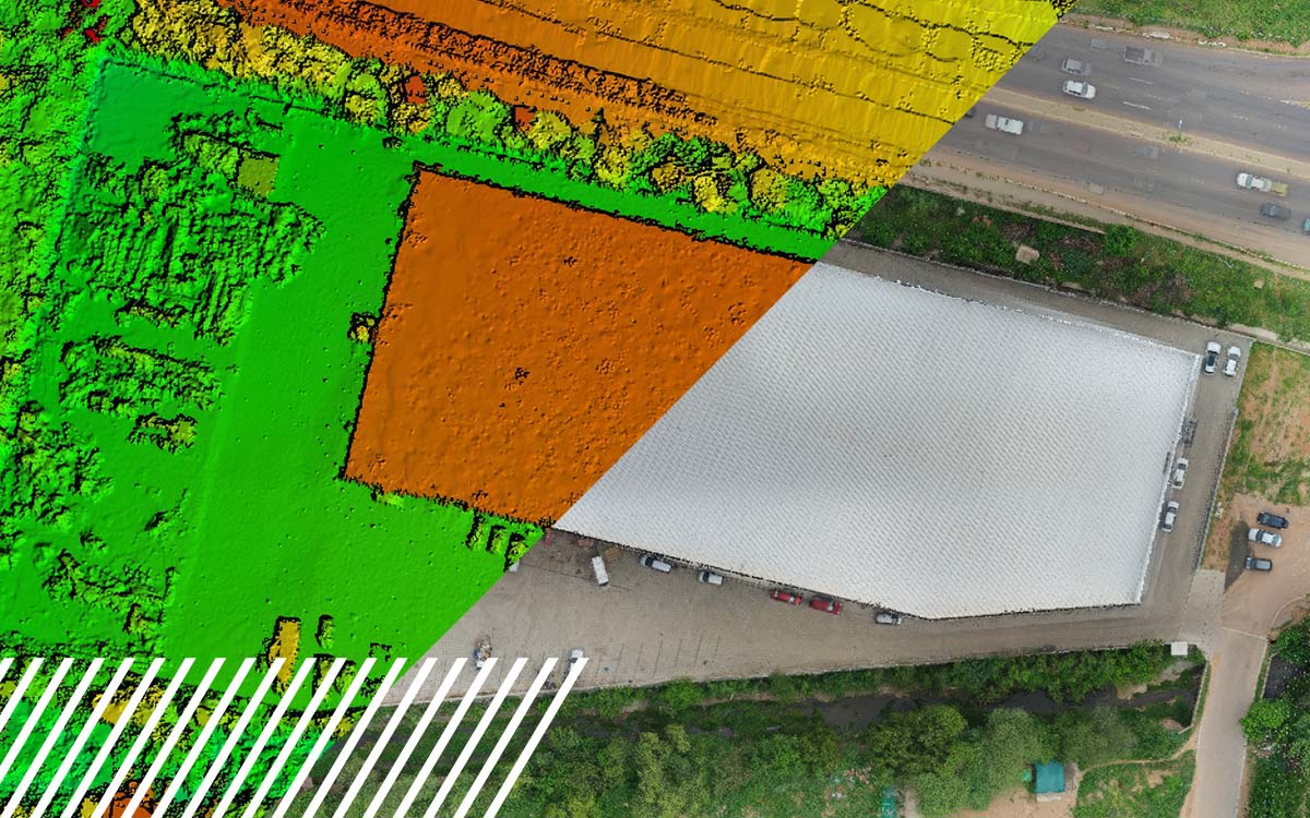
High-accuracy mapping reduces rework by replacing outdated or incomplete survey data with dense, survey-grade digital models of a site’s true conditions. Using drone-based LiDAR, photogrammetry, and reality capture, engineering firms can identify drainage conflicts, utility clashes, and terrain discrepancies during the design phase — when fixes are simple — rather than after construction has already started, when the same problems mean excavation, redesign, and change orders.
Design takes place in a virtual vacuum that is only as accurate as the information comprising it. The question then becomes: Do we have accurate and up-to-date information about the site? When the answer is no, the consequences can be detrimental to the concept, design, schedule, and budget. Inaccurate survey data, outdated site conditions, and missing existing infrastructure often lead to redesigns, construction delays, and costly field corrections.
At FlyGuys, we provide nationwide high-accuracy mapping services, including drone mapping, LiDAR, photogrammetry, and reality data capture, designed specifically to give engineering firms reliable existing-condition data before a single shovel hits the ground.
What Causes Rework on Engineering Projects?
Rework often occurs in the construction phase, but the root cause of the issue is likely produced from a lack of information during the design and engineering phase. An area with inaccurate elevations, missing underground or overhead utilities, or outdated erosion and settlement conditions can ripple through an entire project, requiring engineers to revise designs, contractors to halt work, or owners to approve costly change orders.
Common costs associated with rework include:
- Redesign labor
- Construction delays
- Field change orders
- Material waste
- Equipment idle time
- Contractor claims
- Permit resubmissions
Construction rework represents one of the industry’s largest avoidable costs. Studies from organizations including The Construction Industry Institute (CII) have found that direct field rework averages about 5% of total construction costs, with significantly higher costs on more complex projects. Improving the accuracy of existing-condition data is one of the most effective ways for engineering teams to reduce design errors and field conflicts that lead to rework. Proactively iterating over an accurate environment allows for early issue detection and drives design intent from a source of truth.

What Is High-Accuracy Mapping, and How Is It Different from Traditional Surveying?
Traditional surveying remains an essential part of our built world process to maintain a source of truth, but in tandem with modern aerial mapping technologies, their capabilities scale to an effectively more refined state than before. Rather than collecting isolated survey points, these methods document an entire site as a continuous, measurable dataset:
- Photogrammetry — building accurate 3D models and maps from overlapping drone or aerial photographs
- LiDAR (Light Detection and Ranging) — using laser pulses to measure true surface elevations with survey-grade precision, including through vegetation
- Reality capture — the broader practice of digitally documenting real-world conditions (terrain, structures, infrastructure) as a unified 3D dataset or point cloud
- Digital twin — a continuously updatable, data-dense digital replica of a physical conditions and components, used for various use cases including ongoing design, monitoring, and asset management
Together, these technologies can capture a comprehensive digitization of their actuals. Providing engineers and builders with existing terrain, surface features, roads and pavement, buildings and structures, drainage systems, vegetation, utility corridors, stockpiles, and construction progressto come.
How Does Mapping Data Help Catch Problems Before Construction Begins?
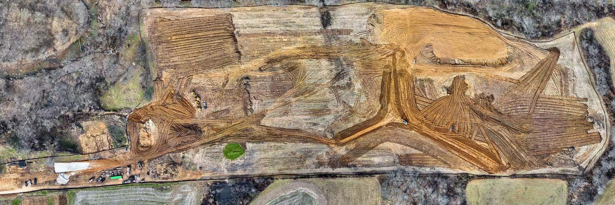
One of the greatest advantages of high-accuracy mapping is identifying conflicts during design instead of during construction. Intelligence models acutely tuned to evaluating data in various conditions such as erosion, environmental, soil seams, and compaction allow for on-equipment-scale preparation and material movement and remediation required.
Reality capture also reveals conflicts involving:
- Existing infrastructure
- Utility locations
- Property boundaries
- Access constraints
- Environmental features
- Structural clearances
- Soil conditions
Providing concise existing site conditions allows for the design efforts to be produced out of conditional intent. Identifying a drainage conflict in a digital terrain model may inform early design decisions. Discovering that same conflict after grading begins could reduce the overall effectiveness of systems, design, materiality, and timelines.

How Does LiDAR Improve Earthwork and Quantity Estimates?
Earthwork represents one of the largest cost variables on civil engineering projects. On a 100-yard stockpile, a traditional survey’s 5-10% margin can be off by 6-12 tons. Ground-controlled LiDAR tightens that to 1-3% under 4 tons. The gap is worth 8+ tons of bust on a single pile of a 100-yard stockpile. These seemingly small inaccuracies in terrain data can lead to incorrect cut-and-fill calculations, resulting in excess hauling, additional material purchases, or unexpected grading work.
High-resolution topographic mapping improves:
- Cut and fill calculations
- Volume and density measurements
- Material quantity estimates
- Grading plans
- Stormwater design
- Site balancing
- Unsuitable soil management
Precise measurements allow for accurate findings for estimates based on facts. Creating an optimal design purpose-built for the environment is the true challenge and overall objective of any design team. Accurate condition assessments are the critical element of that understanding.

Can Mapping Data Prevent Utility Conflicts?
Unexpected utility conflicts remain one of the leading causes of project delays. High-accuracy mapping provides engineers with a clearer understanding of both surface features and supporting geospatial data, allowing teams to coordinate around existing infrastructure earlier in the design process.
When combined with utility records, ground surveys, or subsurface investigations, accurate mapping improves planning for water systems, sewer infrastructure, storm drainage, electric utilities, telecommunications, and transportation corridors, reducing the likelihood that engineers will need to redesign projects after uncovering unexpected field conditions.
How Does Shared Geospatial Data Improve Team Coordination?
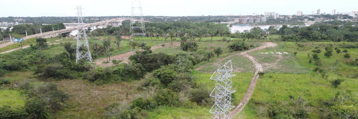
Large-scale projects involve multiple disciplines working simultaneously in the same space. Civil engineers, structural engineers, surveyors, architects, contractors, and project owners often rely on different datasets with one paper set as a source of truth. When those segregated datasets are not fettered into a consolidated model of true-world conditions, clashes within the design and actuals can emerge in the field.
High-accuracy mapping creates a shared geospatial foundation that all stakeholders can reference, improving coordination among civil engineering, structural engineering, survey teams, MEP design, construction management, and asset owners. A consolidated source of truth that is built upon validated reality capture and shared with all parties creates a unified front of communication, transparency, and consistency.

Does Digital Twin Technology Reduce the Need for Site Visits?
Mobilizing a team of licensed professionals carries a financial burden of time and often travel. The consolidation of design, digital twins, and high-resolution reality capture enables engineers to inspect project sites remotely, without having to return to collect missing measurements and to adjust their design diagram early in the programming phase. Teams can review detailed imagery, measurable point clouds, and compiled 3D models from their office. Validated baseline data supports design verification, measurement validation, progress documentation, stakeholder collaboration, and existing-condition reviews. Fewer return trips translate into faster project timelines and lower project costs.

Does High-Accuracy Mapping Help with Permitting and Regulatory Compliance?
Permitting delays often stem from incomplete or inaccurate project documentation. Capturing high-accuracy mapping strengthens documentation for drainage studies, floodplain analysis, environmental assessments, boundary verification, easement documentation, and as-built records. Providing regulators with complete, accurate information reduces the likelihood of rejected submissions and redesign requests that can delay project schedules. Deploying to capture these maps before costly surveys and site confirmation may inform an owner if there are hurdles to the intent of the overall design.
Does More Accurate Mapping Improve Construction Layout?
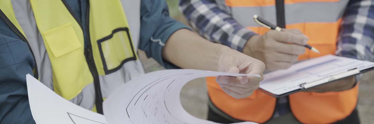
The most effectively designed facility can fail in construction if the overall site context and building layout are not cohesively integrated. Site laydown, utility coordination with city connections, site access, and existing structures are integral to an effective design implementation. Survey-grade reality capture provides early design composition with roads, foundations, utilities, and structures, reducing the need for demolition, reconstruction, corrective grading, material replacement, and schedule recovery efforts. Taking the approach of a “Design Build” strategy from the front end provides a more constructible perspective and allows for the unique conditions of various sites.

A Simple Example: Road Extension Design
Imagine an engineering firm designing a road extension using outdated topographic information. The plans appear complete until construction begins. Once crews start grading, they discover that the site’s actual slopes differ from the original survey. Drainage no longer functions as designed, and an undocumented utility line conflicts with the proposed alignment. The project pauses while engineers revise grading plans, contractors submit change orders, and surveyors return to collect updated measurements.
Now consider the same project using high-accuracy mapping from the beginning. Drone-based LiDAR and photogrammetry capture the site’s true terrain and existing conditions before design starts. Engineers identify the drainage issue, adjust the road alignment, and coordinate around the utility conflict during design rather than during construction. The result is a smoother project with fewer delays, fewer surprises, and significantly lower rework costs.

Traditional Survey vs. High-Accuracy Mapping
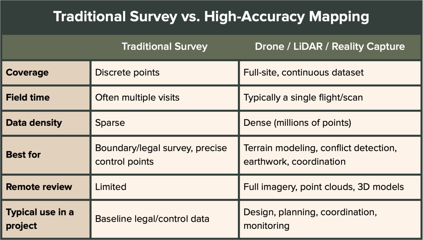
Most projects benefit from combining both: high-accuracy mapping for comprehensive site understanding and traditional survey for legal boundaries and site control.
Why Engineering Firms Are Investing in High-Accuracy Mapping
Today’s engineering firms face increasing pressure to deliver projects faster, with greater accuracy and tighter budgets. Aerial reality data capture improves the quality of information available at every stage of a project from planning and design to construction and asset management. The benefits extend well beyond reducing rework, reduced risk, improved logistics and safety, faster project delivery, improved collaboration, more accurate designs, higher client confidence, stronger cost control, and enhanced long-term asset documentation.

Frequently Asked Questions
Does drone mapping replace traditional land surveys? No. Drone mapping and LiDAR complement or compile with traditional surveys rather than replace them. Traditional surveying remains the standard for legal boundaries and precise control points, while high-accuracy mapping provides comprehensive, full-site data for design, planning, and coordination.
How much does high-accuracy mapping cost compared to the cost of rework? Mapping costs vary by site size and technology used, but they are typically a small fraction of even a single rework event. With direct field rework averaging about 5% of total construction costs — and considerably more on complex projects — the upfront investment in accurate mapping is generally recovered many times over by avoiding just one major redesign or change order.
What technologies are used in high-accuracy mapping? The most common are drone-based photogrammetry, LiDAR scanning, and ground-based or mobile reality capture. These are often combined with GNSS ground control points to achieve survey-grade accuracy.
How accurate is drone-based LiDAR mapping? When properly executed with ground control and quality-controlled processing, drone LiDAR can achieve survey-grade vertical and horizontal accuracy, typically within a few centimeters, depending on equipment, flight parameters, and site conditions.
Can high-accuracy mapping be used for existing infrastructure, not just new construction? Yes. Reality capture and digital twins are widely used for as-built documentation, asset management, and monitoring existing infrastructure over time, not just for planning new projects.
How long does it take to get high-accuracy mapping data after a site visit? Timelines depend on site size and deliverable complexity, but processed data is commonly available within days rather than the weeks sometimes associated with traditional survey turnaround.
Rework is expensive, but much of it is preventable. High-accuracy mapping deliverables give engineering firms the reliable existing-condition data needed to design with confidence, coordinate across disciplines, and execute projects more efficiently.
Ready to reduce rework on your next engineering project? Contact FlyGuys today to learn how our nationwide high-accuracy mapping services — drone mapping, LiDAR, photogrammetry, and reality data capture — can support your team with reliable, survey-grade data.