
Nationwide Drone Services
Let Your Projects Take Flight
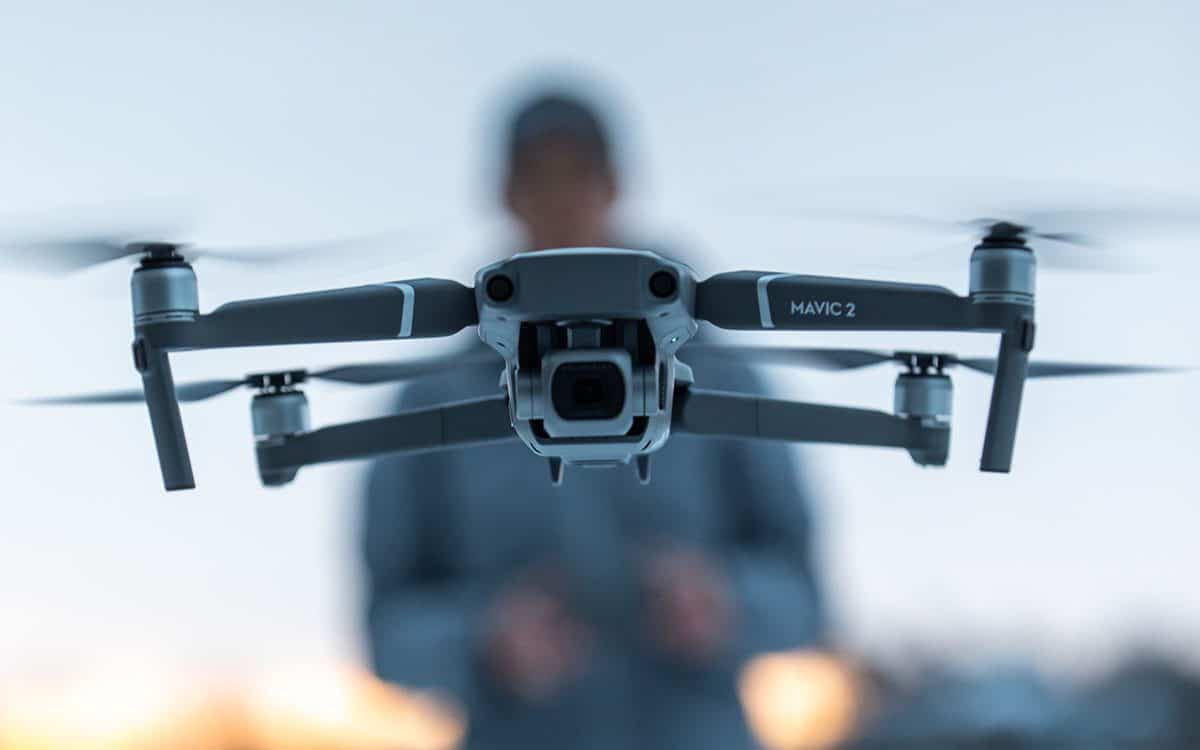
Our pilots fly your location
FlyGuys connects you with a trusted, deployment-ready network of drone pilots to capture your site—anywhere, anytime.
- Nationwide reach with experienced, FAA-certified pilots
- High-resolution imagery and accurate data captured
- Reliable delivery of actionable insights
Save time, reduce costs, and improve safety with drone services built to scale.
Expertise Across Industries
- Agriculture
- Asset Management
- Construction
- Engineering & Surveying
- Insurance
- Oil & Gas
Request a Drone Service Quote
“We needed a quick turnaround on a substantial LiDAR project. FlyGuys responded and arranged the service quickly. The work was performed professionally and we received high-quality assets. We will be working with FlyGuys for the foreseeable future.”
William Hayes

“The project was fruitful and eye-opening. It gave us a glimpse of what’s possible. FlyGuys didn’t just deliver; they came back, refined the data, and made sure the final product truly met expectations. Their communication and commitment to quality really stood out.”
–Scott Prather, Public Relations Manager, LFT Fiber
Our previous drone imagery lacked sufficient resolution to allow for accurate detection of chestnuts in individual tree canopies. FlyGuys was able to provide drone and sensor kits that significantly improved image quality. As we have analyzed this data over the last 6 months, we have been extremely happy with the accuracy of the models we have been able to build.
–Scott Brainard, PhD. Tree Crop Breeder

Diverse Capabilities
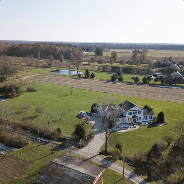
HD still and video imagery
Aerial imaging generates interest and excitement in your audience and prompts action: more vacation bookings or high-end homes sold. A better fan experience. Quicker and more efficient inspections. The panoramic aerial vantage point is sure to amaze and inspire action.
Stunning HD aerial still and video imagery can be used for TV or movies, sporting or concert events, or corporate/brand marketing.
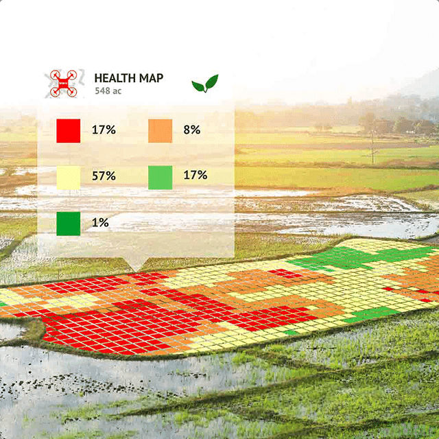
Thermal, Infrared & Multispectral Imaging
Thermal, infrared, and multispectral drone imaging uncover critical data not visible to the naked eye, revealing temperature variations, material inconsistencies, and vegetation health.
These imaging solutions are widely used across energy and utilities, construction and infrastructure, agriculture, environmental monitoring, and facility inspections to identify inefficiencies, monitor assets, and support data-driven decisions.
FlyGuys delivers high-quality, calibrated datasets captured by certified pilots, providing accurate insights you can act on with confidence.
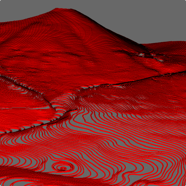
Topographical Imagery
FlyGuys delivers high-precision topographical mapping using LiDAR-equipped drones to capture detailed elevation and surface data.
LiDAR mapping provides:
- Accurate terrain and elevation models
- Contour maps for planning and grading
- Classified point clouds for CAD and GIS workflows
This data supports civil engineering, land development, mining, and infrastructure projects—delivered faster and more cost-effectively than traditional survey methods.
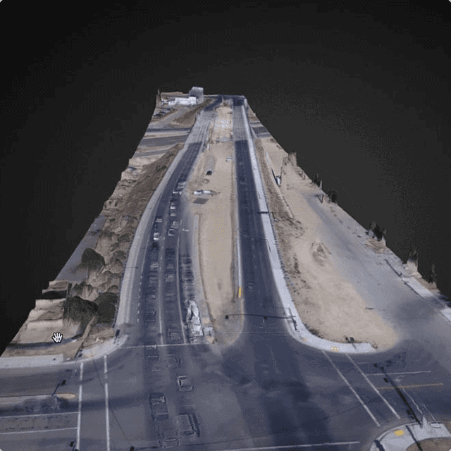
3D & Volumetric Models
FlyGuys uses drone data to create precise 3D models and volumetric measurements that help you understand material volumes and site features with confidence.
Volumetric deliverables include:
- Accurate volume calculations for stockpiles, aggregates, and cut/fill
- 3D surface models for project documentation and planning
- Immediate reporting for faster decision-making
Drones capture high-resolution aerial data more quickly and cost-effectively than traditional survey methods, minimizing downtime and improving workflow efficiency.
Reach for the Sky
Some environments are difficult, dangerous, or impossible to access using traditional methods. Drones make it possible to capture critical data in remote locations, confined spaces, and high-risk environments without putting people in harm’s way.
With a nationwide network of professionally certified, fully insured, and FAA-compliant pilots, FlyGuys delivers reliable drone services wherever your projects take you across the United States.
Located across the United States, FlyGuys drone pilots are professionally certified, fully insured, and FAA-compliant.