
Prepping for Ag Season: How Reality Data Capture and AI Are Changing the Game for Farmers
November is here, and farmers across the country are already thinking ahead, reviewing harvest results, preparing equipment, and planning for the next planting season. But there’s a new tool helping farms of all sizes plan smarter, save time, and get more from every acre: reality data capture.
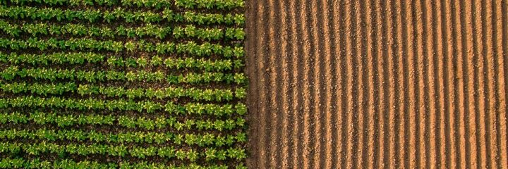
Reality data capture, using multispectral imagery, RGB, and LiDAR scanning, is changing how farmers see and understand their land. When paired with AI-powered precision agriculture tools, it gives farmers real-time insights that used to take weeks or even months to gather.
Whether you’re already using digital tools in your operation or you’re just starting to explore technology in the field, now’s the time to learn how these innovations can make next season your most efficient one yet.
What Is Reality Data Capture—and Why Does It Matter?
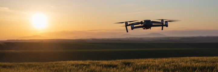
Reality data capture uses drones and sensors to collect accurate, up-to-date visuals and measurements of your farmland. Think of it as a “snapshot” of your operation, only with far more detail than the human eye can see.
FlyGuys contracts FAA-certfied drone pilots nationwide to capture multispectral imagery, aerial photos, videos, and LiDAR data that show exactly what’s happening across your fields. That means you can make better decisions about crop health, water management, and stand counts early on in the season.
How it helps before planting season:
- Map field elevations and slopes to prevent water pooling and runoff.
- Identify compaction zones or areas needing drainage improvement.
- Review historical data from past seasons to assess soil variability for more targeted fertilization and seeding.
- Visualize field boundaries and equipment paths for easier planning and management.
Having this level of data now, before planting begins, sets you up for a more efficient and productive season.
How AI Turns Field Data Into Actionable Insights
Once your aerial data is collected, it can be analyzed through AI-driven precision ag platforms. These software tools interpret data to give you clear, easy-to-understand insights.
For example, AI can:,Detect variations in soil moisture or crop residue.
- Predict yield potential based on crop health and performance.
- Recommend variable rate applications for better efficiency and cost savings.
- Monitor drainage patterns and flag erosion risks before they become problems.
By combining real-world aerial data with AI analysis, you can move from guesswork to data-backed decision-making, spotting early trends, reviewing historical field performance, and planning smarter before the season even begins.

For Farmers New to Drone Data
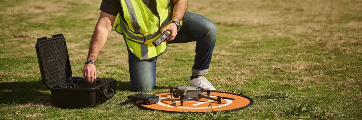
If you’ve never used drones or aerial data before, getting started is easier than you might think. FlyGuys takes care of the entire process from flight planning to data delivery so you can focus on what you do best: farming.
Here’s how it works:
- Schedule a mission through FlyGuys’ online platform.
- Certified pilots collect the data using high-quality drones and sensors.
- Receive your maps, models, and reports, ready for use in your preferred ag software or to review directly.
- Use your data to plan next season’s planting, irrigation, and equipment routes with confidence.
There’s no need to invest in new equipment or learn complex software right away. FlyGuys’ team can guide you through how to use your data effectively.

Real-World Example: Spotting Issues Before They Spread
Imagine it’s early in the season and you notice one section of your crop isn’t keeping pace; the plants look less mature and are showing early signs of stress. With reality data capture, those subtle differences become visible long before they’re obvious from the ground.
By identifying this underperforming area early, you can take corrective action, applying the right nutrients, adjusting irrigation, or addressing soil compaction, to bring that zone back in line with the rest of the field.
Instead of waiting until harvest to see lower yields, you’re empowered to respond in real time, protecting your output and maximizing performance across every acre.
Why Now Is the Best Time to Start
Winter is the perfect season to capture and analyze your field data. Here’s why:
- Clearer fields after harvest mean more accurate terrain and soil analysis.
- Extra lead time lets you fix issues before planting begins.
- AI models improve with each new data set, making your predictions sharper year after year.
- Better collaboration—if you work with agronomists, seed reps, or co-ops, sharing visual data keeps everyone aligned on goals and strategy.
By investing in reality data capture now, you’re not just preparing for the next season, you’re building a smarter, more resilient operation for the long term.

The Future of Farming Is Data-Driven
Agriculture is evolving, and data is leading the way. From seed to harvest, reality data capture and AI help farmers see the full picture of their land, make precise decisions, and increase yields while conserving resources.
FlyGuys helps to make that data easy to access. With our nationwide network of professional drone pilots, we provide accurate, high-quality imagery and data that turns every acre into actionable insight.
Ready to Get Ahead of the Season?
Now’s the time to prepare your farm for success. Get the data you need today to make smarter decisions tomorrow.