
LiDAR (Light Detection and Ranging) has evolved from its roots in 1960s aerospace technology into a core tool for modern mapping and modeling. While its capabilities are impressive, LiDAR still flies under the radar for many professionals simply because they don’t realize what it can do.
Used in everything from forest analysis to construction planning, LiDAR is fast becoming an essential data source in industries that rely on accuracy, efficiency, and real-world insights. This guide breaks down what LiDAR is, what it delivers, what it’s not, and where it’s making an impact.

LiDAR Glossary: Terms to Know
LiDAR (Light Detection and Ranging)
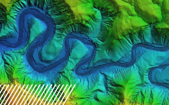
A remote sensing system that measures distance by sending out laser pulses. The time it takes for a laser to bounce back to the sensor is used to calculate the distance, creating highly accurate 3D representations of surfaces.
Active Sensor System
LiDAR generates its own energy source (laser light), unlike passive systems that rely on external light sources (e.g., satellite imagery).
Point Cloud
The raw result of a LiDAR scan—millions of data points, each with X, Y, and Z coordinates that form a digital 3D model of the scanned area.
Return Number
A single LiDAR pulse can reflect off multiple surfaces. These “returns” help distinguish layers like treetops, buildings, or ground.
Point Density / Point Spacing
How many data points are captured in a given area.
LiDAR Intensity
Refers to the strength of the return signal, which can help distinguish materials and surface types.
Classification
Each grouping of LiDAR points can be assigned a classification (e.g., ground, building, vegetation) to facilitate the processing and visualization of the data.
Digital Elevation Model (DEM/DTM)
A bare-earth terrain model generated from classified point clouds, stripping out trees, buildings and other surface objects.
Volumetrics
LiDAR data can calculate the volume of materials in stockpiles, pits, or terrain changes, crucial for industries like mining, construction, and landfill management.

What Can LiDAR Deliver?
- Point Cloud Data: Dense 3D data points for modeling and measurement.
- Topographic Maps: Visual terrain maps with contour lines for elevation.
- Digital Terrain Models (DTMs): Ground-only elevation models used in engineering.
- Orthomosaics: Stitched aerial images that are georeferenced and detailed.
- Contours: Elevation indicators used in mapping and civil planning.
- Hillshades: Visual shading for terrain analysis.
- Draped Models: Enhanced 3D visualizations by overlaying images or data on terrain.
- Volumetric Reports: Calculated volumes of earth, material, or space within a defined area.

What LiDAR is NOT
Understanding what LiDAR can’t do is just as important as knowing what it can. Here’s what to keep in mind:
- LiDAR is not thermal imaging. It doesn’t detect heat; it uses light reflection to determine distance.
- LiDAR is not a camera. It doesn’t capture color images or videos, although LiDAR sensors can be paired with RGB cameras for enhanced results.
- LiDAR doesn’t work well underwater. Standard LiDAR can’t penetrate water bodies deeply. Specialized bathymetric LiDAR or green LiDAR waves are required for aquatic use.
- LiDAR isn’t plug-and-play. It requires trained professionals to collect, classify, and accurately interpret the data.
- LiDAR doesn’t see through objects. It cannot see inside buildings or through solid structures; only what the laser can refract off of.

Use Cases
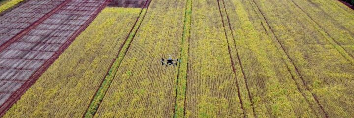
Agriculture + Crop Health
Challenge:
Farmers need reliable insight into crop density, plant height, and terrain drainage for smarter planning and yield optimization.
How LiDAR Helps:
- Maps field elevations to inform irrigation and drainage strategies.
- Tracks vegetation growth and density using return data.
- Identifies areas of poor crop performance due to slope or water pooling.
Results:
Improved land management, optimized planting patterns, and reduced input waste through precision agriculture.
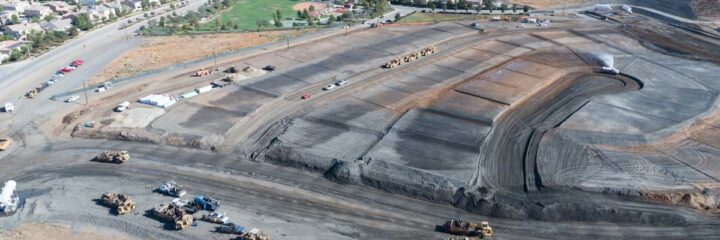
Construction + Civil Engineering
Challenge:
Construction managers need precise measurements of job sites for planning, grading, and progress tracking.
How LiDAR Helps:
- Generates digital terrain models for pre-construction design.
- Tracks earthwork volume for cut-and-fill calculations.
- Provides progress documentation over time with repeat flyovers.
Results:
Reduced survey costs, minimized rework, and faster permitting with accurate, on-demand data.
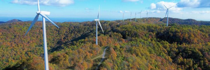
Renewable Energy + Wind/Solar Siting
Challenge:
Energy developers need terrain, vegetation, and obstruction data to optimize site placement for solar farms and wind turbines.
How LiDAR Helps:
- Identifies optimal terrain for solar panel alignment.
- Maps vertical obstacles for wind turbine clearance.
- Evaluates terrain slope and exposure to sunlight.
Results:
Maximized energy output, minimized construction risks, and faster environmental compliance.
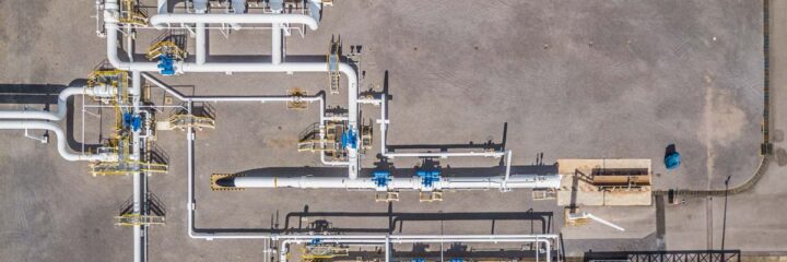
Oil & Gas + Industrial Inspections
Challenge:
Inspection of large-scale, hazardous, or hard-to-access sites can be dangerous and time-consuming.
How LiDAR Helps:
- Enables remote inspection of flare stacks, tanks, and piping infrastructure.
- Captures accurate volume data for containment facilities.
- Supports maintenance planning with 3D change detection over time.
Results:
Increased safety, better predictive maintenance, and reduced downtime.
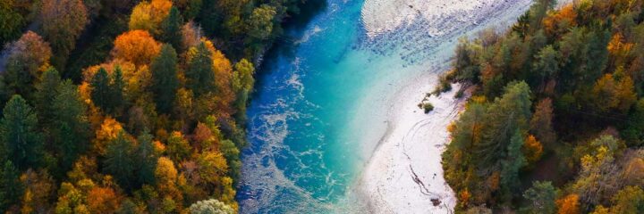
Forestry + Environmental Management
Challenge:
Forestry teams and conservationists need to monitor land changes and accurately calculate biomass.
How LiDAR Helps:
- Penetrates tree canopy to provide bare-earth terrain models.
- Measures tree height, density, and forest structure.
- Supports habitat mapping and erosion risk studies.
Results:
Data-driven land stewardship, regulatory reporting, and conservation modeling at scale.
Ready to Launch Your LiDAR Project?
Whether you’re in agriculture, infrastructure, energy, or land management, LiDAR provides the clarity and precision necessary to make informed decisions. At FlyGuys, we offer nationwide LiDAR data capture and expert deliverables tailored to your goals.
Need help getting started?
Contact us today for a free consultation and explore the possibilities of your next mission.