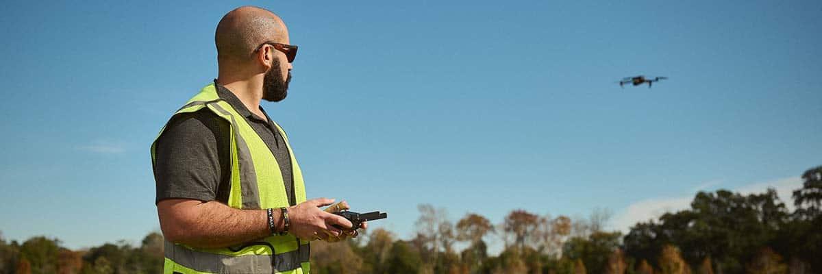
Selling Real Estate with Drone Services
While it is true that the real estate market experiences fluctuations due to various economic and social factors, drone technology provides a reliable and consistent tool that professionals can depend on. The integration of reality data capture with drones in real estate has become a standard practice, offering consistent value through high-quality aerial footage, detailed property inspections, and efficient construction monitoring. While market conditions may change, the benefits of drone technology in enhancing property marketing and management remain constant, making it a stable asset in an otherwise variable industry. Read on to explore how drone videography, construction drone services, and aerial drone services are revolutionizing the industry.
Check out this marketing video for a real estate property.
Drone Videography Services in Real Estate
The Power of Visual Content
In today’s competitive real estate market, first impressions are crucial. According to RubyHome Luxury Real Estate, 100% of buyers use the internet to view homes, making high-quality visual content essential for attracting potential buyers. Traditional photography, limited to ground-level shots, can’t capture the full scope of a property. Drone videography, however, offers stunning aerial views that provide a unique perspective, helping to set a property apart from the competition.
Building Buyer Trust
Drone footage significantly enhances buyer trust by offering a transparent, comprehensive view of a property. Unlike traditional photos that may selectively highlight certain aspects, aerial footage reveals the entire layout, condition, and surroundings of a property. This level of detail allows buyers to feel more informed and confident in their decision-making, as they can clearly see the property’s scale and proximity to amenities. By reducing uncertainties, drone footage can lead to more serious inquiries and stronger offers.
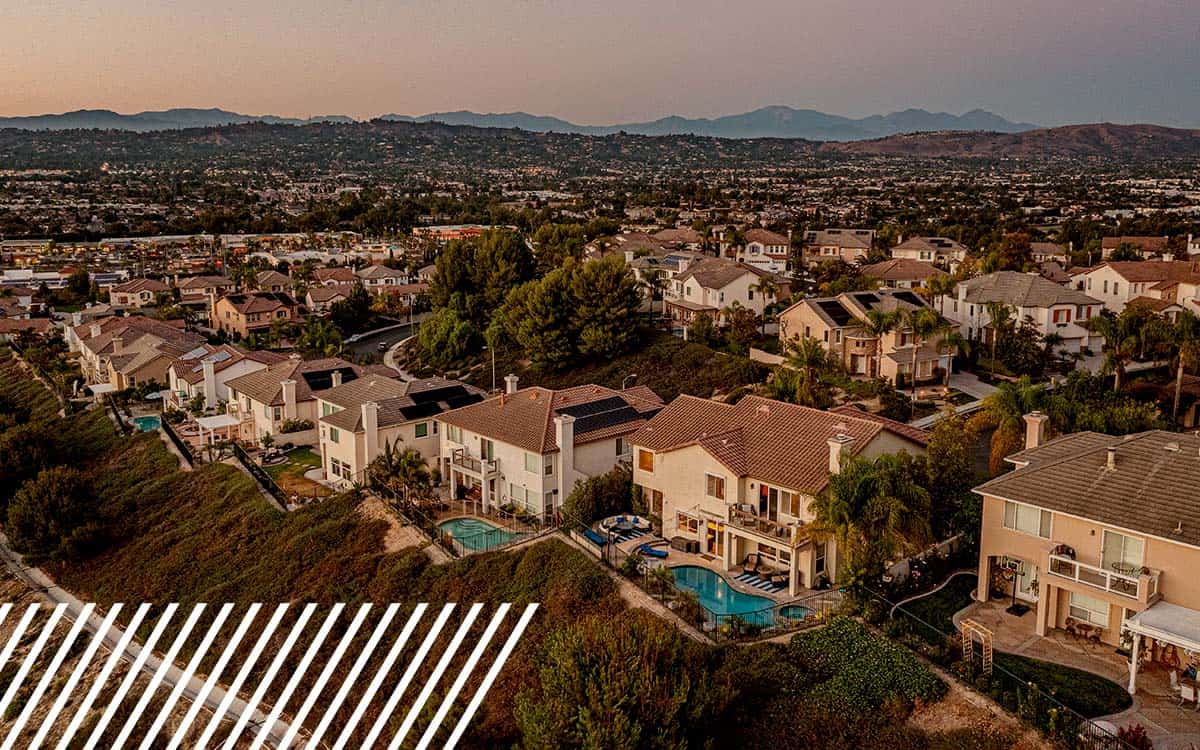
Enhancing Property Listings with Aerial Footage
Aerial drone services allow real estate professionals to elevate property listings by capturing dynamic footage that includes not only the property itself but also its surroundings. This is particularly beneficial for large estates, rural properties, or homes with extensive grounds. The aerial perspective highlights key features such as landscaping, proximity to landmarks, and overall layout, giving potential buyers a more comprehensive view of the property. This broader view can also enhance the perceived value of the property, often leading to higher sale prices and faster transactions. Studies have shown that homes with high-quality images and videos, including aerial footage, tend to sell for more than those without.
Catering to Luxury and Unique Properties
Luxury and unique properties benefit immensely from drone videography. These properties often boast expansive grounds, intricate architecture, or scenic locations, making them ideal candidates for aerial footage. Drones can capture the grandeur and uniqueness of these properties in a way that static images simply cannot, making the listing more engaging and appealing to potential buyers.
Appraisals and Inspections
Drone footage is also valuable in property appraisals and inspections. By providing detailed aerial views, drones enable appraisers to accurately assess a property’s size, layout, and condition, as well as the surrounding area, including neighboring properties and access roads. This comprehensive visual information can lead to a more accurate and fair appraisal, reflecting the true market value of the property. Drones also allow for detailed inspections of hard-to-reach areas like roofs and chimneys, identifying potential issues such as structural damage or leaks. This approach not only increases safety by reducing the need for physical inspections in dangerous areas but also speeds up the inspection process, providing quick and reliable data for decision-making.
Reducing Marketing Costs
Drone footage can consolidate various aspects of property marketing into a single, powerful tool, reducing overall marketing costs. Instead of investing in separate traditional marketing methods like photography, video tours, and aerial surveys, drones can capture all these elements in one session. This efficiency cuts down on time and resources needed to create marketing materials, while also increasing the property’s appeal. This can lead to faster sales, reduced time on the market, and further savings on ongoing marketing expenses.
Impact of Drone Videography on Real Estate Sales
- According to MLS, homes with aerial photos sell 68% faster than those with standard images alone.
- Listings that include video content receive 403% more inquiries than those without.
- 73% of homeowners are more likely to list with an agent who uses video.
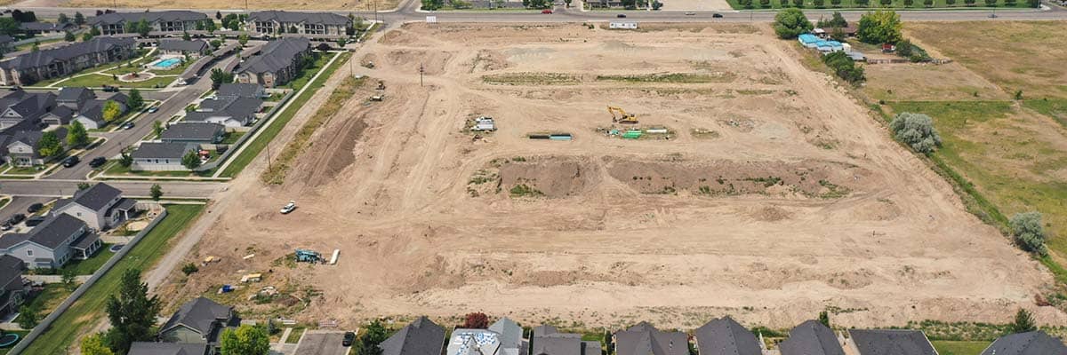
Construction Drone Services: Enhancing Real Estate Development
In the construction phase of real estate projects, drones have become indispensable for improving project management and ensuring timely completion. Construction drone services enable project managers to oversee sites with unparalleled accuracy by providing aerial views that capture the entire development process. This bird’s-eye perspective allows for real-time monitoring, ensuring that every aspect of construction aligns with the project’s timeline and specifications.
Early Issue Detection and Documentation
For real estate developers, early detection of potential issues is crucial. Drones can quickly survey an entire site, identifying problems that might be missed during ground-level inspections, such as structural issues or logistical bottlenecks. By addressing these challenges early, drones help maintain project schedules and avoid costly overruns. Additionally, drones can document the construction process, creating a visual record for quality assurance, stakeholder reporting, and even marketing the property to potential buyers. This not only streamlines project management but also enhances transparency and accountability throughout the construction phase.
Data-Driven Decision Making
Drones play a vital role in providing accurate data that supports informed decision-making. The high-resolution imagery and data collected by drones can be used to create detailed maps and 3D models, which are invaluable for site analysis and planning. This data-driven approach ensures that projects are completed on time and within budget, making construction drone services an essential part of modern project management. In complex projects where multiple contractors and moving parts are involved, the comprehensive overview that drones provide can be the difference between a project staying on budget and spiraling into costly delays.
By integrating drone technology into construction management, real estate developers can achieve greater efficiency, reduce risks, and deliver high-quality projects on time. This, in turn, can lead to higher returns on investment and increased satisfaction for buyers who value timely and well-executed construction.
Aerial Drone Services Beyond Photography
Land Surveys and Site Analysis
Aerial drone services extend beyond photography, playing a crucial role in conducting accurate land surveys and site analysis. For developers, understanding the topography of a potential site is essential, and drones provide a cost-effective and efficient way to gather this information. The high-resolution imagery captured by drones can be used to create detailed topographic maps and 3D models, helping developers assess the suitability of a site for their projects.
Efficiency and Accuracy in Large-Scale Developments
For large-scale developments, drone surveys offer unmatched efficiency and accuracy compared to traditional methods. Drones can quickly cover vast areas, providing consistent and precise data that speeds up the surveying process while reducing costs and minimizing human error. In commercial real estate, where accuracy and timeliness are paramount, aerial drone services have become an invaluable asset, ensuring that developments are planned and executed with precision.
Navigating Drone Regulations in Real Estate
The use of drones in the real estate industry is governed by several key regulations designed to ensure safe and legal operation. The Federal Aviation Administration (FAA) mandates that commercial drone operators must obtain a Remote Pilot Certificate under Part 107. This certification ensures that operators are knowledgeable about airspace classifications, flight restrictions, and safety protocols. Drones must generally operate within Class G airspace and stay below 400 feet. Additionally, they cannot fly over people or beyond the operator’s line of sight without specific waivers.
Privacy is another critical consideration. Operators must respect local and state privacy laws, particularly when capturing footage near residential properties. Unauthorized filming could lead to legal complications, making it essential to understand the boundaries of permissible drone use.
Given these complex regulations, partnering with a professional drone service provider is highly advisable for real estate professionals. Certified drone operators are well-versed in FAA rules and privacy laws, ensuring that all drone activities comply with legal standards. This partnership not only mitigates the risk of regulatory violations but also provides access to high-quality aerial footage, enhancing property marketing while maintaining legal compliance.
By collaborating with a professional drone service provider, real estate businesses can leverage the benefits of drone technology while avoiding potential legal pitfalls, ensuring both safety and efficiency in their operations.