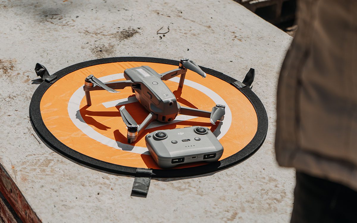
First steps to your first drone flight and important links to ensure compliance with FAA safety and regulations
As the popularity of drones continues to grow, more and more people are interested in becoming drone pilots. However, it’s crucial to understand that flying a drone comes with a great responsibility to ensure the safety of people and property. New pilots must learn and follow safety rules, as set by the Federal Aviation Administration (FAA), to prevent accidents and injuries. If you’re interested in flying with FlyGuys, it’s important to understand and adhere to these regulations. In this comprehensive guide, we’ll walk you through the process of becoming a new drone pilot and provide the information you need to fly with FlyGuys while following all FAA safety regulations.
First Things First: Part 107 License
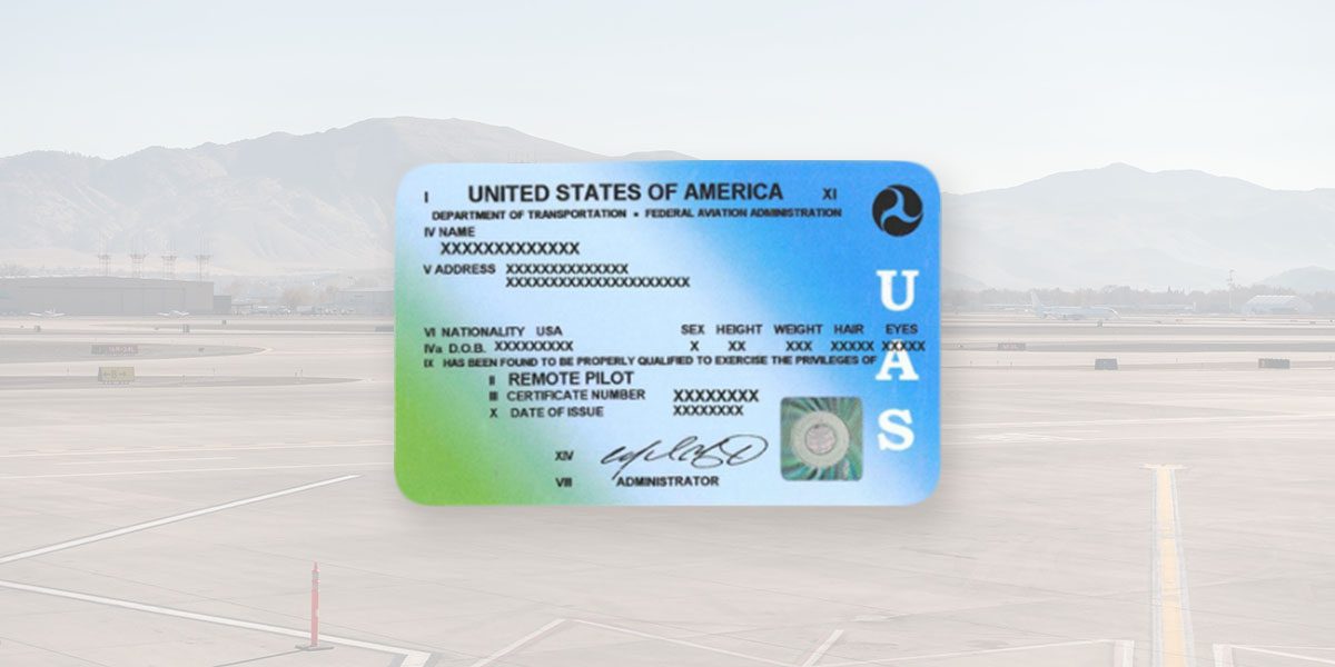 The Part 107 license test is a comprehensive exam covering a wide range of drone operation and safety topics. It is designed to ensure drone pilots understand the regulations and guidelines governing drone use in the United States. To be part of the FlyGuys network, you MUST have your Part 107 license. You can obtain this information through the Federal Aviation Administration (FAA) as they make all drone operations rules.
Some of the key topics covered on the Part 107 exam include airspace classification and operating requirements, weather patterns and their impact on drone operation, emergency procedures, crew resource management, and airport operations. These rules are constantly updated so the FAA requires pilots to pass a recurrent exam every 2 years. There are tons of videos, tests, and training courses out there to help you prep for the exam.
Other areas of focus include the effects of drugs and alcohol on pilot performance, radio communication procedures, and the use of navigation aids and charts.
In addition to these more technical areas, the Part 107 exam also covers safety and ethical considerations for responsible drone operation. These include privacy issues, and safety guidelines for people and property on the ground, and the importance of always maintaining a respectful and professional attitude.
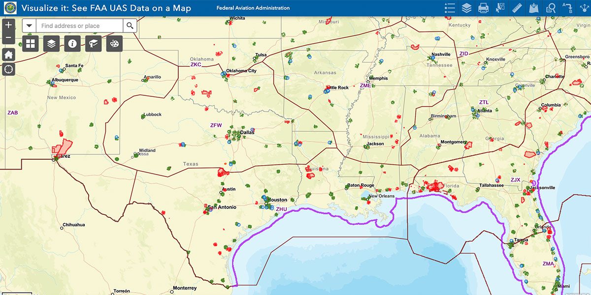
Visualize It: Check Your Airspace
Drone pilots must always check the airspace before flying to ensure they comply with FAA regulations and avoid potential conflicts with other aircraft. The FAA’s Visualize It website is an excellent resource for drone pilots to check their location and see if any waivers are required. The website provides a map that shows different airspace classifications, such as Class A, B, C, D, E, and G, along with special use airspace, such as military operations areas, prohibited areas and restricted areas. Each airspace class has different requirements and restrictions for drone pilots, and the codes on the map can help pilots determine the specific regulations that apply to their location. This tool allows drone pilots to plan their flights accordingly and ensure they operate their drones safely and legally.
To use this tool, search for your site location on the map and note the ceiling number. This number refers to the maximum altitude limit for drones to operate in a specific airspace class. For example, in Class G airspace, which generally extends from the surface up to 1,200 feet above ground level (AGL), the ceiling number would be 1,200 feet AGL. In other airspace classes, such as Class B, C, D, or E, the ceiling number may vary depending on the specific location and the airport’s traffic pattern. The FAA sets these ceiling numbers to ensure the safety of manned aircraft, and drone pilots must always check the map and adhere to the altitude restrictions in the airspace where they plan to operate their drones.
The green squares on the FAA’s Visualize It map represent airports with control towers. The size of the square indicates the airport’s significance, with larger squares representing larger airports with more air traffic. The presence of a control tower means the airport is considered controlled airspace. Drone pilots must follow specific regulations to operate in these areas. In general, drone pilots must obtain clearance from air traffic control (ATC) to fly within five miles of an airport or anywhere in regulated airspace. This is because the airspace surrounding airports is typically busy with manned aircraft taking off and landing, and drone operations could pose a safety risk if not properly coordinated with ATC. Therefore, drone pilots must always check the Visualize It map to see if their planned flight location falls within controlled airspace and take the necessary steps to obtain clearance if required.
The red spaces on the FAA’s Visualize It map represent restricted airspace where drone operations are prohibited without prior authorization. These areas are typically associated with military operations, national security, or other sensitive activities. Examples of red spaces on the map include military training routes, restricted areas, and prohibited areas. These areas may also have a specific altitude restriction, and drone pilots must adhere to these limitations if authorized to fly in these areas. It’s important for drone pilots to be aware of these restricted areas and check the map before planning any flights to ensure they are operating their drones legally and safely. Unauthorized drone flights in these areas could pose a safety risk to manned aircraft and national security concerns, leading to potential legal consequences.
The Low Altitude Authorization and Notification Capability (LAANC) is a program established by the FAA to expedite drone pilot airspace authorizations. Through LAANC, drone pilots can request and obtain near real-time airspace authorizations for flights in controlled airspace up to a certain altitude limit. The program uses automated tools to help drone pilots obtain airspace authorization quickly and efficiently without submitting manual applications or waiting for approval from air traffic control. LAANC is currently available at more than 500 airports and in other select areas across the United States, making it easier for drone pilots to operate their drones safely and legally.
Check your Airspace: DJI FlySafe
The FAA’s role is to ensure that all drone operations in the United States are conducted safely and in compliance with FAA regulations designed to protect public safety and national security. Therefore, they require certain drones to be equipped with geofencing technology that prevents them from flying in restricted airspace. In other words, if a pilot attempts to fly their drone in restricted airspace, the drone’s GPS system will detect the restriction and prevent the drone from taking off.
DJI, a Chinese company and one of the leading manufacturers of consumer and professional drones responded by implementing FlySafe, a web-based platform that provides drone pilots with up-to-date information about airspace restrictions, weather conditions, and other factors that could affect their flight operations.
One of the key features of DJI FlySafe is the ability to “unlock” your drone to operate in restricted airspace because drone pilots may have legitimate reasons to fly in restricted airspace. To do so, pilots must demonstrate that they have obtained the necessary approvals and authorizations to fly in the requested airspace.
After logging into your DJI account, you will attach the Approved FAA Waiver from DroneZone (see next section). If DJI approves the authorization, you will receive a temporary unlock code to be entered into the DJI drone app allowing you to fly in the restricted airspace for a limited time.
Register Your Drone – DroneZone
The DroneZone will be the place to go to
- Register your drone

- Apply for and manage your manual waivers.
Registering your drone with the FAA is one of the most important steps in becoming a FlyGuys drone pilot. Registration is required for all drones weighing between 0.55 and 55 pounds used for recreational or commercial purposes. The registration process is easy and can be completed through the FAA’s online registration portal, DroneZone. To register your drone, you’ll need to provide basic information, such as your name and address, and pay a $5 fee. Once your registration is complete, you’ll receive a unique registration number to attach to your drone. Most pilots do this with a sticker or permanent marker.
In addition to registering your drone, DroneZone is the website where drone pilots must apply and manage manual waivers to fly in restricted airspace or beyond the FAA’s standard operating limitations. For example, if you need to fly your drone higher than the standard altitude limit in your area or in restricted airspace, you must submit a manual waiver application through DroneZone. The FAA reviews these applications on a case-by-case basis, so it’s imperative to provide as much detail as possible to demonstrate that you can safely and responsibly operate your drone in the requested airspace. Once approved, read through the document to recognize any special instructions like a check-in call or a particular flight window. Utilizing DroneZone ensures that you comply with FAA regulations, and operate your drone safely and legally.
Software/Mapping: DroneDeploy
When you are ready to take on larger missions, such as mapping, focus on learning DroneDeploy capabilities. DroneDeploy is FlyGuys’ mapping and automated flight software.
The first step is to create a free account on the DroneDeploy website. Once you’ve created an account, you can download the DroneDeploy app to your mobile device.
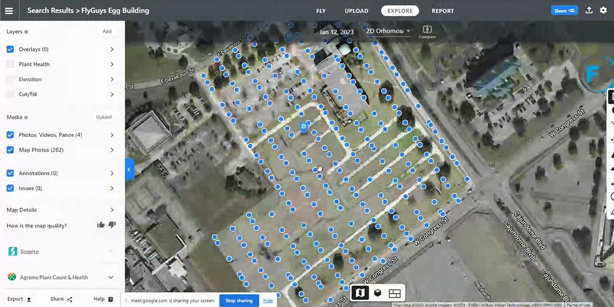
To begin a mapping mission with DroneDeploy, our mission coordinators plan the flight using the app’s mission planning tools. This involves selecting the area needed for mapping, setting the altitude and camera angle, and defining the specific waypoints the drone will follow during the mission.
Once the mission is planned, we rely on our pilots to go out and capture the data through an automated flight. Once at the designated site, you will upload the flight plan to your tablet and launch the mission using the app. During the mission, the drone will follow the defined flight path, capturing images of the mapped area. These images are then automatically uploaded to the DroneDeploy cloud platform for processing.
After completing the mission, our mission coordinators use DroneDeploy software to process and analyze the images captured during the flight. The software stitches the images together to create a highly detailed and accurate map of the area surveyed called an Orthomosaic Map. The map can be exported in various formats, including 2D maps, 3D models, and point clouds.
DroneDeploy is a powerful tool for new drone pilots interested in using drones for mapping missions. The app’s mission planning tools make it easy to define the specific flight path and parameters for the mission. In addition, its data processing and analysis tools turn raw data captured during the mission into useful information.
The only downside to DroneDeploy is that you CANNOT use a smart controller because it is not compatible.
Come Fly With FlyGuys
Are you ready to begin your drone pilot career? Join our nationwide pilot network.
To learn more about drone safety and regulations, head over to the FAA website and read about Drone Safety Day.