Which Drone Data Should You Use for Agriculture?
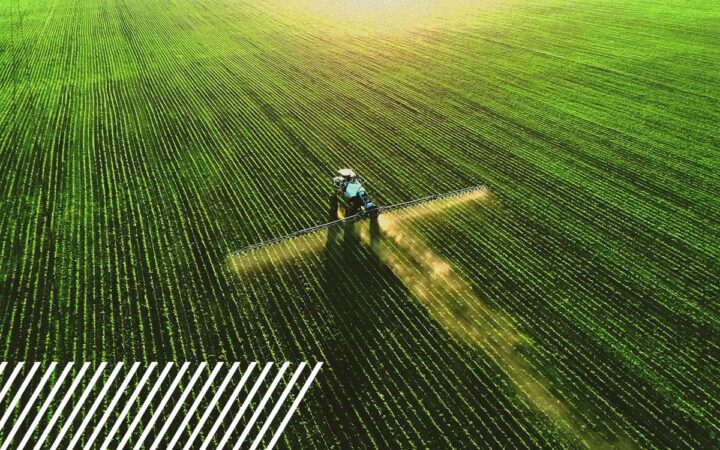
Drone technology has become one of the most powerful tools for modern agriculture. From identifying crop stress to optimizing fertilizer applications, aerial data helps agronomists and farm managers see patterns across fields that are impossible to detect from the ground.
However, the increasing prevalence of drone data raises another question:
Should you use RGB imagery or multispectral imagery for agricultural analysis—and how do you know which one is right for your operation?
Drones capture both data types, providing valuable insights, but they serve different purposes. The right choice depends on what you are trying to measure, how early you need to detect issues, and how the data will ultimately be used in your decision-making process.
Understanding the strengths of each approach can help agricultural operations choose the right dataset and avoid collecting data that doesn’t fully support their agronomic goals.
What Is RGB Drone Imagery?
RGB imagery is the most common type of aerial data captured by drones. The camera records light in three visible bands:
- Red
- Green
- Blue
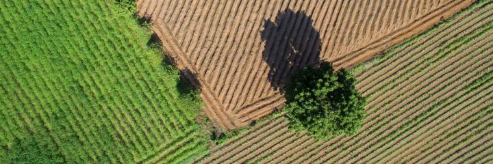
These are the same color bands that human eyes perceive, which means RGB imagery produces high-resolution aerial photographs that look like natural color maps of a field.
When hundreds or thousands of overlapping images are captured and processed together, they produce a detailed orthomosaic, or stitched aerial map, that provides a complete visual overview of the field.
What RGB Imagery Is Best At
Because RGB imagery captures extremely high-resolution visual detail, it is well-suited for applications where visual observation and spatial patterns are critical.
Common agricultural uses include:
Field scouting and crop monitoring
RGB maps allow agronomists and farm managers to quickly scan entire fields for visible issues such as lodging (the bending or falling of crops), pest damage, weed pressure, or irrigation problems.
Stand counts
High-resolution RGB imagery can help estimate plant populations early in the growing season, especially when rows and seedlings are clearly visible.
Mapping physical field conditions
RGB imagery can reveal:
- Soil compaction patterns
- Irrigation equipment issues
- Wheel tracks and planting inconsistencies
- Visible crop damage
Field documentation
Many operations use RGB imagery to document crop conditions, verify field operations, or monitor changes over time.
While RGB imagery provides extremely detailed visual information, it has one key limitation: it captures only what the human eye can see.
Subtle plant stress that has not yet become visually apparent may still go undetected.
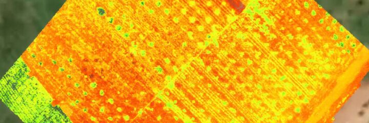
What Is Multispectral Drone Imagery?
Multispectral imagery goes beyond visible light.
Multispectral sensors capture multiple bands of light, including wavelengths outside the visible spectrum—particularly near-infrared (NIR) light.
Plants reflect and absorb light differently depending on their health. Healthy plants absorb more visible red light for photosynthesis and reflect more near-infrared light. Stressed plants reflect light differently.
By measuring these subtle changes, multispectral sensors can detect plant stress before it becomes visible.
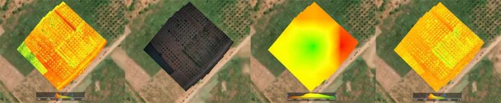
Multispectral imagery produces datasets that allow analysts to calculate vegetation indices such as:
- NDVI (Normalized Difference Vegetation Index)
- NDRE (Normalized Difference Red Edge)
- GNDVI (Green NDVI)
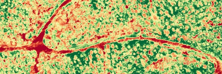
These indices convert light reflectance values into maps that show plant vigor across an entire field.
What Can Multispectral Imagery Reveal That RGB Cannot?
Multispectral imagery allows agricultural teams to move beyond visual observation and begin measuring plant physiology and crop performance.
Some of the most valuable applications include:
Early Crop Stress Detection
Multispectral imagery can identify stress related to:
- Nutrient deficiencies
- Water stress
- Disease pressure
- Pest damage
often days or even weeks before visible symptoms appear.
Early detection gives growers time to intervene before stress spreads or yields are impacted.
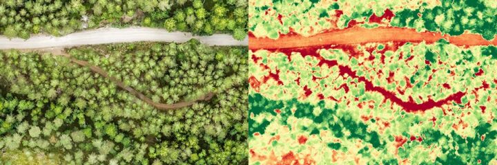
Variable Rate Management
Vegetation index maps, which are graphical representations that use multispectral data to assess plant health, can help identify zones of variability within fields.
These zones can inform:
- Fertilizer prescriptions
- Irrigation adjustments
- Targeted scouting
By understanding which areas of a field are underperforming, operators can apply inputs more precisely.
Biomass and Crop Vigor Analysis
Multispectral indices provide a consistent way to measure plant vigor across entire fields. This helps agronomists track crop development over time and compare performance across multiple growing seasons.

When Should You Use RGB Instead of Multispectral?
Despite the advanced capabilities of multispectral sensors, RGB imagery still plays an important role in agricultural operations.
RGB imagery is often the best choice when:
- The goal is visual inspection of field conditions
- Operators want very high spatial resolution imagery
- Data is needed quickly for general scouting or documentation
- The budget or timeline does not require spectral analysis
In many cases, RGB imagery provides enough information to identify visible issues and guide field inspections.
When Is Multispectral Imagery Worth the Investment?
Multispectral data becomes especially valuable when the goal is early detection, quantitative analysis, or precision management.
Operations often benefit most from multispectral imagery when they want to:
- Detect stress before it becomes visible
- Monitor crop health throughout the growing season
- Support precision agriculture workflows
- Generate prescription zones for variable-rate inputs
Because multispectral data captures measurable reflectance information, it can also be integrated with analytics platforms and agronomic models.
Can RGB and Multispectral Imagery Work Together?
For many agricultural operations, the most effective approach is not choosing one dataset over the other but using both.
RGB imagery provides visual context and extremely detailed spatial information, while multispectral imagery provides quantitative insight into plant health.
Together, they create a more complete picture of field conditions.
For example, multispectral data may identify zones of crop stress within a field. RGB imagery can then be used to visually inspect those zones and determine whether the cause might be pest pressure, irrigation issues, or equipment damage.
By combining datasets, agronomists gain both analytical insight and visual confirmation.

Why Scalable Data Collection Matters for Agricultural Operations
As farms grow larger and agricultural technology platforms expand across regions, collecting drone data consistently becomes a logistical challenge.
Coordinating pilots, maintaining capture standards, and delivering reliable datasets across thousands of acres requires infrastructure that goes beyond basic drone operations.
FlyGuys operates as a reality data infrastructure platform, enabling large-scale aerial data capture through an API-driven system and a nationwide network of professional drone pilots.
Orders move through an automated workflow that includes:
- Pilot sourcing
- Mission dispatch
- Data capture
- Quality assurance
- Structured data delivery
Automation improves speed and scalability, while human-in-the-loop quality assurance ensures that datasets meet accuracy standards before delivery.
This infrastructure allows agricultural organizations and ag-tech platforms to access consistent aerial data without building their own internal nationwide capture networks.

So Which Drone Data Should You Choose?
Choosing between RGB imagery and multispectral imagery ultimately depends on what question you are trying to answer.
If you need high-resolution visual maps and general field observation, RGB imagery is often the right choice.
If your goal is to measure crop health, detect stress early, or support precision agriculture workflows, multispectral imagery provides deeper analytical insights.
And for operations looking to maximize field intelligence, combining both datasets often delivers the most comprehensive view of crop performance.
The Future of Drone Data in Agriculture
Agriculture is rapidly moving toward data-driven decision systems powered by advanced analytics and AI.
As these technologies evolve, the demand for consistent, high-quality field data will only grow.
Drone imagery—both RGB and multispectral—plays a central role in building the data foundation that supports modern agronomy, precision farming, and predictive crop modeling.
The question is no longer simply which sensor to use.
It’s how agricultural operations can leverage the right data at the right time to make smarter decisions across every acre they manage.