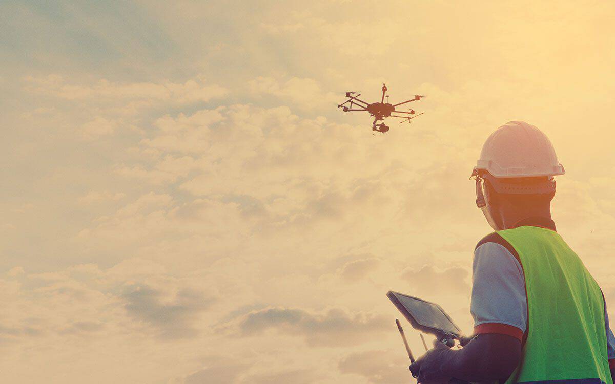
Unlocking New Frontiers: How Drones Revolutionize Industries
Unmanned aerial vehicles (UAVs), more commonly known as drones, have witnessed tremendous growth and innovation in recent years. Drones provide tangible benefits to industries worldwide, realized time and again. Drones are used for various purposes, such as progress monitoring, agricultural mapping, inspections, surveying, etc. Their use is only expected to grow as technology develops and becomes more accessible.
We will explore how drones transform the landscape of construction, agriculture, energy and utilities, surveying and engineering, golf courses, and the oil and gas sector. By harnessing the power of these aerial marvels, these industries experience enhanced efficiency, safety, and cost-effectiveness like never before. As the world evolves, drones are becoming increasingly popular. Companies in various sectors are turning to drones to reduce costs, increase efficiency, and improve safety measures in their operations.
Construction
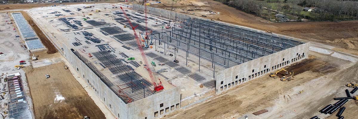
Construction is seeing a revolution thanks to drones, which offer accurate data and aerial imagery. They can efficiently monitor sites, detect problems, and create 3D models and maps for project planning. This has increased productivity and reduced costs, making it an invaluable tool in the industry. 55% of construction projects use drones, which has steadily increased in recent years (Contractors Are Finding More Ways to Utilize Drones on the Jobsite for Increased Productivity and Quality, n.d.).
The Deliverables
- Aerial Imagery: Drones with high-resolution cameras capture aerial photographs and videos, providing a comprehensive view of the construction site. This imagery can be used for documentation, progress tracking, and marketing.
- 3D Models and Topographical Maps: Drones can generate accurate 3D models and topographical maps of construction sites. These models provide a detailed terrain representation, enabling better site analysis, project planning, and coordination.
- Site Monitoring and Progress Tracking: Drones can be programmed to fly pre-defined paths over construction sites, capturing regular images or videos. This data allows project managers to monitor progress, identify bottlenecks, and ensure the project stays on track.
- Structural Inspections: Equipped with high-resolution cameras, drones can inspect structures such as buildings, bridges, and towers. This helps identify potential issues, such as cracks or damage, allowing for timely maintenance and repairs.
- Thermal Imaging: Drones equipped with thermal cameras can detect heat signatures, enabling the identification of energy inefficiencies, insulation problems, or water leaks. This helps improve energy efficiency and detect hidden issues that may not be visible to the naked eye.
- Project Documentation: Drones can visually record the construction process, capturing images or videos at different stages. This documentation can serve as evidence for compliance, legal purposes, or insurance claims.
The Benefits
- Enhanced Safety: Drones reduce the need for manual inspections in hazardous or hard-to-reach areas, minimizing risks to human personnel. They can access rooftops, tall structures, or unstable terrain, providing valuable data without endangering workers’ lives.
- Improved Efficiency and Productivity: Drones can quickly capture aerial imagery and collect data, significantly reducing manual surveys and inspections, which can take days to weeks to complete. This allows construction teams to make informed decisions promptly, leading to improved productivity and streamlined operations. A study by the National Institute for Occupational Safety and Health (NIOSH) found that using drones for site inspections saved up to 50% of the time compared to traditional methods.
- Cost Savings: By reducing the time and resources required for traditional surveys and inspections, drones save money. Drones eliminate the need for expensive equipment, scaffolding, or specialized personnel, making construction projects more budget-friendly.
- Accurate Data Collection: Drones with advanced sensors and cameras provide highly accurate and detailed data. This precision enhances project planning, design, and coordination, leading to more accurate cost estimations and reducing errors or rework risk.
- Real-time Progress Tracking: Drones enable real-time monitoring and progress tracking of construction sites. Project managers can access up-to-date visual information, ensuring that projects stay on schedule and identifying potential issues or delays early on.
- Improved Communication and Collaboration: Drone aerial imagery and data facilitate better communication and collaboration among project stakeholders. With a comprehensive and visual representation of the site, stakeholders can effectively discuss and address project-related concerns.
- Enhanced Project Documentation: Drones capture high-resolution images and videos, providing a detailed visual of the construction process. This documentation is valuable evidence for compliance, quality control, insurance claims, or future reference.
- Better Decision-making: Drones empower construction professionals to make data-driven decisions. With accurate and up-to-date information, project managers can proactively address issues, optimize workflows, and allocate resources more effectively.
- Competitive Advantage: Embracing drone technology gives construction companies a competitive edge. By leveraging drones, companies can deliver projects more efficiently, attract clients with enhanced capabilities, and stay at the forefront of technological advancements.
Agriculture
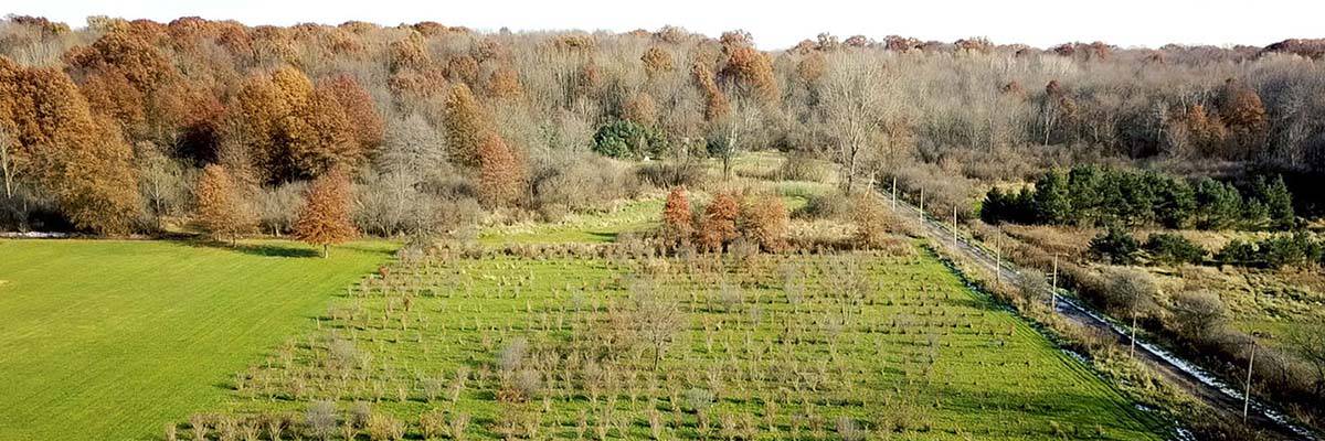
Commercial drones are most popular in the agriculture industry (followed by construction and infrastructure) (Reichenbach, 2023). Drones equipped with cameras help farmers optimize crop health and reduce pesticide and fertilizer use. This precision agriculture tool allows data-driven decisions and increases overall efficiency. Agricultural drones are expected to grow to USD 18.22 billion by 2030 (Agriculture Drone Market Size, Share | Global Report [2030], n.d.).
The Deliverables
- Crop Health Assessment: Drones equipped with multispectral or thermal cameras can capture high-resolution imagery of agricultural fields. These images allow farmers to assess crop health, identify stress areas, detect diseases, and monitor plant growth patterns.
- Precision Mapping and Planning: Drones can generate detailed topographic maps and 3D models of farmland. These maps help farmers identify variations in soil composition, drainage patterns, and elevation, enabling precise planning for irrigation, fertilization, and planting.
- Plant Counting and Growth Monitoring: Drones with advanced imaging sensors can accurately count plants and monitor growth progress. This information optimizes planting densities, assesses crop establishment, and predicts yield potential.
- Irrigation Management: By capturing data on soil moisture levels and vegetation indices, drones help optimize irrigation practices. Farmers can identify areas with insufficient or excessive moisture and implement targeted irrigation strategies, leading to water conservation and increased crop productivity.
- Disease and Pest Detection: Drones equipped with specialized cameras can identify early signs of disease or pest infestation in crops. Timely detection allows farmers to take immediate action, preventing disease spread and minimizing crop losses.
- Crop Yield Estimation: By analyzing drone survey data, farmers can estimate crop yields with increased accuracy. This information facilitates informed harvesting, storage, and marketing decisions.
- Livestock Monitoring: Drones can help monitor and manage livestock by providing aerial surveillance. They can help locate animals, check fence integrity, assess grazing patterns, and identify potential risks or hazards.
- Environmental Monitoring: Drones can monitor environmental factors such as soil erosion, vegetation cover, or water quality. This information aids in implementing sustainable farming practices and complying with environmental regulations.
- Remote Sensing for Crop Insurance: Drones equipped with specialized sensors can capture data for crop insurance purposes. These data sets provide objective evidence of crop health and damage, supporting accurate insurance assessments and claims.
- Documentation and Reporting: Drones capture high-resolution imagery and videos documenting agricultural activities. This documentation can be used for compliance reporting, farm management records, or stakeholder communication.
The Benefits
- Improved Crop Management: Drones enable farmers to monitor crop health, detect diseases, and assess nutrient deficiencies precisely. This allows for timely intervention and targeted treatment, improving crop management and higher yields.
- Enhanced Resource Efficiency: By providing accurate data on soil moisture levels, vegetation indices, and crop health, drones enable optimized resource allocation. Farmers can apply water, fertilizers, and pesticides precisely where needed, reducing waste and improving resource efficiency.
- Time and Labor Savings: Drones significantly reduce traditional field inspection time and labor. With quick aerial surveys, farmers can cover large areas in a fraction of the time, freeing up labor resources for other essential tasks.
- Cost Reduction: Drones eliminate manual labor, specialized equipment, or satellite imagery services for field monitoring. This leads to cost savings in labor, equipment maintenance, and inputs such as fertilizers or pesticides.
- Increased Crop Yield and Quality: By monitoring crop health, optimizing irrigation, and implementing targeted treatments, drones contribute to increased crop yield and improved product quality. Farmers can identify problem areas early and take corrective actions, maximizing productivity.
- Crop Planning and Precision Farming: Drones generate accurate 3D maps and topographic models, providing valuable insights into crop planning. Farmers can identify optimal planting locations, manage field variability, and implement precision farming techniques for customized treatment and management.
- Early Pest and Disease Detection: Drones equipped with advanced imaging sensors can detect pests, diseases, or invasive species at an early stage. This enables farmers to take preventative measures promptly, reducing crop losses and minimizing chemical treatments.
- Enhanced Safety: Drones eliminate farmers’ need to access hazardous or hard-to-reach areas physically. This reduces the risk of accidents, such as falls or exposure to chemicals, enhancing overall safety on the farm.
- Improved Decision-making: Drones empower farmers to make informed decisions based on real-time and accurate information. This helps optimize farming practices, reduce risks, and adapt strategies to changing conditions, improving overall farm management.
- Environmental Sustainability: Drones support sustainable farming practices by enabling targeted interventions and optimizing resource usage. Farmers can reduce environmental impact, preserve biodiversity, and promote eco-friendly agriculture by minimizing excessive pesticide or fertilizer application.
Energy and Utilities
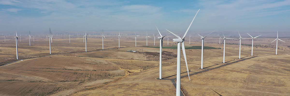
The energy industry uses drones equipped with thermal cameras for maintenance and inspection. Early detection of irregularities prevents downtime and costly repairs. Drones also access hazardous areas, ensuring worker safety. Improved inspections increase reliability and safety for energy operations.
The Deliverables
- Asset Inspection: Drones with high-resolution cameras and sensors can inspect power lines, wind turbines, solar panels, substations, and other critical infrastructure. This allows for the efficient and accurate identification of structural issues, equipment defects, or potential hazards.
- Thermographic Imaging: Drones with thermal cameras can detect heat signatures and identify anomalies such as hotspots or energy inefficiencies in power lines, transformers, and equipment. This helps identify potential failures, optimize maintenance schedules, and prevent downtime.
- Environmental Monitoring: Drones can monitor various conditions at energy and utility facilities, such as air quality, gas emissions, or water sources. This enables compliance with environmental regulations, early detection of leaks or spills, and proactive resource management.
- Emergency Response and Situational Awareness: Drones can be deployed during emergencies to assess damages, identify areas of concern, and provide real-time situational awareness to emergency response teams. This helps prioritize response efforts and enhances overall emergency management.
- Transmission Line and Pipeline Monitoring: Drones enable efficient monitoring and inspection of transmission lines, pipelines, and other linear infrastructure. They can quickly cover long distances and capture high-resolution imagery, facilitating early detection of defects, vegetation encroachments, or leakages.
- Documentation and Reporting: Drones capture high-resolution images and videos as visual documentation for maintenance records, compliance reporting, and insurance claims. This documentation assists with regulatory compliance, asset management, and audit processes.
- Remote Sensing and Data Collection: Drones with various sensors can collect data on weather patterns, wind speeds, or solar irradiation, aiding in renewable energy resource assessment and site selection for energy generation projects.
- Workforce Safety and Efficiency: By utilizing drones for inspections and data collection, energy and utility companies can minimize the need for personnel to work at heights or in hazardous environments, reducing occupational risks and improving workforce efficiency.
The Benefits
- Enhanced Safety: Drones reduce the need for human personnel to perform risky tasks such as climbing power lines or inspecting tall structures. This significantly minimizes accidents and injuries, ensuring worker safety.
- Cost Savings: Drones offer cost-effective alternatives to traditional inspection methods. They eliminate the need for expensive equipment, specialized crews, or helicopter rentals, resulting in substantial cost savings for utility and energy companies.
- Efficient Inspections: Power lines, transformers, wind turbines, and other infrastructure can be thoroughly inspected with drones equipped with advanced cameras and sensors. By detecting issues early, this efficiency allows for frequent and comprehensive inspections.
- Rapid Response: During emergencies or power outages, drones provide quick visual assessments of damages and infrastructure conditions, enabling utilities to respond promptly, prioritize repairs, and restore services faster, minimizing customer disruptions.
- Improved Maintenance Planning: Drone data and imagery help develop proactive maintenance plans. By identifying potential faults, equipment degradation, or vegetation encroachments, utilities can schedule maintenance activities more efficiently, reducing unexpected failures and optimizing asset performance.
- Enhanced Asset Management: Drones facilitate accurate and up-to-date asset documentation, including visual records and geospatial information. This aids in inventory tracking and regulatory compliance, streamlining operations, and reducing administrative burdens.
- Data-Driven Decision-making: Drones capture high-resolution imagery and sensor data, enabling data-driven decision-making. Utilities can analyze the collected data to identify trends, optimize workflows, and make informed decisions about repairs, upgrades, or system expansions.
- Improved Customer Service: Drones help utilities deliver better customer service by efficiently identifying and addressing issues. Quick inspections and timely maintenance prevent prolonged outages, enhance system reliability, and improve customer satisfaction.
- Scalability and Flexibility: Drones provide scalability and flexibility in operations. They can be easily deployed to cover large areas, reach remote or inaccessible locations, and adapt to varying inspection needs, ensuring comprehensive coverage and accurate data collection.
Surveying and Engineering
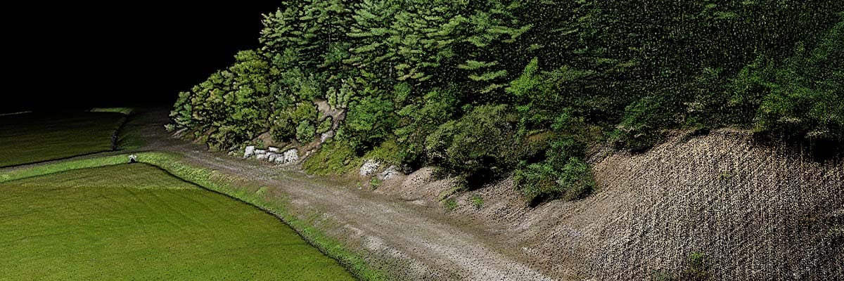
Drones equipped with LiDAR technology have transformed surveying and engineering. According to Research and Markets, the global market for surveying and mapping drones is expected to grow at a compound annual growth rate (CAGR) of 40.7% from 2020 to 2027 (Ltd, n.d.). These drones generate 3D terrain models and evaluate infrastructure without disruption, leading to reduced costs and enhanced precision. This innovation has revolutionized project planning and execution.
The Deliverables
- High-resolution Imagery: Drones capture high-resolution aerial images, providing detailed visual data of survey areas. These images can be used for site documentation, mapping, and visual reference throughout the engineering and construction processes.
- 3D Mapping and Modeling: By capturing images from different angles and utilizing photogrammetry techniques, drones can generate accurate 3D maps and models of surveyed areas. These maps and models aid in the design, planning, and visualizing project elements.
- Topographic Surveys: Drones with precision GPS and advanced sensors can collect accurate topographic data. This data helps create detailed elevation maps, contour lines, and profiles, facilitating site analysis, infrastructure design, and earthwork calculations.
- Volume Calculations: Drones can quickly and accurately calculate volumes of stockpiles, excavations, or construction materials. This information is crucial for quantity estimations, cost analysis, and monitoring progress during construction projects.
- Infrastructure Inspections: Drones enable efficient infrastructure inspections such as bridges, buildings, or pipelines. High-resolution imagery and close-up views assist in identifying structural issues, cracks, or signs of deterioration, aiding in maintenance and asset management.
- Thermal Imaging: Drones equipped with thermal cameras can capture thermal data, revealing temperature variations and identifying potential issues such as energy loss, water leaks, or heat anomalies. This aids in energy audits, building inspections, and infrastructure assessments.
- Geographic Information System (GIS) Integration: The data collected by drones can be integrated with GIS platforms, enabling spatial analysis, data visualization, and integration with other engineering or planning systems.
- Documentation and Reporting: Drones capture comprehensive visual documentation, providing valuable records for documentation, compliance reporting, and project documentation purposes.
The Benefits
- Cost Savings: Drones provide cost-effective alternatives to traditional surveying methods. They eliminate the need for costly equipment, manual labor, and time-intensive fieldwork, resulting in significant cost savings for engineering and surveying projects.
- Time Efficiency: Drones enable rapid data collection over large areas in a fraction of the time compared to traditional surveying methods. This expedites the surveying process, accelerates project timelines, and allows quicker decision-making and implementation.
- Improved Safety: Surveyors and engineers can use drones to minimize the need to work in hazardous or hard-to-reach areas. This reduces risks associated with working at heights, in confined spaces, or on unstable terrain, enhancing overall safety for personnel.
- High-Resolution Data: High-resolution imagery provides detailed and accurate visual data that can be used for mapping, site analysis, infrastructure inspections, and design, resulting in more precise and informed decision-making.
- Enhanced Data Accuracy: Drones with GPS and advanced sensors offer precise positioning and data collection capabilities, improving data accuracy and reducing errors and discrepancies in surveying and engineering calculations.
- Collaboration and Communication: Drones enhance collaboration among project stakeholders by providing visual data that can be easily shared and analyzed. This improves communication, reduces misunderstandings, and facilitates efficient decision-making among engineering teams, clients, and contractors.
Golf Courses
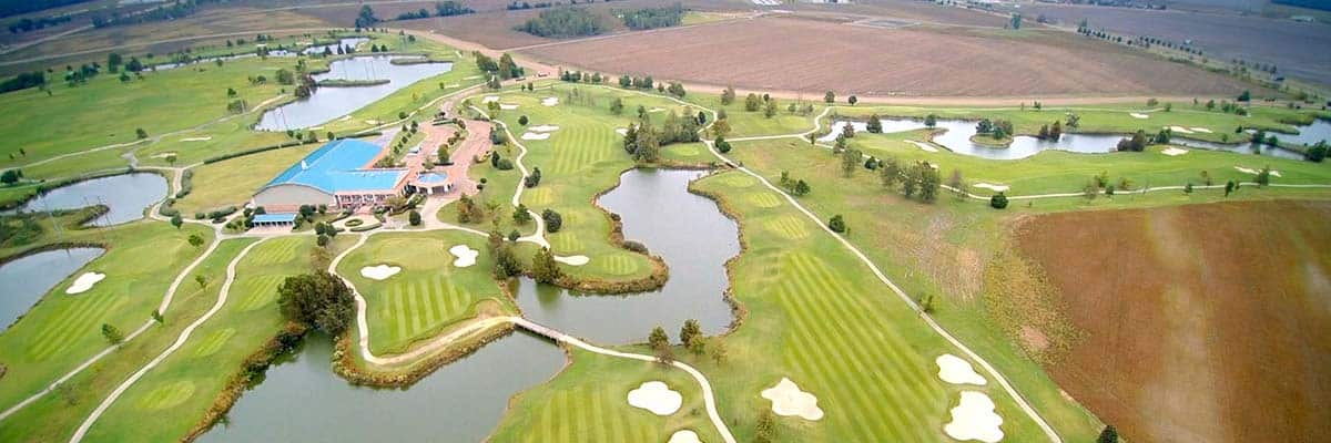
Drones can help golf course superintendents maintain quality playing conditions by evaluating turf health and generating topographic maps. This data enables informed decisions about irrigation, fertilization, and pest control, optimizing maintenance practices while saving resources and reducing costs. When Victoria Golf, Canada’s oldest golf course, started using drones in its operations, it experienced a 20% decrease in water usage and estimated a yearly reduction of $10,000 to $20,000 in pest-control expenses (The Rising Trend of Drones in Golf Agronomy | DroneDeploy, n.d.).
The Deliverables
- Aerial Photography and Videography: Drones capture stunning aerial images and videos of golf courses, showcasing the layout, features, and overall beauty of the course. These visuals can be used for marketing materials, course promotion, and website content.
- Course Mapping and Design: Drones equipped with high-resolution cameras and sensors can create detailed maps and 3D models of golf courses which aid in course design, identifying optimal hole locations, analyzing terrain, and optimizing player experiences.
- Course Maintenance and Inspections: Drones enable efficient and comprehensive inspections of golf course infrastructure, including greens, fairways, bunkers, and irrigation systems. High-resolution imagery helps identify maintenance needs, turf health, and potential hazards.
- Green Health Monitoring: Drones equipped with advanced sensors, such as multispectral or thermal cameras, can monitor the health of golf course greens. They detect areas of stress, disease, or inadequate irrigation, allowing for timely interventions and improved turf management.
- Pace of Play Monitoring: Drones can monitor the pace of play on golf courses. Course managers can identify bottlenecks, optimize course flow, and enhance player experience by capturing aerial footage and analyzing player movements.
- Event Coverage and Broadcasting: Drones provide captivating aerial footage for golf tournaments and events. They capture dynamic shots of players, the course, and the surrounding scenery, enhancing event coverage and broadcasting capabilities.
- Golf Course Marketing: Drones capture unique and compelling visuals that can be used for promotional videos, virtual tours, and social media content. These visuals attract golfers, showcase the course’s features, and enhance the marketing efforts of golf course operators.
- Course Analysis and Performance Evaluation: Drones provide valuable data and visuals that aid course analysis and performance evaluation. They assist in measuring distances, analyzing obstacles, and evaluating course conditions for continuous improvement and player satisfaction.
The Benefits
- Course Management Efficiency: Drones enable efficient and precise monitoring of golf course conditions. They provide real-time data on turf health, irrigation needs, and maintenance requirements, allowing for proactive management and optimized resource allocation.
- Cost Savings: Drones offer cost-effective alternatives to traditional course management and maintenance methods. They reduce the need for manual labor, minimize chemical usage through targeted applications, and optimize resource utilization, resulting in significant cost savings for golf course operators.
- Course Presentation and Marketing: Drones capture stunning aerial footage and imagery of golf courses, showcasing their beauty and unique features. These visuals can be used for marketing materials, website content, and social media promotion, attracting golfers and enhancing the course’s reputation.
- Player Experience Improvement: Drones help optimize the player experience on golf courses. They assist in monitoring pace of play, identifying bottlenecks, and suggesting improvements to enhance the flow and enjoyment of the game for golfers.
- Time Efficiency: Drones enable rapid data collection over large golf course areas in a fraction of the time compared to traditional methods. This saves time in course management, maintenance, and data analysis, allowing golf course operators to focus on other aspects of the business.
Oil and Gas
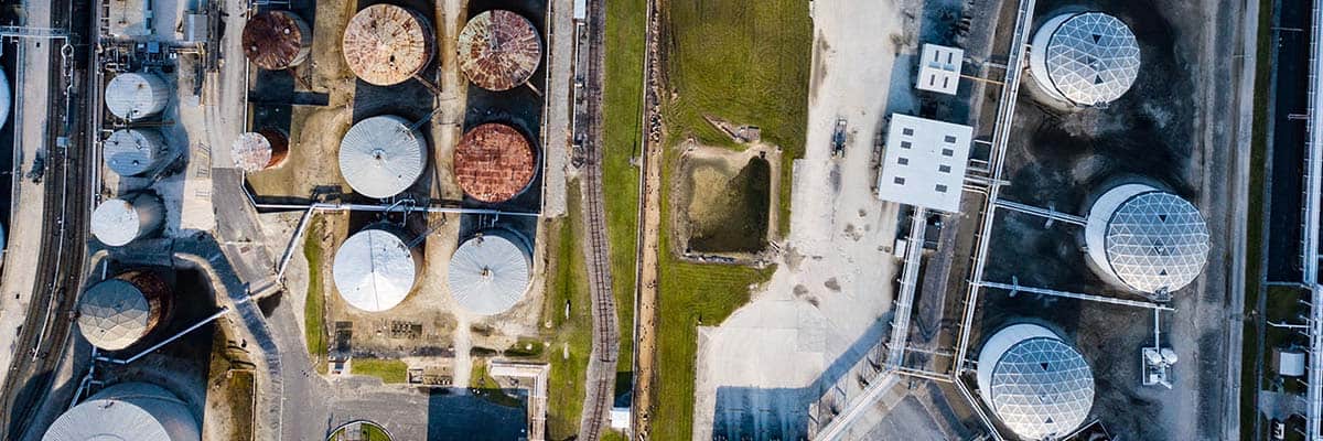
The global market for drones in oil and gas is expected to reach 16.72 billion USD by 2025 (5 Major Benefits of Drones in Oil and Gas, 2023.) Drones are revolutionizing the oil and gas industry with their ability to detect leaks, identify weaknesses, and inspect pipelines, rigs, and storage tanks. This technology improves safety, productivity, and maintenance schedules while reducing downtime and minimizing risks to human personnel. Drones increase efficiency and reduce costs.
The Deliverables
- Pipeline Inspections: Drones equipped with high-resolution cameras and sensors can perform aerial inspections of pipelines, detecting leaks, corrosion, or structural damage. They provide visual documentation, accurate mapping, and data analysis, aiding in maintenance and asset integrity management.
- Facility and Infrastructure Inspections: Drones enable efficient and safe inspections of oil and gas facilities, including tanks, flare stacks, rigs, and offshore platforms. They capture high-resolution imagery, allowing for detailed visual assessments, identification of maintenance needs, and compliance monitoring.
- Remote Sensing and Monitoring: Drones with thermal sensors can remotely monitor oil and gas operations. They detect gas leaks, identify heat anomalies, and measure emissions, enhancing safety, environmental compliance, and operational efficiency.
- Environmental Monitoring: Drones can be used for environmental monitoring, such as monitoring spills, identifying vegetation encroachments, or assessing wildlife impact. This aids in environmental impact assessments, regulatory compliance, and proactive environmental management.
- Emergency Response and Incident Management: Drones provide rapid and real-time situational awareness during emergencies like oil spills or industrial incidents. They capture high-resolution imagery, assess damages, and facilitate decision-making for effective response and mitigation strategies.
- Geographical and Spatial Data Collection: Drones with GPS and advanced sensors can collect accurate geographical and spatial data in oil and gas operations. This includes topographic surveys, volumetric calculations, and planning, design, and infrastructure development mapping.
- Asset Inventory and Documentation: Drones capture comprehensive visual documentation of oil and gas assets, including pipelines, storage tanks, and equipment. They provide accurate and up-to-date asset inventories, aiding in maintenance planning, regulatory compliance, and asset management.
- Risk Assessment and Safety Audits: Drones assist in conducting risk assessments and safety audits of oil and gas facilities. They provide visual data for evaluating safety compliance, identifying potential hazards, and implementing preventive measures to enhance worker safety.
- Workforce Training and Simulation: In the oil and gas industry, drones can be used for workforce training and simulation purposes. They provide a realistic and safe environment for training operators, practicing emergency response scenarios, and improving operational skills.
The Benefits
- Improved Safety: Drones eliminate or reduce the need for personnel to perform dangerous tasks, such as manual inspections at heights or in hazardous environments. This enhances worker safety by minimizing exposure to risks and potential accidents.
- Cost Savings: Drones offer cost-effective alternatives to traditional methods of inspections and monitoring. They reduce the need for expensive equipment, manual labor, and time-intensive processes, resulting in significant cost savings for oil and gas companies. Drones have been estimated to save companies about $5 million per day by preventing time shutdowns.**
- Time Efficiency: Drones enable rapid data collection over large areas in a fraction of the time compared to traditional methods. They expedite inspections, monitoring, and data acquisition, allowing quicker decision-making, response, and operational efficiency.
- Remote Monitoring and Surveillance: Drones provide remote monitoring and surveillance capabilities, enabling real-time situational awareness and monitoring of remote or inaccessible areas. This enhances security measures, facilitates emergency response, and mitigates potential risks.
- Environmental Compliance: Drones aid in environmental compliance by monitoring spills, assessing vegetation encroachments, or identifying potential sources of pollution. They support environmental impact assessments, regulatory compliance, and proactive environmental management.
- Emergency Response and Incident Management: Drones offer rapid situational awareness during emergencies like oil spills or industrial incidents. They provide real-time imagery, assess damages, and support decision-making for effective response and mitigation strategies.
- Improved Operational Efficiency: Drones streamline oil and gas industry operations by reducing manual intervention, optimizing workflows, and enhancing data collection and analysis. This leads to improved operational efficiency, reduced downtime, and increased productivity
Insurance
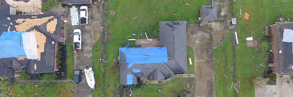
Drones are transforming the insurance industry. With the collection of detailed imagery, aerial inspections, and valuable data, insurers now use drones for efficient property inspections, accurate damage assessments, and streamlined processes. This technology provides a competitive edge and improves risk management and claims handling.
The Deliverables
- Aerial Inspections: Drones with high-resolution cameras and sensors can inspect properties, structures, or assets. They capture detailed visual data, helping insurance companies assess damages, evaluate risks, and determine coverage requirements.
- Claims Documentation: Drones capture high-resolution imagery and videos as visual documentation for insurance claims. They provide accurate and time-stamped records of property conditions before and after incidents, facilitating claim processing and reducing fraudulent activities.
- Risk Assessment: Drones aid risk assessment by providing visual data for underwriting purposes. They enable insurers to evaluate properties, assess risks, and determine appropriate coverage based on accurate and up-to-date information.
- Damage Assessment: After natural disasters or accidents, drones can quickly and safely assess damages to buildings, infrastructure, or vehicles. They provide visual documentation of the extent and severity of injuries, enabling insurers to expedite claims processing and streamline the assessment of liabilities.
- Property Surveys: Drones facilitate efficient property surveys for insurance purposes. They capture high-resolution imagery of buildings, roofs, or large properties, aiding insurers in property valuation, asset management, and accurate premium calculations.
- Safety Inspections: Drones enhance safety inspections of high-risk areas, such as rooftops, towers, or industrial sites. They minimize the need for human personnel to perform risky tasks, reducing potential accidents and improving overall safety measures.
- Catastrophe Response: Drones are crucial in catastrophe response and emergencies. They provide real-time aerial imagery, aiding insurers in assessing damages, prioritizing response efforts, and expediting claims handling for affected policyholders.
- Fraud Detection: Drones assist in fraud detection by capturing accurate visual evidence and documentation. They help identify fraudulent claims, assess discrepancies, and enhance the overall integrity of insurance processes.
- Data Analysis and Visualization: Drones generate large amounts of data that can be analyzed and visualized for better insights. They provide geospatial data, 3D models, or thermal imagery, enabling insurers to make informed decisions, detect patterns, and improve risk management strategies.
- Customer Engagement: Drones enhance customer engagement and satisfaction by providing visual documentation, processing claims, and facilitating efficient inspections. They improve customer experience by expediting claim settlements and streamlining insurance processes.
The Benefits
- Efficient Claims Processing: Drones expedite claims processing by capturing detailed visual documentation of properties before and after incidents. This documentation helps insurers assess damages, validate claims, and streamline the claims handling process, leading to faster settlements and improved customer satisfaction.
- Enhanced Loss Control: With aerial inspections and monitoring capabilities, drones assist insurers in loss control measures. They help identify potential risks, vulnerabilities, or safety hazards, allowing insurers to provide risk management recommendations and support policyholders in mitigating losses.
- Cost Savings: Drones offer cost-effective alternatives to traditional inspection methods, reducing the need for manual labor, specialized equipment, and lengthy on-site visits. Insurers can save on resources while obtaining accurate data for risk assessment, claims processing, and underwriting.
- Improved Safety: Drones minimize the need for human personnel to conduct risky inspections in challenging or dangerous environments. Insurers can use drones to assess properties, roofs, or other high-risk areas, enhancing safety measures and reducing potential accidents or injuries.
- Rapid Damage Assessment: Drones provide quick and efficient damage assessment capabilities following natural disasters or accidents. They capture detailed imagery and data, enabling insurers to remotely assess the extent and severity of damages, prioritize response efforts, and expedite claims handling.
- Enhanced Customer Experience: Drones improve customer experience by expediting claims settlements and streamlining insurance processes. Insurers can provide visual documentation and real-time updates to policyholders, enhancing transparency and instilling trust in their services.
- Enhanced Operational Efficiency: By leveraging drones, insurers can streamline operations, reduce manual labor, and optimize resource allocation. Drones offer efficient property inspections, accurate risk assessments, and expedited claims handling, ultimately improving the overall operational efficiency of insurance companies.
Common Benefits
Although drone benefits may vary depending on the industry, some common advantages apply to all. Below are some examples of drone benefits in any industry.
Efficiency: Drones significantly improve operational efficiency by streamlining processes, reducing manual labor, and expediting data collection and analysis. They enable faster and more accurate inspections, mapping, and monitoring, saving time and cost.
Safety Enhancement: Drones enhance safety by minimizing or eliminating the need for personnel to perform hazardous tasks or access dangerous environments. They can access difficult-to-reach areas, reducing human involvement risks in challenging or risky conditions.
Data-driven Decision Making: Drones provide valuable data and visuals that support data-driven decision-making processes. The collected data can be analyzed and integrated into existing systems, facilitating informed decision-making, risk assessment, and asset management.
Cost Savings: Drones offer cost-effective alternatives to traditional methods by reducing the need for expensive equipment, manual labor, and time-intensive processes. They optimize resource utilization, minimize operational costs, and improve overall cost efficiency.
Enhanced Data Collection and Analysis: Drones with advanced sensors and cameras capture high-resolution imagery, allowing for detailed data collection and analysis. This provides valuable insights, promotes accurate assessments, and aids proactive decision-making.
Improved Accuracy: Drones provide precise and accurate data, surpassing traditional methods. They offer high-resolution imagery, mapping capabilities, and sensor data that enhance inspection accuracy, measurements, and asset monitoring.
Remote Access and Monitoring: Drones enable remote access to and monitoring areas that are challenging to reach or require frequent inspections. They provide real-time situational awareness, remote monitoring, and surveillance capabilities, enhancing security, compliance, and emergency response.
Enhanced Communication and Visualization: Drones facilitate improved communication and visualization of projects, assets, and landscapes. They provide visual documentation, aerial photography, and 3D modeling, enabling stakeholders to better understand and collaborate on projects.
Seamless Scalability, Nationwide Reliability
Elevate your business with FlyGuys – the reliable provider of all-encompassing drone services. Regardless of your industry or location within the US, we’re here to fulfill all your drone service requirements. Our nationwide team can conduct aerial inspections, monitor progress, and collect aerial data anywhere, anytime. Get in touch with FlyGuys now to leverage the capabilities of drones and unleash your business’s full potential. Call us today and soar above your competitors!