The Next Dimension: 3D Modeling and Simulation in Civil Engineering
Revolutionizing Project Visualization and Decision-Making Processes
Like many modern industries, civil engineering must evolve to keep up with the competition and the fast-paced world. With the adoption of digital technologies, civil engineering has made a pivotal shift from traditional methodologies toward a future ripe with potential. Among these innovations, 3D modeling and simulation stand out as transformative tools, with reality data capture technologies spearheading the revolution. Let’s delve into how these technologies are not just altering but fundamentally enhancing the way civil engineering projects are conceptualized, visualized, and executed.
The Revolution of 3D Modeling in Civil Engineering
3D modeling in civil engineering goes beyond mere representation. It encapsulates the essence of a project in its entirety, enabling engineers to visualize, analyze, and communicate complex design concepts with unprecedented clarity. Traditional methods, while foundational, often fall short of capturing the dynamic nuances of a site or design.
Enter reality data capture—a suite of technologies like LiDAR, photogrammetry, drones, and 3D scanning—ushering in a more productive era of precision and efficiency.
Reality Data Capture Technologies: Tools of the Trade
The arsenal of reality data capture is extensive and diversified.
- Drones soar above sites, mapping terrain with agility and precision.
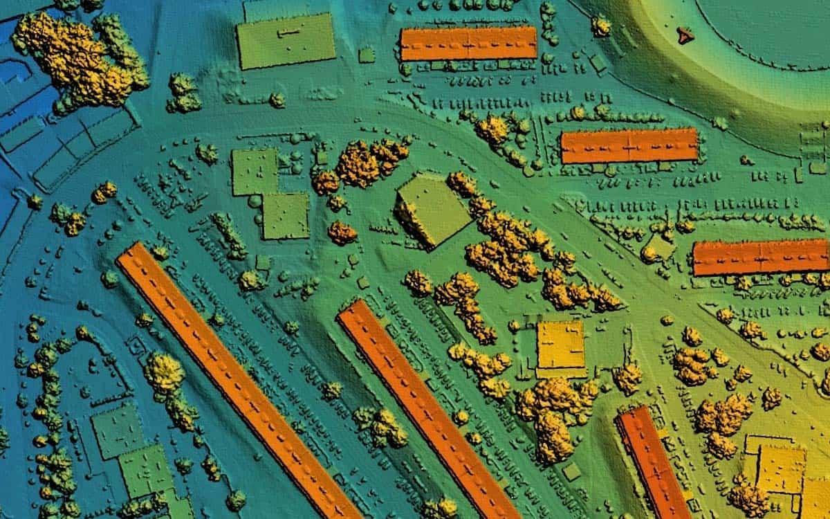
- LiDAR sensors pierce through foliage, revealing the contours of the land beneath.
- Photogrammetry stitches together images to construct digital twins of physical spaces.
Each tool, unique in its function, is united by a common goal: to gather accurate, comprehensive data that forms the backbone of 3D models.
Drones
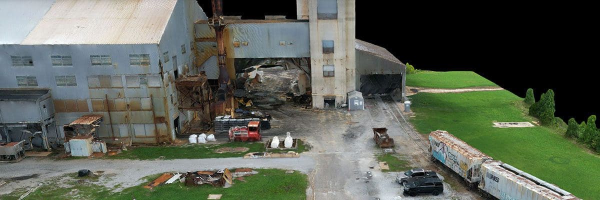
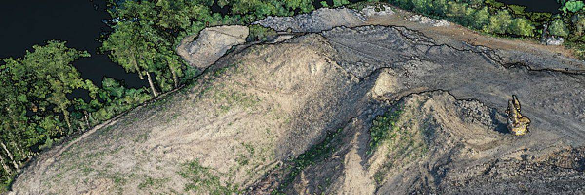
With their ability to soar above difficult or inaccessible terrain, drones have revolutionized data capture in civil engineering. They provide a bird’s-eye view of construction sites, enabling engineers to monitor progress, inspect structures, and gather topographic data with speed and accuracy previously unimaginable. This aerial perspective is not just about capturing images; drones equipped with advanced sensors can perform detailed surveys, map large areas in high resolution, and even detect structural problems before they become critical. By reducing the need for manual site inspections, drones also enhance safety and significantly cut down project timelines and costs.
LiDAR
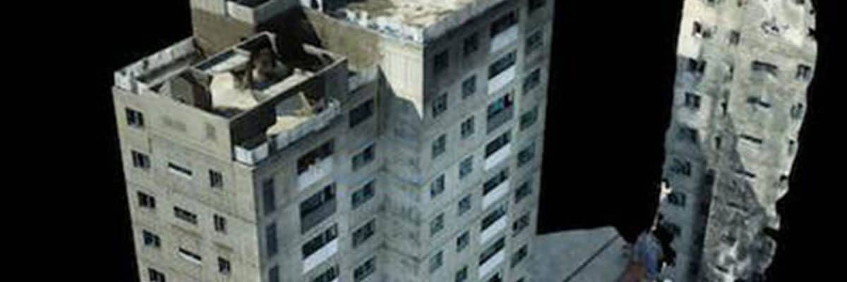
LiDAR technology, known for its ability to generate precise three-dimensional images of objects and landscapes, has similarly transformed the field. Mounted on drones, vehicles, or stationary platforms, LiDAR sends out thousands of laser pulses per second to measure distances to the Earth’s surface. These measurements are then compiled into detailed 3D models of the terrain, buildings, and other structures. For civil engineers, the accuracy and detail provided by LiDAR are invaluable for planning and designing infrastructure projects, from new highway corridors to flood defense systems, with a level of detail and accuracy never seen before.
3D Printing
3D printing, or additive manufacturing, introduces a new paradigm in construction methods, allowing for the fabrication of complex structures directly from digital models. This technology has the potential to reduce waste, lower construction costs, and slash the time required to build. From printing customized components for buildings to constructing entire structures with specialized concrete mixes, 3D printing enables architects and engineers to experiment with innovative designs and materials.
Enhancing Project Visualization with Reality Data Capture
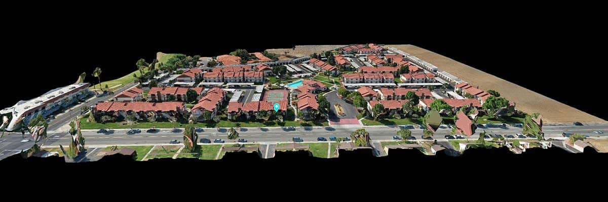
The impact of these technologies on project visualization cannot be overstated. They enable engineers and stakeholders to immerse themselves in the project, foresee potential issues, and explore solutions in a virtual environment. This enhanced visualization aids not only in the meticulous planning and design phases but also serves as a powerful communication tool, bridging the gap between technical teams and non-technical stakeholders.
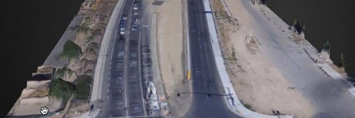
In a recent urban highway interchange project, reality data capture technologies were utilized to overcome design and planning challenges. Once the data was collected, the civil engineers were able to generate detailed 3D models of the project area. The 3D models were then used to accurately assess the conditions, simulate design options, and preemptively address potential issues, ensuring a design that would minimize traffic disruption and environmental impact.
These 3D visualizations were then used as communication tools, offering stakeholders—from city officials to local residents—a clear understanding of the project’s impact. As construction progressed, continuous aerial surveys updated the model, allowing for real-time adjustments and ensuring the project stayed true to its vision.
Simulation and Decision-Making in Civil Engineering
Beyond visualization, the true power of 3D models lies in simulation. These models, informed by rich, accurate data, allow engineers to simulate various scenarios, from natural disaster impacts to traffic flow. This predictive capability is invaluable, enabling informed decision-making that mitigates risk, optimizes resources, and ensures the sustainability of projects.

Overcoming Challenges and Limitations
Despite their potential, the integration of reality data capture and 3D modeling into civil engineering is not without its challenges. The high cost of technology, the need for specialized training, and the complexities of data management are notable hurdles. However, as the industry progresses, these challenges are increasingly being met with innovative solutions, making these technologies more accessible and integrated into mainstream practices.
The Future of 3D Modeling and Simulation in Civil Engineering
Looking ahead, the horizon of 3D modeling and simulation is expansive. Technologies such as augmented reality and digital twins promise to enhance the accuracy and interactivity of models further, offering a glimpse into a future where the lines between the physical and digital worlds blur. The potential for these technologies to improve efficiency, accuracy, and environmental sustainability in civil engineering projects is boundless.
As civil engineers continue to embrace the role of technologies like 3D modeling and reality data capture, the future of the industry is unequivocal. The ability to enhance project visualization, improve decision-making processes, and ultimately revolutionize project outcomes is a testament to the transformative power of digital innovation.
FlyGuys is proud to be at the vanguard of this revolution, empowering civil engineers with the tools and insights needed to bring their visionary projects to life. We invite you to explore, learn, and integrate these tools into your work, paving the way for a future where the possibilities are as limitless as the technologies themselves. For more insights into how FlyGuys can elevate your projects with reality data capture and 3D modeling solutions, connect with our team of experts today.