
Scaling Aerial Mapping: How FlyGuys and Vertex Combine Drone and Aircraft Data Solutions
Collaboration is redefining the future of aerial data capture. When two companies combine their strengths to deliver smarter, faster, and more scalable data collection, clients gain the best of both worlds.
That’s the power of the partnership between FlyGuys, the nationwide leader in reality data collection, and Vertex Unmanned, the trusted supplier of professional surveying equipment and LiDAR sensors, along with its sister company Point Cloud Aviation. Together, they’re transforming how businesses approach LiDAR data collection, aerial imaging, and large-scale mapping—proving that collaboration truly is the new frontier.

Complementary Strengths That Reach New Heights
FlyGuys has built its reputation as the reality data marketplace connecting businesses across industries with a nationwide network of certified drone pilots. From utilities and construction to energy and infrastructure, FlyGuys delivers end-to-end drone services that provide actionable data quickly and accurately.
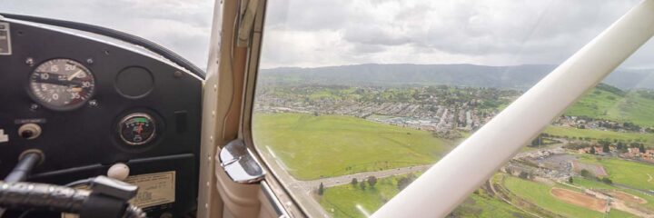
Vertex Unmanned serves as the technical backbone for aerial professionals. The company supplies drone equipment, sensors, and NDAA-compliant hardware, helping engineering firms, utilities, and data service providers choose the right tools for their missions. Its sister company, Point Cloud Aviation, operates two Cessna 182 aircraft specializing in LiDAR and orthomosaic mapping. These aircraft, and the sensors they carry, are built for scale, covering expansive corridors and challenging terrain that drones can’t always reach.
Together, FlyGuys and Vertex deliver complete aerial data collection solutions, combining drone precision with manned-aircraft range for projects of any size or complexity.
Collaboration Over Competition
This partnership thrives because each company stays true to its strengths.
- Vertex doesn’t provide drone services, ensuring it never competes with the companies it supplies.
- FlyGuys focuses exclusively on unmanned aerial operations, making them the go-to team for drone-based mapping and inspections.
When projects are too large for drones to complete efficiently, FlyGuys calls in Point Cloud Aviation for fixed-wing LiDAR mapping. When projects are smaller or highly localized, Vertex refers clients to FlyGuys’ nationwide drone pilot network.
This complementary approach means both companies can say “yes” to more opportunities, while clients enjoy benefits from seamless, transparent, and cost-effective data solutions.

Case Study: Powering Progress in Wyoming
A recent power line inspection project in Wyoming demonstrates the strength of this collaboration. FlyGuys was tasked with collecting video and structure imagery for a 120-mile power corridor. Working together, FlyGuys managed ground control and drone data collection, while Point Cloud Aviation flew overhead, gathering orthomosaic and LiDAR data from a Cessna 182.
The outcome was a comprehensive dataset that:
- Combined structure-level drone imagery with wide-area aerial mapping.
- Significantly reduced project time and costs.
- Delivered a high-quality, integrated data package for the client.
This hybrid workflow showcased how manned and unmanned aerial systems can work in tandem to achieve precision, efficiency, and scalability on a national level.

Scalable Solutions, Real-World Results
With this partnership, clients benefit from a unified ecosystem of aerial data services designed to fit projects of any scale, ranging from a 10-acre site survey to a 10,000-acre infrastructure mapping mission.
Why it works:
- Efficiency: Projects are matched to the most effective platform, ensuring no wasted resources.
- Scalability: Combining drones and aircraft unlocks nationwide coverage.
- Accuracy: Every dataset is delivered with FlyGuys’ commitment to white-glove quality and operational excellence.
Together, FlyGuys and Vertex ensure customers receive the right data, from the right altitude, every time.

Looking Ahead: The Future of Reality Data Capture
As technology advances through automation, BVLOS operations, and digital modeling, FlyGuys and Vertex are positioned to lead the way. Their shared vision focuses on building a future-ready aerial ecosystem, where manned and unmanned platforms work side by side to deliver faster, smarter, and more precise data.
“We see manned and unmanned aircraft as two tools in the same toolbox,” says Cody Gralish, Director of Sales at Point Cloud Aviation. “The key is knowing which one to use, and when, to deliver the most value to the customer.”
From NDAA-compliant “blue drones” to next-generation LiDAR systems, both companies are investing in technology that future-proofs their clients’ operations and expands access to high-quality geospatial data.
The Sky’s Not the Limit—It’s Just the Beginning
By combining FlyGuys’ nationwide drone network with Vertex’s equipment expertise and Point Cloud Aviation’s manned-aircraft capabilities, this partnership is breaking traditional boundaries and reshaping the future of aerial mapping.
The result is a powerful model of collaboration, one where innovation, efficiency, and scalability come together to deliver more data, faster, and smarter than ever before.