LiDAR Terms you Need to Know
LiDAR systems have been around since the 60s and evolved rather slowly through the decades. In the mid-’90s, the first commercial use of LiDAR to create topographic maps paved the way for future mapping applications. What was once used predominantly for NASA, today LiDAR is a go-to technology for numerous industries and various implementations. LiDAR is highly accurate and reliable, yet the uses and benefits are still unknown due to a lack of education on the applications.
We have compiled a glossary of LiDAR terminology and applications. After reading through the list, you may learn that LiDAR can help with your next project.
All About LiDAR
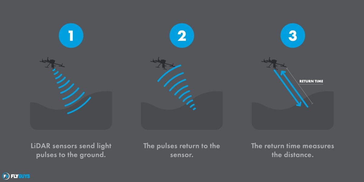
LiDAR– Li(ght) D(etection) A(nd) R(anging) is a remote sensing technology that measures the distance to an object. A laser illuminates the target through light pulses that move at the speed of light. The laser then returns to the sensor, and the time it takes for the laser to return is calculated to determine the distance to the object.
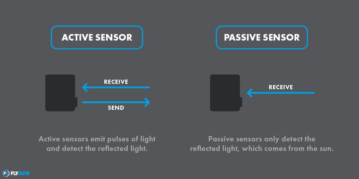
Active Sensory System- the source of energy collected by sensors actively generated by a manufactured device, such as LiDAR. LiDAR systems are active because they emit pulses of light and detect the reflected light.
LAS – a laser file format to interchange 3-dimensional point cloud data between data users.
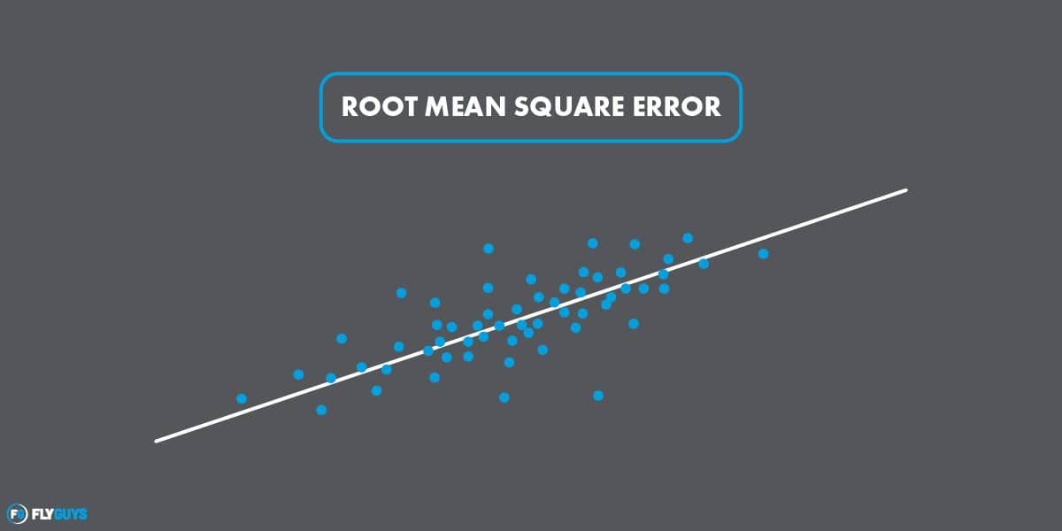
RMSE – root mean square error; how concentrated the data are around the line of best fit.
Vertical Accuracy – the accuracy between a point in the world compared to the same point in a point cloud.
Classification – LiDAR points can have a classification assigned to them that defines the type of object that has reflected the laser pulse. Lidar points can be classified into several categories, including unclassified, bare earth or ground, vegetation and buildings.
Density Measurement – LiDAR-equipped drones can reach ground surfaces through tiny openings in the canopy of foliage and plant life, capturing data difficult to collect by traditional methods – especially useful for industries such as agriculture, forestry, surveying, and land management/development.
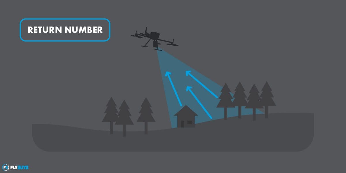
Return Number – LiDAR systems can record the first, second, third, and last return from a single laser pulse, which can determine what the reflected pulse is from, i.e., ground, tree, etc.
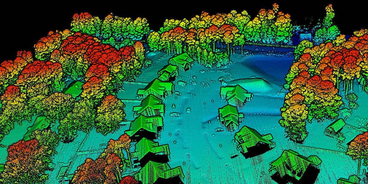
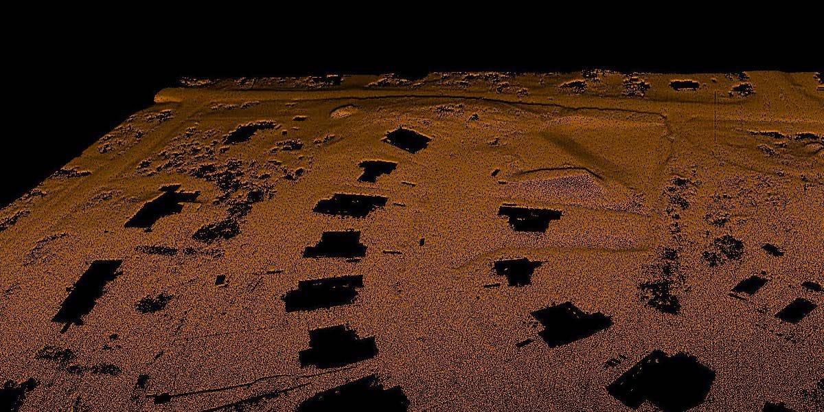
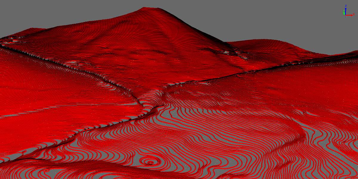
Point Cloud – A point cloud is a collection of individual data points in a three-dimensional plane, with each point having a set coordinate on the X, Y, and Z-axis. When each point is placed together, it creates a three-dimensional map or model.
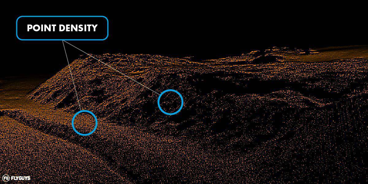
Point Density – the number of points in a given area.
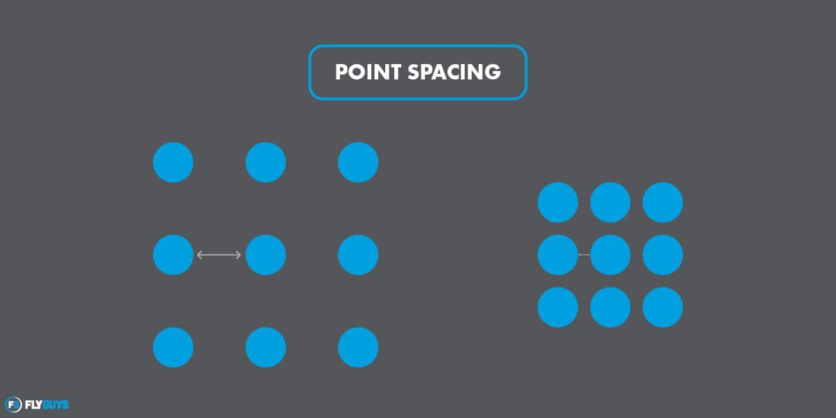
Point Spacing – the distance from two adjacent points in a given area.
Pulse Rate – the pulse rate is measured in pulses per second, describing how many individual pulses of infrared light are generated in one second.
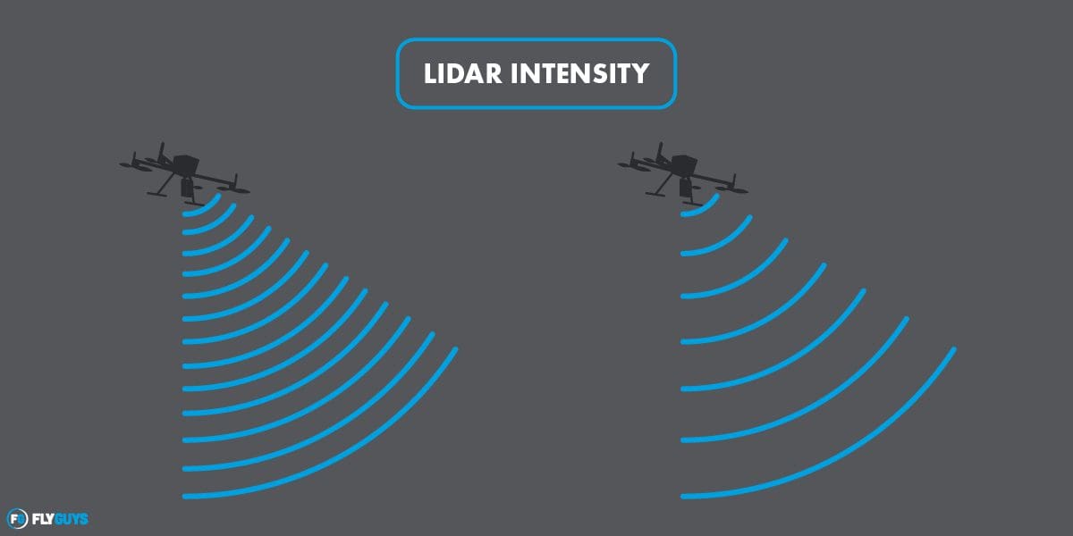
LiDAR Intensity – recorded as the return strength of a laser beam. Intensity is often used to detect and distinguish features, classify land cover, identify wet areas, and even classify vegetation.
LiDAR Deliverables
So, what can you get with this technology? Here are some of the deliverables that the data collection can help create.
Point Data – the x, y, and z values of a given area.
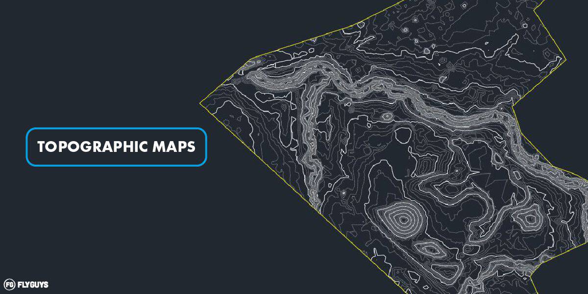
Topographic Maps – detailed illustrations of the earth’s surface, including contour lines that show the elevation levels of the surface.
Digital Elevation Model (DEM, DTM, or Digital Terrain Model) – represents the bare ground topographic surface of the Earth, excluding trees, buildings, and other surface objects. It is used to capture the surface’s width, length, and height when constructing bridges, buildings, and roads.
Volumetrics – LiDAR technology can measure the volume contained within an area through point clouds. LiDAR drone technology can collect data that will enable licensed professionals to measure the volume contained within an area. Helpful for mining, aggregate stockpile measurement, dredging, landfills, industrial sites, or other locations where volume measurement is vital.
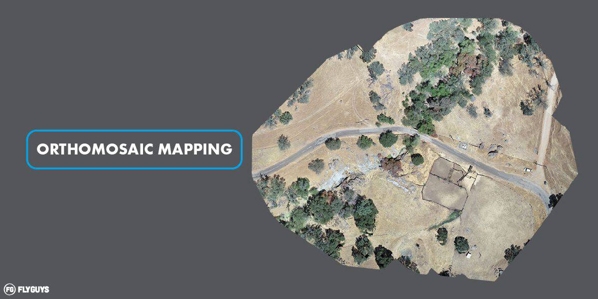
Orthomosaic Mapping – An Orthomosaic represents a large area made up of aerial images that have been stitched together to produce measurements of topography, buildings, and infrastructure. These maps can be used to monitor changes in vegetation and landscape.
Contours – lines that mark points of equal elevation on a map. Contours are the most commonly used representations of elevations.
Hillshade – a technique that brings out slight variations in the elevation data revealing imperfections in the surface.
Drape – draping graphics over a bumpy surface to provide more information.
Do you see a familiar application common in your workplace? If so, find out if LiDAR can help with your next project. Call FlyGuys for a free consultation today and learn more about our LiDAR services.