Advantages and Disadvantages of LiDAR Technology
We are breaking down the advantages and disadvantages of LiDAR technology and if it’s the right application for your project. Learn More!
Licensed surveyors and engineering firms across the US are turning to FlyGuys for their LiDAR drone services needs. Our expert services and best in class sensors can save you a significant amount of both time and money.
Licensed surveyors and engineering firms deploy FlyGuys to capture high-accuracy LiDAR data—nationwide, on demand, and ready for professional workflows.
FlyGuys is committed to capturing and delivering accurate, reliable LiDAR data—efficiently and at scale. Our LiDAR services are designed to support your project needs while maintaining the highest standards of quality and precision.
Through our trusted nationwide network of LiDAR-qualified pilots, we’re ready to deploy when and where you need data capture, without sacrificing consistency or turnaround time.
Learn about LiDAR in this free download. Discover complete information on:

Testimonials
“We needed a quick turnaround on a substantial LiDAR project. FlyGuys responded and arranged the service quickly. The work was performed professionally and we received high-quality assets. We will be working with FlyGuys for the foreseeable future.”
William Hayes

“FlyGuys offered wonderful data and service at a great value point. Easy navigation of their online platform, quick coordination about needs and offerings, and professional collection and sharing of products made for a fantastic resource in developing our projects.”
John Handley

“FlyGuys performed an aerial LiDAR collection that was used to create a topographical map for our client. Their team helped us achieve a fast, accurate result over a large and densely vegetated area.”
Jeff Collins, P.S.

Professionals use LiDAR across different fields for a variety of applications, such as:
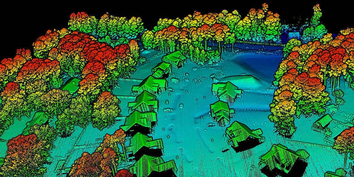
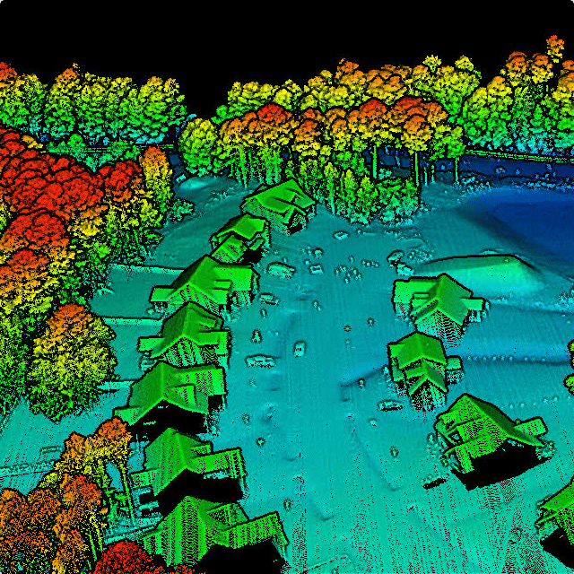
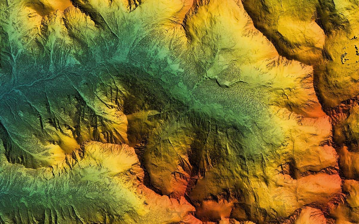
A digital elevation model rendered from a collected point cloud then uploaded into a GIS system. The model helps in planning for many different project types, including farming, land management, civil engineering and construction.
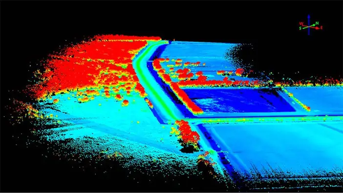
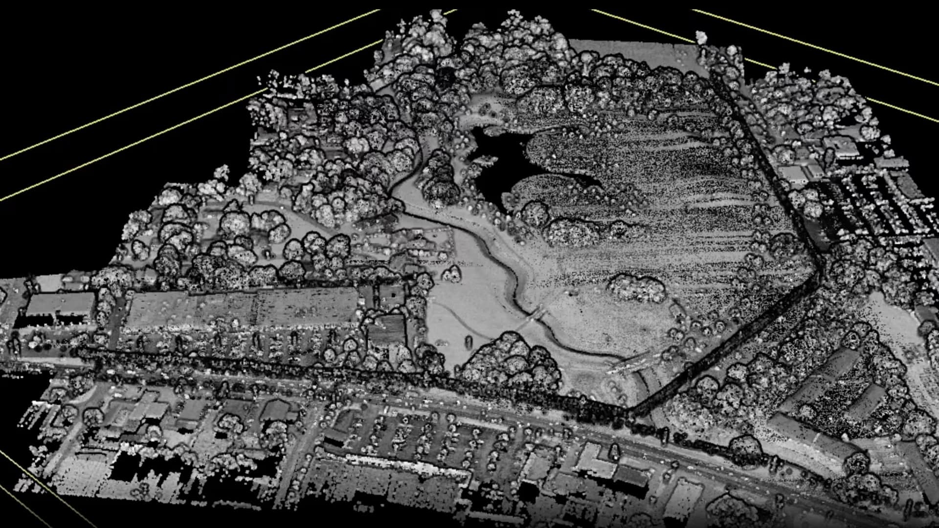
A point cloud collected in one pass of a LiDAR drone. This image shows all the surroundings/environment above ground before filtering into a ground layer.
Density Measurement
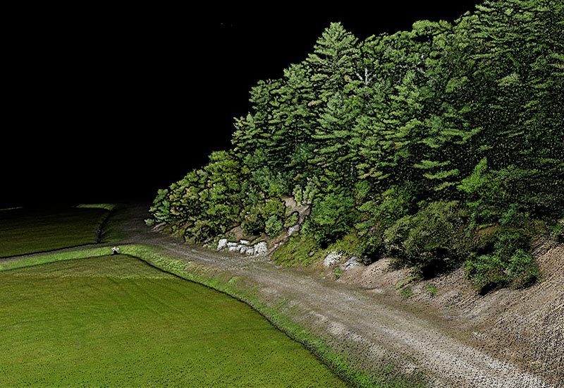
LiDAR-equipped drones can reach ground surfaces through small openings in the canopy of foliage and plant life, capturing data difficult to collect by traditional methods – especially useful for industries such as agriculture, forestry, surveying, and land management/development.
Detailed Detection
LiDAR-equipped drones can fly at low altitudes and reach ground surfaces through heavy vegetation, enabling a precise collection of locational data. This is especially valuable for archaeology, forestry, land development, and energy and utilities.
ROW & Utility Corridor Planning
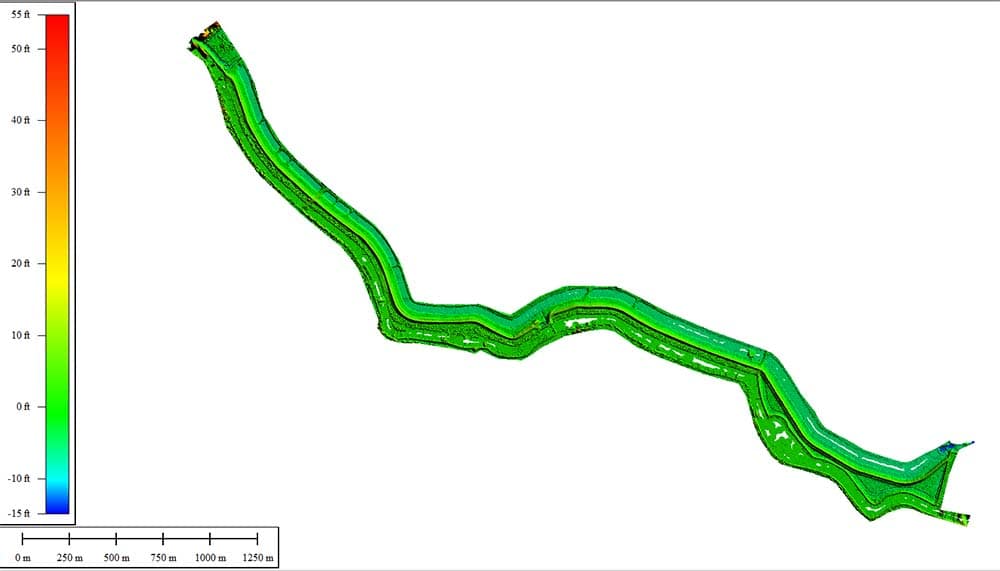
With the ability to obtain highly-detailed elevation data, LiDAR helps licensed professionals with terrain mapping when planning utilities or construction projects. It can help those professionals in ongoing ROW (Right of Way) encroachment monitoring by exposing tree canopies hanging over transmission lines, allowing asset managers to quickly pinpoint and address critical service needs.
Elevation Modeling
LiDAR data can be used by licensed professionals to create high-precision 3D models that deliver robust information not possible by traditional means, such as finding the low points on farmland for irrigation planning. Useful for many industries, including land management, agriculture, civil engineering, and construction.
Environmental & Coastal Restoration
LIDAR technology captures critical data that helps licensed professionals protect and restore vulnerable coastlines. Through consistent flights over an area, ongoing patterns of erosion, coastline shifts, and other changes can be detected over time and managed accordingly.
Volumetrics
LiDAR drone technology can be used to collect data that will enable licensed professionals to measure the volume contained within an area. Helpful for mining, aggregate stockpile measurement, dredging, landfills, industrial sites, or other locations where volume measurement is vital.
Working with FlyGuys
FlyGuys deploys LiDAR-equipped drones capable of scanning 400–700 acres per day per team, delivering accurate, scalable topographical data across a wide range of environments.
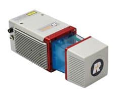
We utilize multiple LiDAR sensor options to match project requirements:
We have a nationwide network of licensed, insured pilots available to help capture all types of data, including LiDAR, each with a valid FAA Part 107 certification.
We are breaking down the advantages and disadvantages of LiDAR technology and if it’s the right application for your project. Learn More!
A variety of factors affect the cost of LiDAR drone services. Read on to find out what aspects of your project to keep in mind for evaluation.
How does your LiDAR data get processed? Find out everything you need to know about LiDAR processing and analysis with FlyGuys’ mission coordiantor.
Take Your Project To New Heights
No matter where your project is located, FlyGuys connects you with certified, FAA-compliant drone pilots ready to capture the data you need—quickly, safely, and reliably.
Request a quote today and let our team match you with the right drone solution for your project.
Please note that we are currently unable to assist in the search for missing pets. This limitation is due to the specific challenges and regulations associated with using drones for such purposes.