
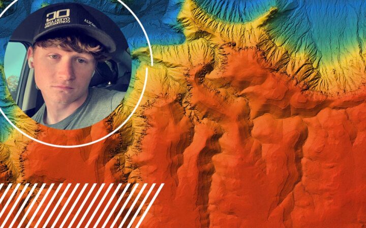
How LiDAR Could Have Saved Time, Money, and Improved Accuracy in Surveying: Insights from LiDAR Pilot, Levi
Surveying large construction sites, especially ones as expansive as the 4,000-acre solar site Levi managed in Georgia, comes with unique challenges. For years, Levi and his team relied on traditional surveying methods, which, although effective to some extent, often led to inefficiencies, delays, and increased costs. But with the introduction of LiDAR technology, everything changed.
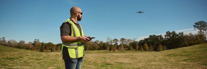
We sat down with Levi, one of FlyGuys’ Premium Drone Pilots, to discuss the challenges he faced without LiDAR and how the technology could have made a world of difference in his work.
The Limitations of Traditional Surveying
When Levi first encountered LiDAR, he didn’t fully understand its capabilities. “I didn’t trust it at first. I thought LiDAR was just aerial imaging without ground control points. I was used to the traditional methods, but they were far from ideal,” he explains.
His background in surveying meant that he was comfortable with GPS equipment and walking the terrain, even when conditions weren’t perfect. But traditional methods had their downsides, particularly when working in challenging environments.
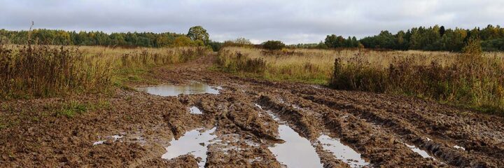
“After rain, the site became a mess. Trucks got stuck in the mud. It was hazardous, and the data we were collecting wasn’t always reliable,” Levi recalls. In the past, his team would use buggies or four-wheelers with GPS equipment to cover the ground, but it wasn’t efficient, especially on rough terrain or in challenging weather conditions.

How LiDAR Could Have Improved Efficiency and Accuracy
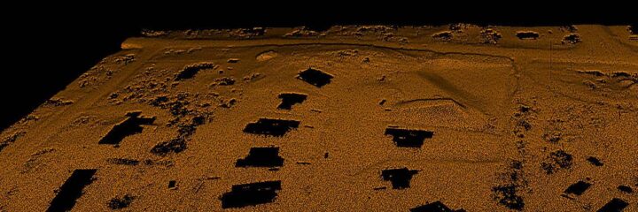
One of the key benefits of LiDAR is its ability to provide highly accurate data, regardless of the conditions. “LiDAR uses a laser to penetrate through the vegetation to give real, accurate ground elevations, even in areas where traditional methods fail,” says Levi.
LiDAR’s ability to capture data through dense vegetation is a huge advantage, particularly when compared to RGB imagery, which struggles to provide accurate ground elevation in areas with tall grass or dense foliage.
Without LiDAR, Levi’s team faced discrepancies in machine control files, especially when working with equipment like dozers and excavators. “Without LiDAR, our machine control files were often off by feet. That meant more dirt to move and unexpected delays,” he explains. These errors led to significant issues with cut-and-fill quantities, impacting budgets and project timelines.

Real-World Examples: How LiDAR Would Have Saved Time and Money
One of Levi’s most eye-opening realizations was just how much time and money LiDAR could have saved in the field. For example, when surveying the site, it took his team 8 weeks to clear 30 different areas before walking them for data collection. “With LiDAR,” Levi shares, “we could have flown the site without clearing the trees, allowing engineers to start estimating the cut-and-fill budget right away and providing better forecasting before the project even began. The files created would have been accurate from the start, ensuring everything was ‘first time right’ without the need for revisions.”
This approach would have dramatically cut down on time and effort spent on site preparation. While engineers always do estimates, those estimates can often be inaccurate, leading to additional hours spent fixing errors that weren’t originally accounted for.
LiDAR would have also been significant for environmental projects. “In environmental projects, like BMPs (Best Management Practices) for protecting wetlands, LiDAR could have helped us design better systems to avoid rework and potential shutdowns,” Levi explains. BMPs are critical in preventing water runoff from contaminating sensitive environmental areas. With LiDAR, engineers could have worked more efficiently, ensuring that designs were better suited to the natural topography of the land.
The Role of LiDAR in Improving Collaboration and Decision-Making
Beyond the immediate time and cost savings, LiDAR has a significant impact on collaboration and decision-making across teams. “LiDAR allows for precision down to an inch. When you’re working with machines that need to be that accurate, LiDAR can make all the difference in cost and scheduling,” Levi says.
When working with heavy equipment, precision is a priority. The ability to trust the data used for machine control is invaluable. Unlike traditional survey methods, where points are often spaced 20-50 feet apart, LiDAR saturates every inch of the ground with a dense point cloud, offering much more precise control. With more accurate data, equipment like pile drivers (PD10) can operate autonomously with greater precision. ‘With more data points from LiDAR, you get better control, especially with new autonomous machines. It saves money and time and ensures the job is done right,” Levi adds.
Reducing Manual Data Collection or Rework
In Levi’s experience, traditional surveying methods often required manual data collection and frequent rework. “The data collection methods we were using were inefficient. Sometimes we’d have to recollect the data, which meant more time on site and delays in the schedule,” he explains. Engineers also had trouble trusting the data from field staff, which further hindered progress.
LiDAR, by contrast, eliminates many of these inefficiencies by providing accurate, reliable data that doesn’t require extensive rework. This improvement in data reliability not only boosts confidence in the field but also helps keep projects on track.

LiDAR for Hard-to-Reach Areas
One of the biggest advantages of LiDAR is its ability to capture data in hard-to-reach areas, particularly in dense vegetation or rough terrain. “In areas that were too difficult to survey manually, LiDAR could have helped us capture critical data that was impossible to obtain,” Levi says.
This ability to easily map hard-to-reach areas makes LiDAR a valuable tool for surveying projects in challenging environments, ensuring that no crucial data is left behind.
LiDAR vs. Traditional Methods: Real-Time Data Collection
LiDAR also provides the benefit of real-time data collection, which contrasts with the slower, more traditional methods of surveying. “Working with LiDAR now, I see how valuable it is to collect real-time data. Engineers can act faster. Traditional methods just can’t keep up with the pace,” Levi explains.
With traditional methods, data processing can take days or even weeks, whereas LiDAR offers near-instant results, allowing teams to make decisions and adjust plans on the fly.
Final Thoughts: Why LiDAR is Essential for Modern Surveying
Looking back on his experience, Levi now fully understands the value of LiDAR in improving surveying processes. “Looking back, I know LiDAR would have saved us weeks of work and tens of thousands of dollars, eliminating so many inefficiencies. If you’re not using it yet, you’re falling behind,” Levi says.
LiDAR offers unparalleled accuracy, speed, and efficiency in data collection, saving both time and money while improving collaboration and decision-making across teams. For surveying projects, whether in construction, environmental protection, or other industries, LiDAR is no longer just an option; it’s a necessity.
Are you ready to take your surveying projects to the next level with LiDAR? Contact FlyGuys today to learn how our LiDAR services can help streamline your workflow and improve your project outcomes.