Introducing NavVis: Elevating Reality Data Capture with Cutting-Edge Technology
In today’s turbo-charged and increasingly digital world, reality data capture has become essential across industries. As businesses strive for accuracy, efficiency, and data-driven decision-making, reality data capture provides the foundation for insights that were previously unattainable. From creating precise digital twins of buildings and infrastructure to enabling predictive maintenance and enhancing inventory management, reality data capture transforms how we visualize and interact with the physical world. This powerful technology not only aids in improving operations and reducing costs but also drives innovation by delivering the high-quality data necessary to make informed, strategic decisions. In a world where precision matters more than ever, reality data capture is no longer a luxury—it’s a necessity.
As the demand for accurate, high-quality data grows, so does the need for advanced tools that can meet these expectations. Traditional methods of data capture often fall short when it comes to speed, detail, and flexibility—especially in complex environments. That’s where the NavVis VLX 2 steps in. This state-of-the-art device is designed to address the challenges of modern reality data capture with groundbreaking technology that not only enhances data accuracy but also improves efficiency and ease of use. Let’s take a closer look at how the NavVis VLX 2 is redefining what’s possible in 3D data capture and transforming industries that rely on precision.
Key Features of NavVis VLX 2
Dual LiDAR Sensors for High-Quality Point Clouds The NavVis VLX 2 integrates two 16-layer LiDAR sensors, which work in tandem with sophisticated SLAM (Simultaneous Localization and Mapping) software to capture exceptionally detailed and accurate point clouds. This setup provides survey-grade quality data, allowing for nuanced and reliable measurements across a wide range of environments.
360-Degree High-Resolution Imaging Four strategically placed cameras capture high-resolution 360-degree images without the operator appearing in the shots. This capability provides full spatial coverage and visual documentation, adding significant value to clients requiring immersive and interactive data.
Dynamic Object Removal and Drift Minimization NavVis VLX 2’s technology can identify and remove dynamic objects from scans in real time, enhancing data quality by focusing only on static structures. It also minimizes drift, even in complex environments, ensuring that point cloud data retains precision over extensive scanning sessions.
Smart Mapping Capabilities Smart mapping with the NavVis VLX 2 allows for seamless and automated panoramic image capturing, ideal for large-scale projects. This smart scanning capability makes it easier to capture high-quality data without repositioning the device, saving time and ensuring consistency in the data collected.
Real-Time Scanning Feedback A built-in touchscreen interface allows operators to monitor scan progress as they work, ensuring complete coverage and eliminating the risk of missing any critical areas. This real-time feedback offers confidence in the completeness and quality of data, further streamlining workflows.
Benefits of Using NavVis VLX 2
The NavVis VLX 2 transforms how companies approach reality capture by boosting efficiency, ensuring quality, and making complex data capture projects more manageable.
- Improved Efficiency and Coverage
The NavVis VLX 2 captures panoramic images and point clouds with high detail at range without stopping to adjust or reposition, making it ideal for large, complex sites. - Enhanced Data Quality and Detail
The device’s combination of LiDAR sensors, SLAM software, and intelligent object recognition ensures exceptional data quality. The high level of detail captured is valuable for applications that require precise measurements, such as surveying and digital twin creation. - Live Feedback for Instant Quality Assurance
With real-time feedback on scan progress, operators can quickly adjust on-site to ensure full coverage. This immediate feedback minimizes the need for rescans, increasing efficiency and confidence in the data collected. - Innovative Technology to Win More Projects
NavVis VLX 2’s technology distinguishes firms in competitive fields, helping them win projects by delivering superior data quality and project efficiency that exceeds client expectations.
Industry Applications of NavVis VLX 2
The versatility and precision of the NavVis VLX 2 make it an essential tool across various industries, from construction to manufacturing to infrastructure management.
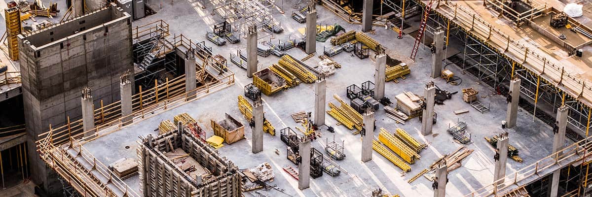
Construction and Architecture Construction professionals benefit from NavVis VLX 2’s ability to create accurate digital twins and 3D models of sites, simplifying tasks such as progress tracking, as-built verification, and clash detection. Architectural firms also utilize this data for virtual walk-throughs and design validation, enhancing client presentations and project planning.
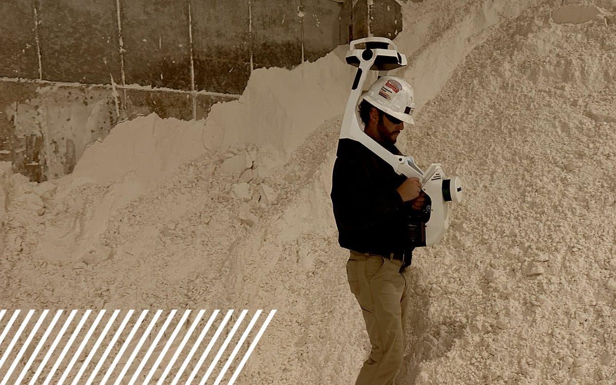
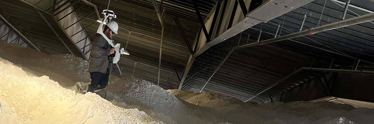
Manufacturing and Inventory Management For inventory assessments and warehouse management, the NavVis VLX 2 provides detailed 3D scans that streamline inventory counts. As FlyGuys demonstrated in their proof of concept with Advanced Corrosion, the NavVis VLX 2 effectively measured Alumina Trihydrate (ATH) stockpiles, providing essential data on the warehouse’s inventory count.
Facility and Infrastructure Management With its robust data capture capabilities, the NavVis VLX 2 is a valuable tool for capturing high-detail scans of facilities and infrastructure. Asset managers can monitor equipment and building conditions, track maintenance needs, and make informed decisions about upgrades or repairs.
Surveying and Geospatial Analysis Surveyors rely on NavVis VLX 2’s high accuracy and detailed data capture to create accurate point clouds for land and site assessments. Its SLAM technology minimizes drift, ensuring precision in expansive or challenging environments.
Utilities and Energy From power plants to pipelines, the NavVis VLX 2 enables energy sector professionals to capture comprehensive 3D data of critical infrastructure. This data aids in predictive maintenance, asset management, and risk assessment, helping companies maintain safety and efficiency in operations.
“Using the NavVis VLX 2, we have truly transformed our workflows. Before, capturing detailed visual data felt like a long, complex process. Now, with NavVis, we can scan stockpiles, piping, floor plans, etc. quickly and with incredible accuracy. The NavVis captures every detail we need, so we don’t have to second-guess our data. FlyGuys made everything easy, from setup to support, and the impact on our efficiency has been immediate. We’re excited to keep building on this technology in our work.” – Luke Prejean, Business Process Analyst (BPA), Advanced Corrosion
Transform your Data Collection Today
The NavVis VLX 2 represents a substantial leap forward in reality capture technology, providing industries with an efficient, reliable, and precise way to gather high-quality data. With its dual LiDAR sensors, 360-degree imagery, dynamic object recognition, and real-time feedback, the NavVis VLX 2 is a comprehensive solution for businesses looking to elevate their data capture capabilities. For industries focused on accuracy, efficiency, and innovation, the NavVis VLX 2 is an invaluable tool that not only meets but exceeds modern reality capture demands.
Whether for digital twins, inventory management, or complex construction projects, the NavVis VLX 2 sets a new standard in data quality and efficiency, empowering businesses to move confidently into the future of reality capture.