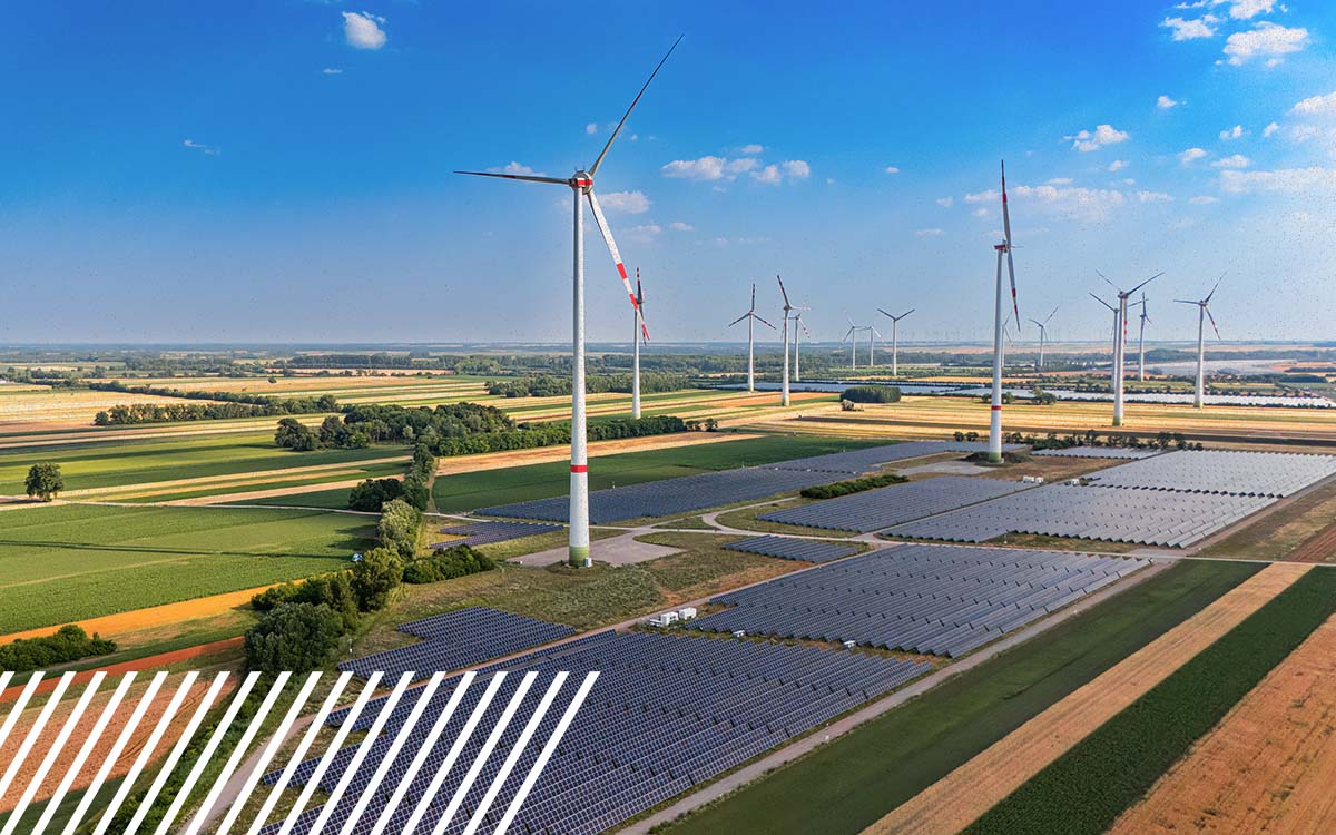
Why Are Large Energy Sites Difficult to Map?
Quick summary: Large energy sites are difficult to map because scale magnifies nearly every part of the collection process. Access, ground control, terrain, vegetation, airspace and data volume all become more complicated as the footprint grows. Mapping these sites successfully requires choosing the right capture method for the intended outcome rather than simply applying a small-site workflow across more acres.
A 5,000-acre energy site is not just a 500-acre mapping project multiplied by ten, and that distinction matters.
As energy projects grow, decisions about how data will be collected, controlled, processed and ultimately used begin to change. A drone may be the right tool for one site. Another may be better suited to a manned aircraft. Dense vegetation could shift the conversation toward LiDAR, while certain projects may require multiple collection methods working together.
To understand where those decisions come from, we spoke with FlyGuys Mike Ardoin, PLS, Director, Professional Services, and Julia Guerra, Solutions Architect, about what actually happens when mapping projects get big.
When Does the Size of an Energy Site Change the Mapping Strategy?
There is no universal acreage where a site suddenly becomes “large.” But there is a point where continuing to use the same collection method can stop making practical or financial sense.
For Mike, one important benchmark is around 2,500 acres. “Around the 2,500-acre mark is where the costs of mapping using a manned aircraft start to make sense,” he says. “But several factors beyond size alone further influence that decision.”
With a drone, increasing acreage means increasing flight time, battery requirements and time in the field. Eventually, those operational requirements can make another capture method more efficient.
That does not mean every project over 2,500 acres should automatically move to manned aircraft. Site accessibility, airspace and the customer’s required outputs still matter.
The important shift is in how the project is evaluated.
Julia has seen the consequences when organizations treat a large project as if it were simply a collection of small ones. Trying to map large-scale areas using the same methods used to capture small areas is one of the biggest planning mistakes she sees. “For example,” she explains, “stitching together 100 small maps may not be as efficient or accurate as collecting one large manned flight.”
In other words, scaling the acreage should also trigger a conversation about scaling the methodology.

Why Isn’t a 5,000-Acre Site Just Several Smaller Mapping Projects?
At first glance, breaking a large site into smaller pieces sounds reasonable. Operationally, it can introduce a new set of problems: ground control being one of them.
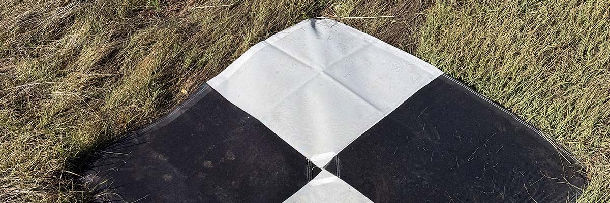
For high-accuracy mapping, control points help connect collected data to known coordinates and provide a way to verify the accuracy of the resulting dataset. How those points are distributed across thousands of acres matters.
The shape and continuity of the property matter too.
“The contiguous nature of the parcels affects several important factors,” Mike says. “Primarily the amount of ground control that must be established and the process used to establish it.”
Field logistics can also look very different.
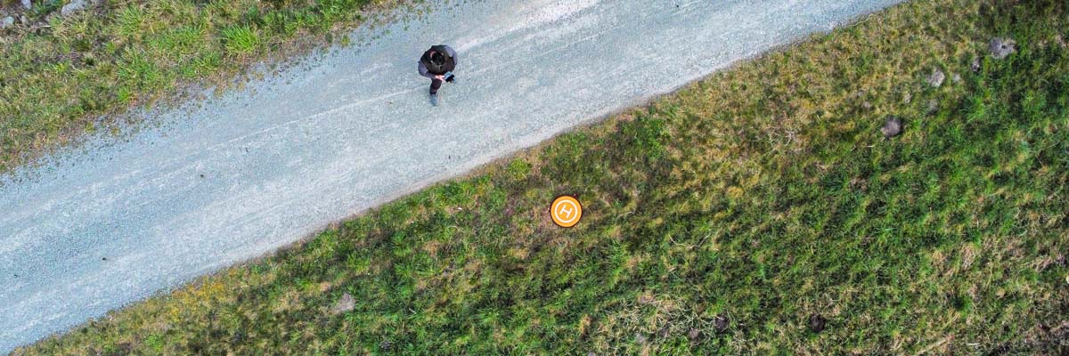
On one large, open property, a drone pilot may be able to complete the work from only a few operating locations. Divide the same acreage among separate parcels, and suddenly the crew may need to pack up, move and establish a new operation at every site.
That additional setup time adds up quickly.
This is why acreage alone never tells the full story. How the acreage is distributed can be almost as important as how much of it exists.
What Do Experts Look at Before Mapping a Large Energy Site?
Before choosing an aircraft or sensor, Mike’s team wants to understand the site itself.
“The first things we look at are location and airspace, size, and site accessibility,” he says.
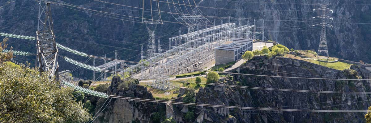
Remote energy sites can require significant pilot mobilization. Restricted or complicated airspace can affect how a mission is conducted or whether the proposed collection is feasible at all. Nearby critical infrastructure may introduce additional considerations.
Then there is the question that guides nearly every technical decision that follows: What does the customer need to do with the data?
That question is more important than starting with a preferred technology.
When asked when RGB mapping stops being enough and LiDAR or another method should take over, Mike cautions against treating those technologies as competing choices. “The sensor type or capture methodology is nearly always defined by the intended outcome and not necessarily an either/or.”
A project requiring a high-resolution visual record may call for RGB imagery. A project where engineers need reliable ground information beneath vegetation may push the strategy toward LiDAR. Very large footprints could favor manned collection.
And some projects need more than one. The solution should follow the problem, not the other way around.
How Do Terrain and Vegetation Complicate Energy Site Mapping?
Large energy sites rarely provide thousands of acres of perfectly flat, unobstructed terrain.
Of the challenges Mike encounters, accessibility is often one of the most consequential because it directly affects the team’s ability to establish ground control and collect check shots. “Without sufficient coverage of either, due to accessibility, we cannot guarantee the output for those areas,” he explains.
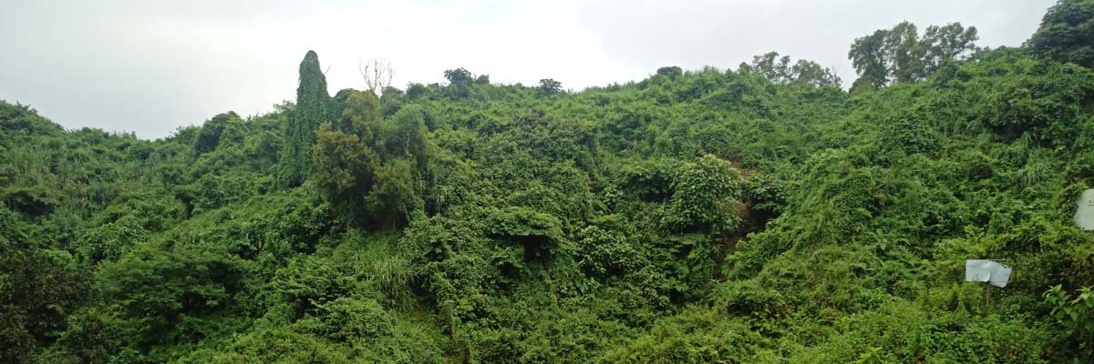
Steep terrain or heavy vegetation can turn what appears straightforward on a map into a very different operation once crews arrive.
Vegetation can also change the type of sensor needed. Julia points to LiDAR as an example. “When mapping large areas of dense vegetation, utilizing LiDAR instead of standard RGB photogrammetry is a more effective solution.”
Unlike standard imagery, LiDAR sends laser pulses toward the surface. Some of those pulses can pass through small openings in foliage. Because the sensor can record multiple returns, a single collection can capture information from the vegetation canopy as well as the ground below.
For an energy company that needs terrain information in a heavily vegetated corridor or site, that difference can determine whether the dataset actually answers the question that prompted the project.
How Do You Maintain Accuracy Across Thousands of Acres?
Accuracy gets more complicated as distances grow. It is not enough for one corner of a project to look right. The dataset needs to maintain the required accuracy throughout the entire site.
Mike points to two concepts that become particularly important at this scale: control networks and error propagation. “Having a thorough understanding of control networks and error propagation is key to ensuring that accuracy is maintained across larger sites,” he says.
Julia offers an example from another type of large, difficult environment that illustrates the same challenge.
Her team has conducted large-scale LiDAR collections across ski slopes to create terrain datasets supporting autonomous vehicle navigation and snow grooming. Their baseline ground control plan called for approximately one ground control point per 100 acres. Because of the site’s variable terrain and scale, they increased the density of that control network by 30%.
The lesson extends well beyond ski slopes. “It’s worth separating two distinct things here: sensor accuracy and control network integrity,” Julia says. “Sensor accuracy tells you how precise the instrument is relative to itself. A dense, well-distributed and auditable ground control network is what ties that data to a real, globally referenced coordinate system.”
That distinction is particularly important when an organization is making engineering or operational decisions from the resulting data. A highly accurate sensor does not automatically guarantee a defensible mapping product. The control strategy still matters.

Does Higher Accuracy Always Mean Better Data?
Not necessarily.
Accuracy requirements should come from the intended use of the dataset.
Mike says most expectations are relatively standardized based on the collection method. The bigger conversation happens when a requested specification goes beyond what would normally be delivered for that type of project.
When that happens, his team asks a simple question:
Why?
If a customer requests an unusually tight accuracy specification, Mike wants to understand what downstream decision requires it. “It’s important to find out their ‘why’ and ensure that it’s a legitimate ask that is rooted in reality,” he says.
That conversation can prevent a project from becoming unnecessarily expensive or operationally complicated in pursuit of a specification that does not meaningfully improve the final use case.
The goal is not to collect the most precise dataset technically possible. It is to collect data accurate enough to reliably support the work that comes next.
Can One Collection Produce Multiple Types of Energy Site Data?
Often, yes.
Energy companies may have several teams interested in the same site. Engineering may need topography while another group needs imagery or a 3D representation. That does not necessarily mean sending crews back for separate collections.
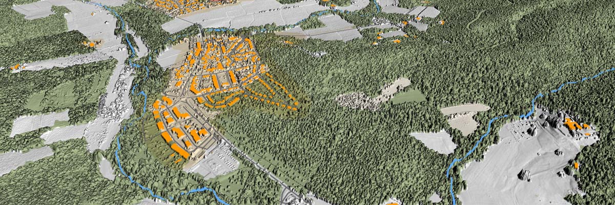
“One set of data collected can produce a wide variety of deliverable types,” Julia says. A combined LiDAR and RGB collection, for example, can support 2D and 3D outputs such as point clouds, orthomosaics, topographic drawings and 3D meshes.
This is another reason planning should start with intended outcomes.
If everyone who will eventually use the data is brought into the conversation before collection begins, the capture strategy can potentially serve multiple downstream needs. If those requirements surface afterward, the existing dataset may not contain everything needed.
Why Is Repeatability So Important for Energy Companies?
For many energy operators, mapping is not a one-time project.
The same assets may need to be captured monthly, quarterly or annually. Once that happens, consistency becomes part of the data’s value.
Julia explains that small changes in efficiency can be difficult to recognize from one period to the next. “Loss of efficiency over time can often be marginal week over week. These discrepancies can be difficult to track until there is a large issue, repair needed or deficit.”
Repeatable collection gives teams a better baseline for identifying those changes earlier.
But repeatability requires more than sending someone back to the same coordinates six months later.
Flight specifications need to remain consistent. Minimum deliverable requirements should be defined. Where possible, repeatable or automated flight plans can help ensure each collection follows the same specifications.
There also needs to be a system for storing and comparing what was captured. Julia describes the stronger approach as a “holistic system to store, review, track and analyze the data.”
That is what turns a sequence of individual mapping projects into something much more valuable: a record of how the site is changing over time.
What Happens After You Collect a Massive Dataset?
Collection is only half of the large-site mapping problem.
A beautiful 3D model is not particularly useful if the person who needs it cannot open it.
Julia sees data visualization as an overlooked challenge of large-area mapping. “Large datasets can be debilitating to most standard computers,” she says.
Imagine asking someone to open a massive point cloud covering thousands of acres on a typical office laptop. Technically, the project may have been captured and processed correctly. Practically, the dataset may be difficult to use.
Planning, therefore, needs to include how data will be delivered and consumed. That could mean tiling a model into manageable sections, parsing a larger dataset into relevant portions or using purpose-built visualization software capable of handling large geospatial datasets.
This is where the definition of a successful mapping project needs to expand.
Success is not simply collecting accurate data. The data has to be usable by the people who need it.

What Is the Best Way to Map a Large Energy Site?
There is no single best method for every large energy site.
And that may be the most important takeaway from both Mike and Julia.
A drone is not automatically the answer because the site needs aerial data. LiDAR is not automatically better because it provides dense 3D information. Manned aircraft do not become the default simply because a project crosses an acreage threshold.
Each technology solves a different part of the problem.
A successful strategy considers the site’s footprint, physical conditions and access limitations alongside the required accuracy and final use of the data. It also considers what happens after collection, especially when the project will be repeated.
For some sites, that leads to RGB drone mapping. For others, LiDAR makes more sense. At a certain scale, manned aircraft may dramatically improve the economics of collection. Complex projects may call for a hybrid approach.
The common thread is planning. As Mike puts it, the methodology is ultimately defined by the intended outcome.
For energy companies managing increasingly large and complex assets, that is a useful way to rethink mapping altogether. The question is no longer simply: How do we capture this site?
It is: What do we need to learn from this site, and what is the smartest way to collect data that can reliably give us that answer?
Frequently Asked Questions
Why are large energy sites difficult to map?
Large energy sites amplify challenges involving accessibility, terrain, vegetation, airspace, ground control and data management. As acreage increases, the most efficient capture method can also change, meaning a workflow designed for a smaller property may not scale effectively.
How do you map a large energy site?
The process should begin by defining the required outputs and accuracy, then evaluating the site’s size, location, airspace and accessibility. From there, the collection team can determine whether drones, LiDAR, manned aircraft or a combination of technologies is most appropriate.
When should you use a manned aircraft instead of a drone for mapping?
There is no universal cutoff, but FlyGuys Professional Services begins closely evaluating manned collection around the 2,500-acre mark. At that scale, drone flight time can increase enough that manned collection becomes more economical. Site conditions and deliverable requirements still need to be considered.
Is LiDAR better than photogrammetry for energy sites?
It depends on the intended output. RGB photogrammetry can provide highly detailed visual mapping, while LiDAR is particularly valuable when terrain information is needed beneath vegetation. Some projects benefit from collecting both.
Why is ground control important for large-site mapping?
Ground control helps tie collected data to known coordinates and verify the accuracy of the mapping product. On very large or highly variable sites, the density and distribution of the control network become especially important for maintaining consistent accuracy across the project.
Can the same energy site be mapped repeatedly to track changes?
Yes. Repeat mapping can help energy companies compare site conditions over time, but collection specifications should remain consistent. Repeatable flight plans, defined deliverable standards, and a system for storing and analyzing historical datasets make those comparisons much more useful.