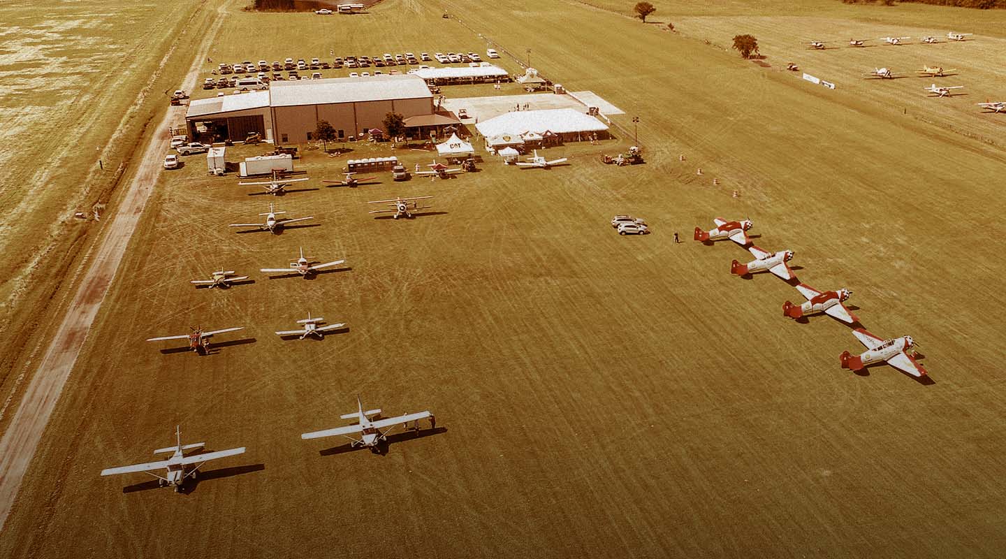
Drone Photography and Videography for Marketing
capture high-definition video, 360° panoramic photos, & more
Take marketing and promotional material to new heights with high-quality drone photography and videography from FlyGuys. Our FAA-certified and fully insured UAV pilots can capture high-definition video, 360° panoramic photos, and more to create majestic, alluring, and captivating marketing and media campaigns.
Drone Photography for Marketing & Media
High-quality aerial photography and video give marketing and media teams a powerful way to showcase properties, destinations, and developments from perspectives that ground-based visuals can’t capture. FlyGuys produces professional drone imagery that highlights scale, layout, and surroundings—helping audiences understand a property at a glance.
From resorts and vacation properties to real estate and commercial developments, aerial visuals create immersive experiences that draw viewers in and hold their attention. Wide-angle perspectives combined with smooth, cinematic motion elevate listings, promotional campaigns, and investor presentations, extending reach and enhancing how properties are experienced and shared.
Benefits of Drone Photography for Marketing & Media
- Highlight the area around a property, such as nearby attractions or beautiful scenery.
- Provide never-before-seen viewpoints of a property.
- Provide immersive marketing video and virtual tours.
- Update websites with new, high-definition images, panoramic photos, and videos.
- Create high-quality printed materials and brochures with stunning photographs to showcase your business.
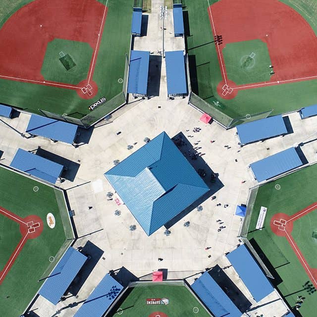
Industries That Use Aerial Marketing
We provide comprehensive aerial photography and videography services to numerous industries, expanding the reach of our image capturing services far beyond marketing and media.
Real Estate & Property Management
Professional aerial photography and video give real estate and property management teams a clearer, more compelling way to present listings. High-resolution drone imagery captures property layout, surroundings, and key amenities, providing valuable context that helps listings stand out.
From residential homes to multi-unit and commercial properties, aerial visuals support faster marketing cycles by giving buyers and tenants a better understanding of the property before they ever visit the site. The result is stronger engagement, improved presentation, and more effective property marketing across digital platforms.
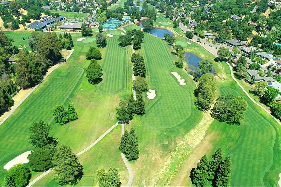
Golf Courses
Aerial photography and video showcase golf courses in a way that ground-based imagery cannot—highlighting course layout, elevation changes, and surrounding scenery. High-resolution drone visuals create compelling marketing assets that help clubs promote membership, tournaments, and events. These perspectives give players a true sense of the course experience before they ever step onto the fairway.
Tourism & Hospitality
Professional aerial imagery helps hotels, resorts, and destinations capture attention and set the tone for the guest experience. Drone photos and video highlight location, amenities, and nearby attractions—creating engaging visual content for websites, social media, and promotional campaigns. The result is stronger first impressions that encourage travelers to explore, book, and share.
Drone Mapping & Inspections
FlyGuys provides drone mapping and inspection services that support documentation, monitoring, and visual storytelling across a project’s lifecycle. High-resolution imagery can be used to track progress, document site conditions, and create time-lapse visuals that show work from start to finish. Consistent site capture also keeps stakeholders and investors informed with clear, up-to-date visuals they can trust.
Golf Course Drone Photography & Mapping
FlyGuys provides golf course drone photography services including marketing videos, drone inspections for maintenance and construction, and aerial mapping. The aerial footage can also be used in the production of a unique Digital Yardage Book application.
Aerial Photography
Golf courses face the challenge of showcasing their expansive beauty while offering granular details to help players perfect their game. Ground-level photography and traditional marketing won’t cut it in today’s digital landscape, and flyover imaging with helicopters or planes is costly.
Aerial photography helps golf courses market their properties by giving them advanced and immersive collateral.
Marketing, Inspections, and More
FlyGuys provides golf course drone photography services including marketing videos, drone inspections for maintenance and construction, and aerial mapping. The aerial footage can also be used in the production of a unique Digital Yardage Book application.
Aerial photos and videos capture the full beauty and unique terrain of your golf course better than ground-level images. Our drone pilots are skilled in capturing effective drone golf course photography to convey to golfers the quality of the course and the complexity of the holes.
Golf Course Drone Marketing
Golf course drone photography captures aerial images and comprehensive ground data quickly and affordably. The images and data collected can be used in marketing tactics that inspire players to take control of their game, and beautiful imagery can be used on digital platforms and print brochures. In addition to the marketing possibilities, collecting data via drones for golf courses helps maintenance crews with oversight and upkeep.
Benefits
- Promotional Videos. FlyGuys can capture raw aerial videos that can be set to music to create promotional presentations. Share on digital platforms to showcase course amenities.
- Aerial Pathways. Show the golf course from the golfball’s perspective and create videos and models of the holes.
Digital Yardage Book
FlyGuys can capture the information you need to create a modern and innovative yardage book that far surpasses paper-based books. Forget drawings and animations — our drones will capture actual course imagery and videos that are more visually appealing and accurate.
- Benefits for golfers: Speeds up play by eliminating blind spots and helping to plan a game in advance, similar to how NFL players study films in preparation for game day.
- Benefits for course owners: Offers the opportunity to cross-sell and upsell to patrons while providing a modern amenity.The quality of any course is directly related to the condition of its greens. Using drone images and video, FlyGuys can simplify and expedite the maintenance and improvement of a golf course.
Maintenance, Planning, and Expansion
The quality of any course is directly related to the condition of its greens. Using drone images and video, FlyGuys can simplify and expedite the maintenance and improvement of a golf course.
- Comprehensive course oversight. Know the condition of your greens and allocate resources (labor / water) more efficiently.
- Irrigation and course health. Detect irrigation issues not seen in ground-level checks.
- Plan and expand with thorough data. See the big picture for redesigning and/or planning golf course expansion, e.g., tree removal, building site selection. With our high-end drone sensors, we can assist with surveying and mapping as well as inspections and monitoring construction progress.
Join the growing number of golf courses using FlyGuys to simplify maintenance, planning, and marketing.
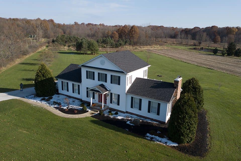
Real Estate Drone Photography & Videography
According to the National Association of Realtors (NAR) 90% of home buyers find their property information online. Agents who provide the best information and comprehensive, compelling imagery are rewarded with more leads, faster sales and future listings, making drone photography the clear choice in real estate marketing.
Residential Real Estate Drone Photography
Real estate drone photography services offer many advantages for residential properties. Drone aerial imagery is an affordable way to get the high-resolution images you need to maximize sales and manage properties more efficiently.
Add Value to Property Listings
- Capture sweeping sky views. Drones can capture spectacular aerial views of properties of all sizes, helping to set them apart from the rest.
- Showcase unique interior and exterior features such as architectural facades, pools or tennis courts with high resolution camera capabilities.
- Demonstrate interior flow. Drones create very life-like virtual tours, mimicking the experience of an in-person visit.
- Highlight neighborhood benefits such as nearby parks, schools, shopping, and commuter routes.
- Show the town. Help buyers see the local lifestyle with views of the local area and its areas of interest.
More Qualified Buyers Fast
Expand your market. Give out of town buyers more reason to contact you when your listing both shows and tells the best story possible.
Answer key buyer questions visually. Display features important to buyers without a site visit.
Commercial Drone Real Estate Photography
Aerial imaging in commercial real estate development and property management saves time and costs and makes it easier to build, and manage properties.
Simplify Property Management
- Fill open units faster. Attracting tenants for open units is easy when prospective tenants can review detailed aerial images of property interiors and exteriors.
- Inspect and maintain more efficiently. Drone inspections are safer for property and roof inspections, Potential damage can be monitored to show any major change that needs to be addressed before they become large and expensive repairs.
- Ensure HOA compliance.
Efficient Commercial Property Development
- Attract future occupants. Show investors, buyers, or prospective occupants views around a site, generating interest when selling the land or starting construction.
- Identify commercial neighbors. Show the businesses and facilities nearby planned developments.
- Easy, comprehensive mapping data. LiDAR services are used by professional surveyors to collect valuable data for undeveloped land mapping and existing properties.
- Project management reporting. Manage construction development and redevelopment projects with site surveys, regular project inspections, and progress reports.
Contact us to learn how we can make real estate development and management more efficient and cost-effective.
Tourism & Hospitality Drone Photography
The tourism and hospitality industries continue to look for new ways to improve customer experience and increase the efficiency of operations. Utilizing drones for immersive and innovative marketing tactics can help attract more guests to properties and destinations.
Unlike ground-level images, drone photography captures the expansive beauty and surrounding amenities of a location and can create breathtaking marketing that immerses viewers and sparks their imaginations. Additionally, drones can be leveraged by properties for maintenance and inspection.
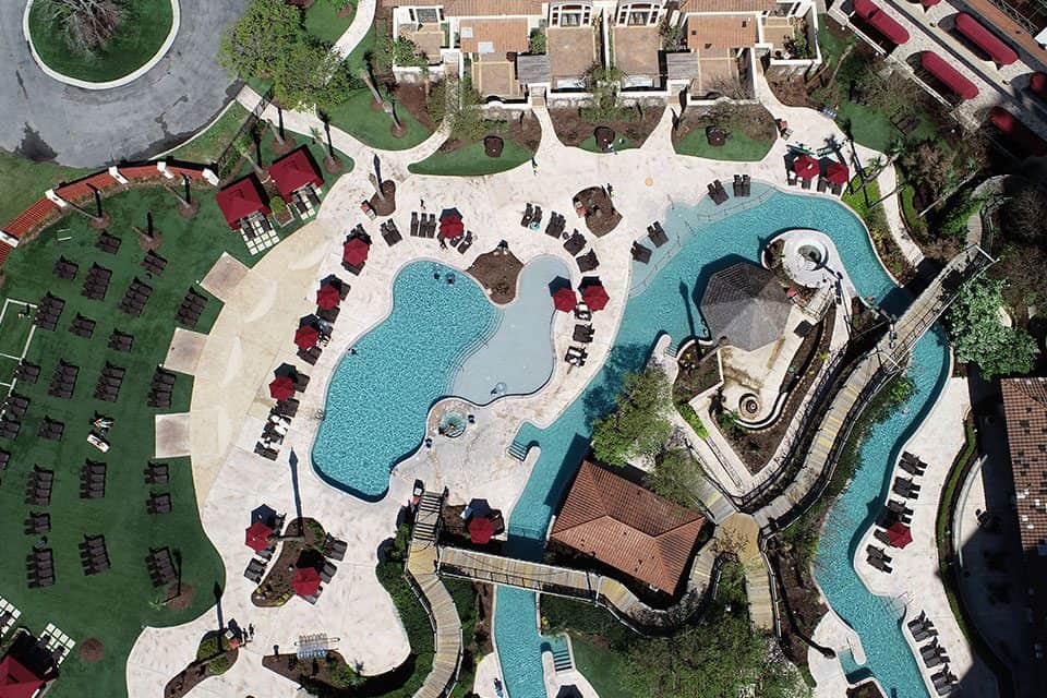
Hospitality
Using drones, hotels, casinos, spas, and resorts can get 360-degree aerial shots of their property. These images can be used for an array of collateral like websites, brochures and presentations.
Tourism
Drones provide affordable and beautiful destination videos without compromising quality. Capture stunning footage to create dazzling destination videos.
Property Mapping & Inspections
Drones can also assist with comprehensive asset and property maintenance and management and take scheduled footage of a property for grounds inspection, equipment inspection, and maintenance prioritization. For example, theme parks and tourist attractions can leverage drones for regular site inspections that streamline maintenance and ensure every area – even previously inaccessible areas – get checked.
Choosing FlyGuys for Drone Photography & Videography
FlyGuys is a national company with a large network of FAA-certified, insured pilots led by a team of experienced project managers on hand to meet any photography or videography need, from single projects to ongoing photography needs. With rapid turnaround times, competitive prices, and high-quality deliverables, FlyGuys has a proven track record of quality and reliability in drone photography and videography services.
Get A Quote
Take Your Project To New Heights
No matter where your project is located, FlyGuys connects you with certified, FAA-compliant drone pilots ready to capture the data you need—quickly, safely, and reliably.
Request a quote today and let our team match you with the right drone solution for your project.
Please note that we are currently unable to assist in the search for missing pets. This limitation is due to the specific challenges and regulations associated with using drones for such purposes.