
Drone data for smarter real estate decisions
Unlock fast, accurate property insights with aerial data capture
Whether you’re evaluating an investment, managing assets, or preparing to market a property, FlyGuys provides high-quality drone data that brings clarity to every stage of the commercial real estate process. Our nationwide network of FAA-certified pilots delivers the visuals and analysis you need—safely, efficiently, and at scale.
See More, Know More with Drone Technology
Real Estate Drone Photography
Showcase properties from every angle with high-resolution images captured from above. Ideal for listings, appraisals, and site evaluations, real estate drone photography enhances your marketing and gives stakeholders a clear view of assets, without ever stepping on site.
Real Estate Drone Services
From property overviews and site mapping to ongoing inspection support, FlyGuys delivers real estate drone services that are tailored to your objectives. We help brokers, developers, and owners reduce risk, plan smarter, and lease faster using precise aerial data.
Real Estate Drone Videography
FlyGuys creates sweeping, cinematic content through real estate drone videography, transforming property tours into immersive experiences. These dynamic videos help listings stand out and support virtual walkthroughs for remote investors or tenants.
Site Intelligence
& Risk Assessment
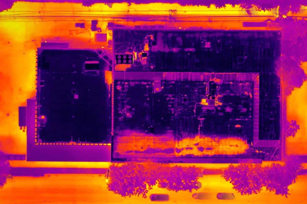
Structural & Roof Data
- Identify potential issues like water damage, HVAC failure, or facade deterioration
- Use thermal imaging to uncover insulation inefficiencies or hidden moisture
- Monitor site health with scheduled drone missions

Drones for Insurance Inspections
Document baseline conditions, detect hazards, and speed up claims processing. Our drone flights provide objective data that supports smarter underwriting and faster response in the event of a loss.
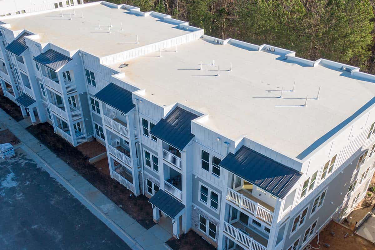
Roof Inspections for Insurance
Capture every inch of a property’s rooftop—without ever climbing a ladder. Our drone-based roof inspections for insurance providers deliver accurate, timestamped imagery that helps validate claims and minimize disputes.
WHY CRE PROFESSIONALS PARTNER WITH FLYGUYS
| Need | Solution |
|---|---|
| Due Diligence | Detailed visuals and environmental analysis for confident decision-making |
| Development Planning | Slope, drainage, and zoning insights with topographic maps |
| Portfolio Management | Periodic condition monitoring and data archiving |
| Marketing & Leasing | Stunning visual assets that attract and convert prospects |
THE FLYGUYS DIFFERENCE
- Nationwide Coverage: Deploying FAA-certified drone pilots anywhere you need
- Quick Turnarounds: Get data, imagery, and reports in days, not weeks
- Comprehensive Deliverables: From 2D maps to 3D models and thermal overlays
- Secure Data Access: Easily manage and share your insights through our online platform
Get A Quote
Take Your Project To New Heights
No matter where your project is located, FlyGuys connects you with certified, FAA-compliant drone pilots ready to capture the data you need—quickly, safely, and reliably.
Request a quote today and let our team match you with the right drone solution for your project.
Please note that we are currently unable to assist in the search for missing pets. This limitation is due to the specific challenges and regulations associated with using drones for such purposes.