Counting What Counts
Advancing Chestnut Breeding and Pre-Harvest Yield Intelligence with Precision Drone Data
The Savanna Institute, a Midwest-based nonprofit dedicated to advancing agroforestry, partnered with FlyGuys to solve a persistent research challenge: accurately estimating chestnut yield at the individual tree level. Through a custom drone capture strategy across a 50-acre Ohio orchard, FlyGuys delivered ultra-high-resolution imagery that enabled the Institute to train an AI model to count chestnut burrs. This task was previously impossible with their own equipment. The result is a scalable, non-destructive workflow that benefits both breeding research and forward-thinking crop farmers.
Executive Summary
The Savanna Institute works to promote agroforestry systems that intentionally integrate trees—such as chestnuts—into working farmland. As part of its breeding program, the Institute needed a reliable way to measure yield at the individual tree level across thousands of trees.
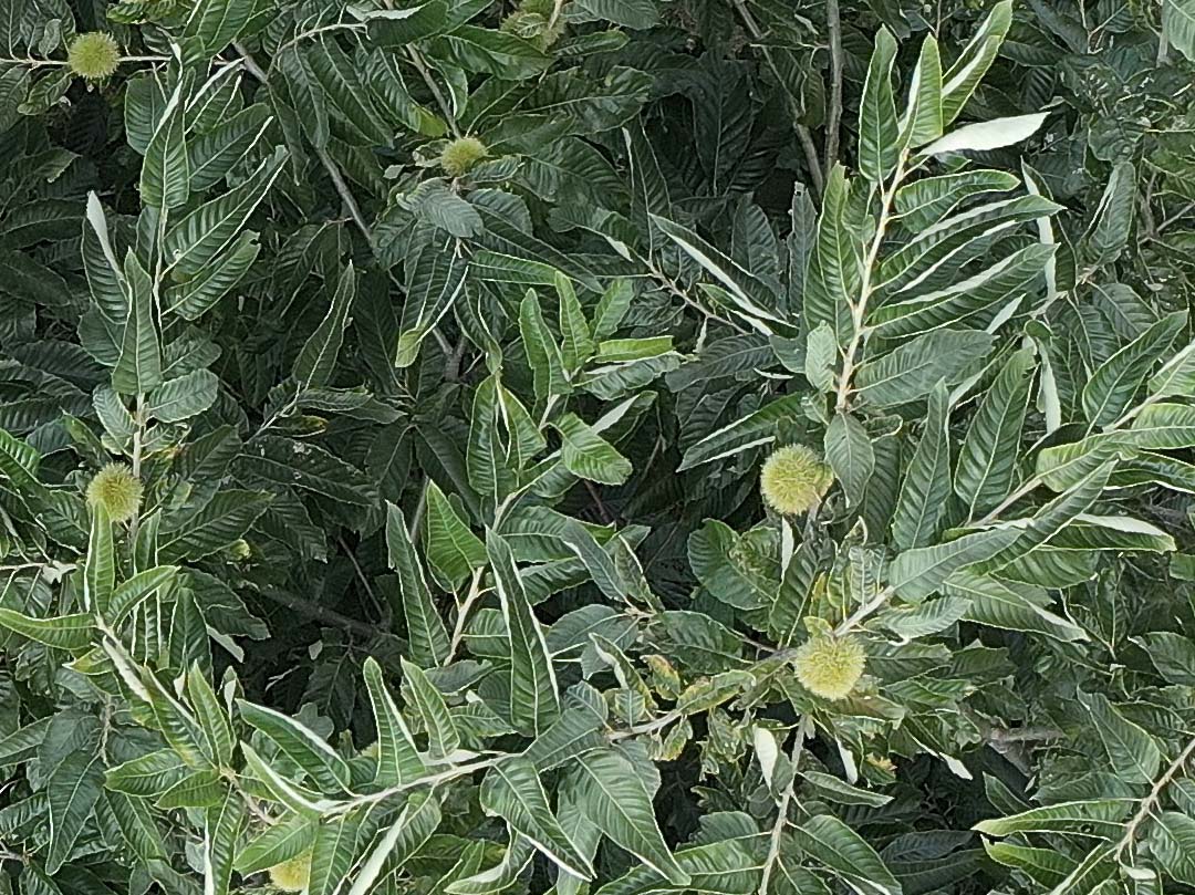
Traditional methods were destructive and time-intensive. Previous drone attempts failed to provide imagery detailed enough to distinguish green burrs from foliage.
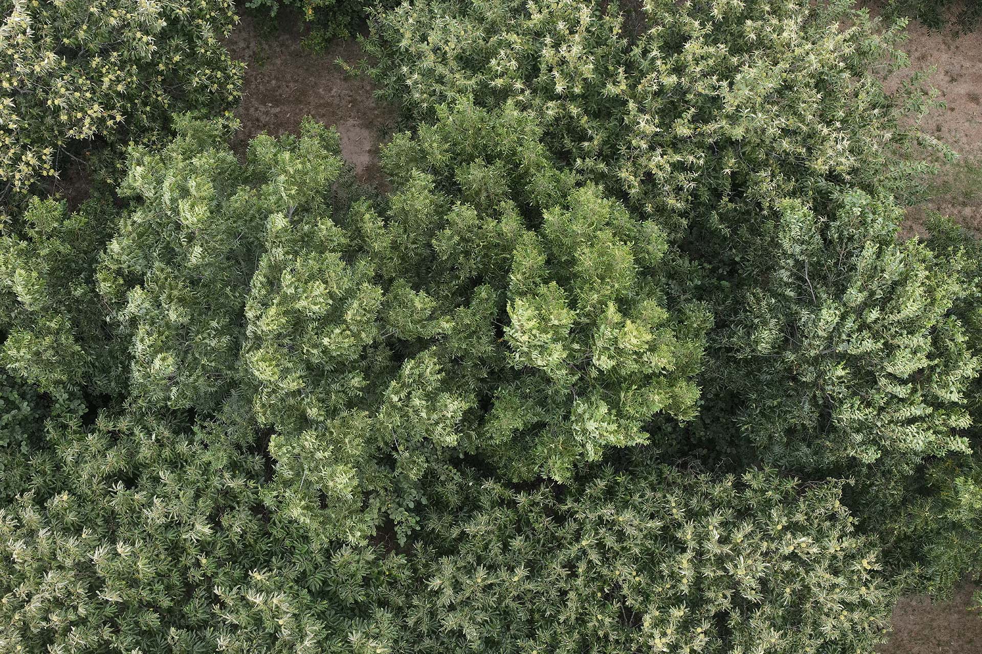
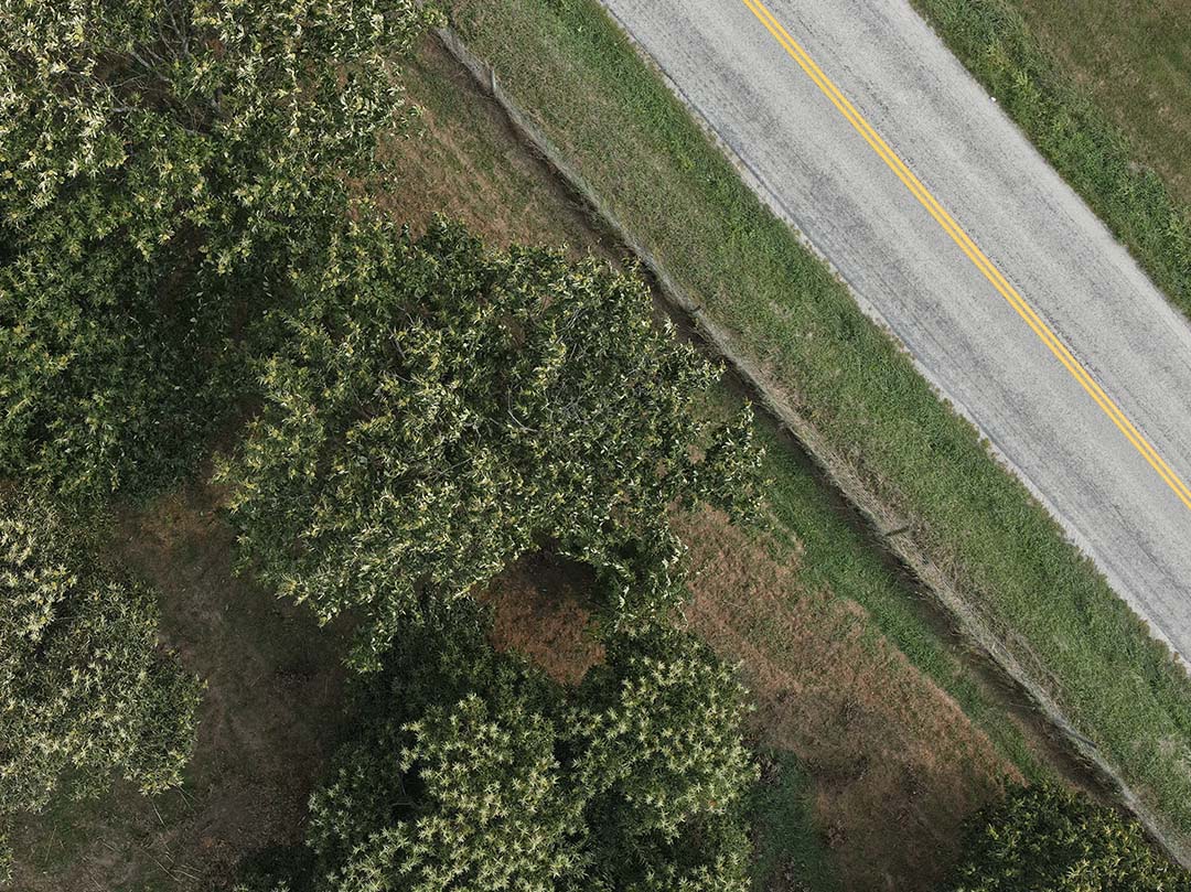
FlyGuys designed and executed a bespoke drone data capture strategy, flying approximately 50 acres and 5,500 mature chestnut trees in two days. The resulting imagery enabled the Institute to train an AI model to automatically count burrs per tree, unlocking a faster, scalable method for yield estimation and breeding selection.
The Challenge
Chestnuts are terminally bearing crops, meaning burrs form at the outer canopy. Because mature chestnut trees are tall and dense:
- Burrs are difficult to see from the ground
- Yield cannot be accurately estimated prior to harvest
- Harvested nuts are aggregated, eliminating tree-level data
- Farmers cannot identify their highest-performing trees
- Breeders lack efficient tools to select superior genetics
For research purposes, the only reliable “ground-truth” method required cutting down trees and manually counting burrs, taking approximately 30 minutes per tree. At scale, this approach was unsustainable.
The Institute had previously experimented with drones, but:
- Image resolution was insufficient
- Burrs could not be distinguished from leaves
- Flight planning lacked precision
- AI model training was not viable
The concept was sound, but execution required higher-quality data and technical expertise.

The Solution
After searching for specialized drone providers, the Savanna Institute selected FlyGuys, one of the few companies capable of responding to the niche research request.
Rather than delivering a standard agricultural NDVI flight, FlyGuys developed a custom capture workflow tailored to tree-level yield analysis.
Dual-Flight Strategy
FlyGuys conducted:
- A standard orthomosaic flight to reconstruct the entire orchard in 3D
- Waypoint-guided stationary captures above each individual tree (~30 seconds per tree)
This approach enabled:
- Tree canopy segmentation
- Individual tree analysis
- Ultra-high-resolution burr visibility
- AI training dataset generation
With RTK-guided systems, advanced flight planning, and high-fidelity sensors, FlyGuys provided a complete, standardized data acquisition solution, serving as a data conduit between the research team and verified professional pilots.
The result was imagery that was described as “more than twice as good” as previous attempts, finally allowing burrs to be clearly distinguished from foliage.


Implementation Process
The project was executed over two days, covering:
- 50 acres
- Approximately 5,500 mature chestnut trees
Approximately 5,500 mature chestnut trees
Each tree received a dedicated high-resolution stationary capture in addition to full-orchard mapping.
The collaboration included:
- Aligning capture specifications to support AI training requirements
- Coordinating with the research team on flight timing within a tight pre-harvest window
- Delivering datasets structured for downstream analysis
The FlyGuys team ensured standardized capture across thousands of trees, creating repeatable workflows for future breeding cycles.
OUTCOME
Results & ROI
Metric Callouts
- 50 Acres Surveyed
- 5,500 Trees Captured
- 2 Days of Flight Operations
- Reliable and quantifiable metrics for each tree
- ~30 Seconds Per Tree (Drone Capture)
- ~30 Minutes Per Tree (Manual Ground Truth Alternative)
- >2× Imagery Quality Improvement Over Prior Attempts
Research Impact
- Enabled successful training of an AI burr-counting model
- Created scalable, non-destructive yield estimation workflow
- Improved identification of high-performing genetics
- Accelerated breeding selection decisions
- Eliminated need for destructive sampling
Farmer Impact
While the initial application focused on research, the implications for crop farmers are significant:
- Pre-harvest yield estimation
- Improved labor planning
- Better forecasting for pre-sales
- Insight into tree-level productivity and remediation.
As agroforestry adoption expands across the Midwest, yield intelligence at this level could help farmers make more informed management and planting decisions.
Testimonials
What Our Client Says
Our previous drone imagery lacked sufficient resolution to allow for accurate detection of chestnuts in individual tree canopies. FlyGuys was able to provide drone and sensor kits that significantly improved image quality. As we have analyzed this data over the last 6 months, we have been extremely happy with the accuracy of the models we have been able to build.
–Scott Brainard, PhD. Tree Crop Breeder

THE TAKEAWAY
- Agroforestry systems require specialized aerial data solutions
- High-resolution imagery is critical for AI-driven agricultural analysis
- Custom waypoint-guided capture enables tree-level intelligence
- Drone-enabled yield estimation reduces destructive sampling
- Data-driven breeding accelerates climate-adapted crop development
- Precision aerial workflows benefit both researchers and farmers
Looking Ahead
The Savanna Institute continues refining its AI model and exploring how this drone-based workflow can scale across additional orchards and breeding trials. As perennial cropping systems expand in colder Midwest climates, reliable yield intelligence will play a critical role in advancing both scientific research and farm profitability.
Get A Quote
Take Your Project To New Heights
No matter where your project is located, FlyGuys connects you with certified, FAA-compliant drone pilots ready to capture the data you need—quickly, safely, and reliably.
Request a quote today and let our team match you with the right drone solution for your project.
Please note that we are currently unable to assist in the search for missing pets. This limitation is due to the specific challenges and regulations associated with using drones for such purposes.