Raptor Maps & FlyGuys
Services Provided: Aerial Imaging
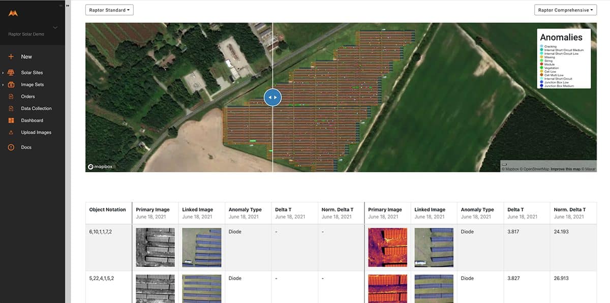
Raptor Maps offers advanced analytics, insights and productivity software for the entire solar lifecycle. The Raptor Solar software platform features a digital twin of your solar sites, aerial thermal inspections, data standardization and normalization, serial number mapping, warranty claim features, equipment records, mobile tools and more — all powered by their industry-leading data model. With intelligence for the entire solar industry — asset owners, managers, O&M, engineers, EPCs, financiers and OEMs — you can standardize and compare data across installations, increase performance, reduce risk and ultimately lift ROI.
Customer Problem
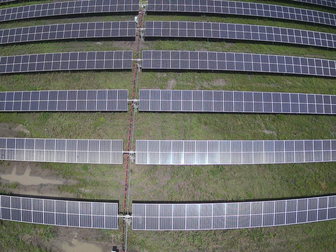
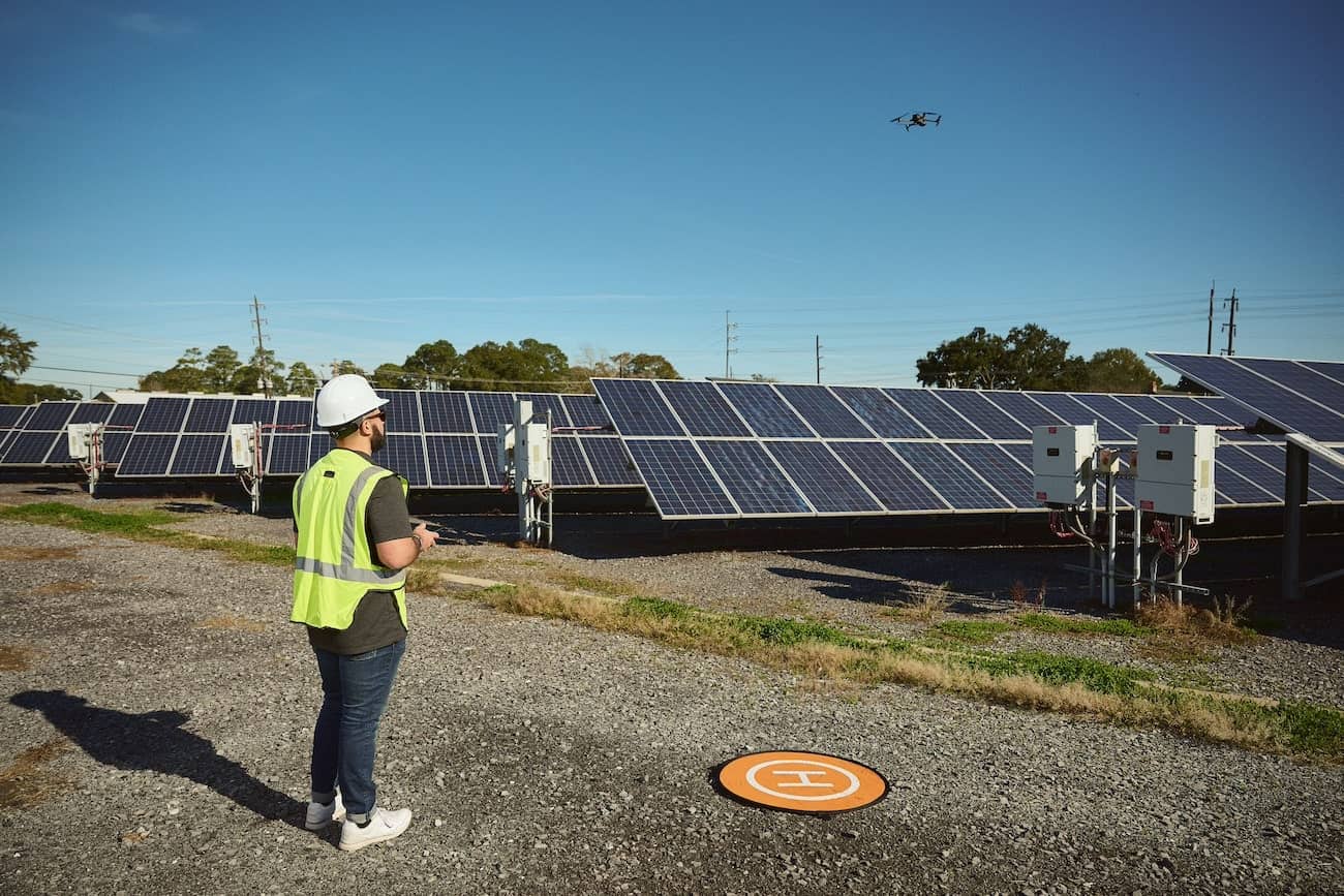
Raptor Maps needed consistent, accurate and timely thermal data from across the country and turned to FlyGuys for a solution. Without the use of drones, gathering data for solar panel analytics is a labor-intensive process which requires manually inspecting each panel. Raptor was looking for a faster, cheaper, and more scalable approach to conducting these inspections.

FlyGuys Solution
FlyGuys performs flights coast-to-coast for Raptor Maps delivering raw thermal data which is then analyzed and used to create extensive reports.
Customer Outcome
Raptor Maps has become one of our largest clients and partners. As we are able to gather the data they rely on, Raptor Maps increased their focus on what they do best – analytics. Their partnership with FlyGuys has eliminated the need for an internal UAV department, resulting in less overhead and headache.
Get A Quote
Take Your Project To New Heights
No matter where your project is located, FlyGuys connects you with certified, FAA-compliant drone pilots ready to capture the data you need—quickly, safely, and reliably.
Request a quote today and let our team match you with the right drone solution for your project.
Please note that we are currently unable to assist in the search for missing pets. This limitation is due to the specific challenges and regulations associated with using drones for such purposes.