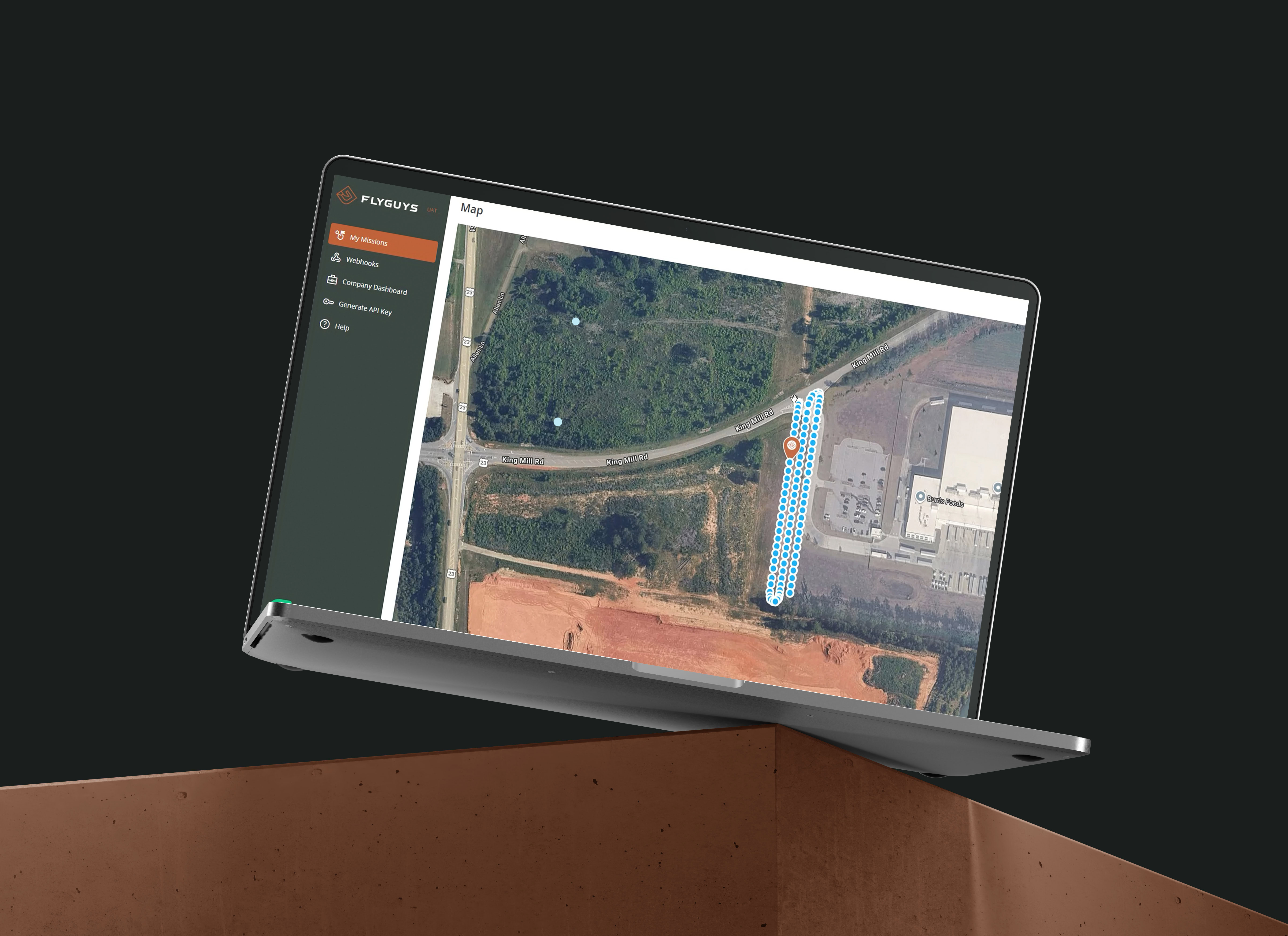
Enterprise Data Capture Software
Manage Every Mission from One Platform
FlyGuys Capture is the leading data capture platform trusted by 500+ organizations across industries, transforming how aerial operations are managed at scale. Our platform covers every step of your workflow—from mission planning and pilot coordination to quality assurance and final delivery—so nothing falls through the cracks.
Whether you’re managing ten sites or ten thousand, FlyGuys Capture removes the operational complexity without sacrificing the precision and reliability your projects demand.

One Source of Truth for Data Capture
Total Project Clarity
Streamlined Mission Management from Start to Finish
Traditional aerial data programs require juggling multiple vendors, chasing uploads, and manually coordinating every mission detail. FlyGuys Capture eliminates that friction with integrated data capture management that handles the entire operational lifecycle. Our platform connects you with a nationwide network of 20,000+ FAA-certified drone pilots while managing scheduling, execution, quality assurance, and structured delivery.
- Full Lifecycle Mission Control: Every step, from request to results—covered.
- Unified Data Management: Data is centralized and connected.
- API-First Architecture: Integrates with the tools you already use.
- Real-Time Visibility: Always know where your mission stands.
Self-Service Portal Eliminates Coordination Overhead
The FlyGuys Capture customer portal transforms mission coordination from a time-consuming back-and-forth process into a streamlined, automated workflow. Our data capture management software features mission-spec templates, automated pricing calculations, and bulk import capabilities for large, multi-site programs.
- Standardized mission intake forms
- Automated pricing and scheduling
- Bulk site import for enterprise programs
All you have to do is submit and step back—we’ll take it from here.
Nationwide Pilot Network and Mission Management
The Right Operator for Every Mission
Identifying, vetting, and coordinating qualified drone pilots across markets requires more time and structure than most teams have.
Our aerial data capture platform automates this entire process through intelligent pilot matching and comprehensive credential verification.
- Quality Assurance: Consistent performance standards across all operators
- Complete Geographic Coverage: 20,000+ FAA-certified pilots across all 50 states
- Automated Pilot Selection: Smart matching based on location, equipment, and qualifications
- Credential Verification: Continuous monitoring of certifications and compliance
- Equipment Tracking: Real-time inventory of available drone technology
Full Visibility, From Takeoff to Delivery
Once missions launch, most platforms go dark, leaving you waiting for completion notifications. FlyGuys Capture maintains complete visibility throughout mission execution with dedicated mobile and web applications for pilots, real-time GPS tracking, and integrated communication tools.
Mission management features:
Field-ready mobile tools for pilots that are offline-capable and GPS-enabled
- Live GPS tracking during flight operations
- Mission-level chat and communication
- Real-time status updates and notifications
- Built-in airspace compliance checking
QA-Validated Data Before Delivery
In unmanaged drone programs, 15–25% of missions require costly reflights due to data quality issues. FlyGuys Capture removes that risk with built-in QA protocols that validate coverage, ensure data integrity, and confirm deliverables meet spec before they ever reach your team.
- Compliance Documentation: Audit-ready records that satisfy procurement, legal, and regulatory requirements
- Automated Quality Checks: Systematic validation of all captured data
- Coverage Verification: Confirmation of complete site documentation
- Data Validation: Technical review of file formats and specifications
- Pre-Delivery Review: Human oversight before final delivery
SLA Monitoring You Can Enforce
In large-scale aerial data programs, the difference between on time and late often comes down to whether anyone was watching. FlyGuys Capture watches everything.
The software includes configurable SLA rules, automated alerts, and portfolio-level performance tracking that ensures on-time delivery across all missions so you always know what’s on track, what’s at risk, and what’s already been escalated.
Performance monitoring includes:
- Complete on-time delivery visibility
- Configurable milestone tracking
- Automated escalation alerts
- Portfolio-level delivery analytics
- Proactive schedule management
What Capture Can Do For You
Every aerial data program is different. Tell us about yours, and we’ll show you exactly how FlyGuys Capture fits. Fill out the form below, and a member of our team will be in touch.

Enterprise Integration and Data Delivery
Data Delivered Directly: Seamless System Integration
Getting captured data into your existing workflows shouldn’t require manual file transfers or format conversions. FlyGuys Capture delivers quality-assured datasets directly to your systems via secure portals, SFTP, or API integration. Our data capture software connects seamlessly with the platforms you already use, helping teams access and act on project information faster.
Whether you operate in cloud-based, on-premises, or hybrid environments, FlyGuys Capture simplifies data delivery and supports more efficient drone mission management with:
- Secure Customer Portal: Browser-based access to project data with role-based permissions, download tracking, and audit trails
- SFTP Integration: Encrypted server-to-server file transfers with automated delivery and confirmation
- API Access: RESTful APIs for programmatic data retrieval, metadata queries, and real-time status monitoring
- Enterprise Connectivity: Integration with leading construction management, GIS, and cloud storage platforms
- Automated Ingestion: Configurable data pipelines that move information from our data capture software directly into your workflows
- Custom Webhooks: Event-driven notifications that trigger downstream workflows when new data becomes available
- Bulk Export Tools: High-volume transfer capabilities optimized for large-scale programs
- Flexible Delivery Options: Real-time or scheduled batch delivery to support operational requirements and drone mission management processes
- Monitoring & Auditability: Comprehensive logging and tracking to support governance, compliance, and troubleshooting
The result is a streamlined data delivery process that reduces manual handling, maintains project momentum, and ensures captured data reaches the right systems quickly and securely.
Industry-Specific Applications
Construction Project Management
Multi-site drone services in construction programs require consistent aerial documentation to maintain project schedules and budget control. Our data management software supports progress monitoring, as-built documentation, stockpile measurement, and inspection-ready deliverables across entire project portfolios.
- Multi-site progress monitoring at scale
- Automated as-built documentation
- Precise stockpile and earthwork measurement
- Inspection-ready deliverable generation
- Zero coordination overhead across sites
Telecommunications & Cell Tower Management
With over 400,000 cell tower sites requiring periodic inspection and ongoing 5G infrastructure development, telecommunications companies need scalable inspection solutions. Our platform delivers tower inspection at national scale with rapid deployment and standardized deliverables.
- National-scale tower inspection programs
- Rapid deployment across all geographies
- Pre- and post-construction documentation
- Standardized deliverable formats
- Significant reduction in tower climb requirements
Agriculture
Large-scale agricultural operations demand timely, accurate field data that ground-level scouting simply can’t deliver at scale. FlyGuys Capture enables precision agriculture through recurring aerial data collection—monitoring crop health, soil conditions, and field variability automatically across every acre.
- High-resolution NDVI and multispectral crop health monitoring
- Early detection of crop stress, pest pressure, and irrigation inefficiencies
- Soil moisture and fertility mapping for smarter input management
- Automated recurring flight schedules across large acreage
- Structured datasets compatible with ag-tech AI and analytics platforms
Energy and Utilities Infrastructure
Distributed energy assets require regular inspection programs that traditional methods can’t scale effectively. FlyGuys Capture enables transmission line inspection, compliance documentation, and recurring inspection programs that operate automatically.
- Comprehensive transmission line assessment
- Compliance-ready audit documentation
- Automated recurring inspection schedules
- Remote site access without crew deployment
- Reduced safety risk for inspection teams
Insurance
Property assessment and claims workflows depend on accurate, defensible visual data, and traditional inspection methods create delays, safety risks, and gaps in documentation. FlyGuys Capture enables drone-based insurance inspections that deliver timestamped, geolocated aerial imagery for underwriting, claims processing, and fraud mitigation automatically.
- Roof and exterior condition documentation for underwriting and risk assessment
- Pre- and post-event imagery for accurate claims validation
- Tamper-proof, timestamped audit trails to reduce fraud and disputes
- Automated recurring property inspections across large portfolios
- API-compatible data delivery for seamless integration with claims platforms
Why Choose FlyGuys Capture?
Proven Scale and Performance
FlyGuys Capture currently serves 500+ active enterprise customers running comprehensive aerial programs across every major industry vertical. Our platform manages thousands of missions monthly with 48-hour turnaround capability for time-sensitive projects.
Our proven track record includes:
- 20,000+ FAA-Certified Pilots: Complete coverage across all 50 states
- 500+ Active Customers: Enterprise programs running today
- 70,000 Projected Missions: Anticipated 2026 mission volume
- 48-Hour Turnaround: Rapid deployment for urgent requirements
- 40-60% Cost Reduction: Compared to traditional inspection methods
Your Goals Drive Every Mission
Every aerial data program has unique requirements based on scope, terrain, timeline, and deliverable specifications. FlyGuys customizes every drone mission management program to fit your specific needs, then deploys the right team from our nationwide pilot network to execute flawlessly.
Our commitment to quality includes meticulous QA/QC review of every dataset before delivery, ensuring you can trust the data and apply it with complete confidence in your decision-making processes.
Schedule a Demo
Put Your Data to Work
FlyGuys Capture eliminates the complexity of managing large-scale aerial data programs while delivering the precision and reliability your projects demand. Our comprehensive data capture software handles every operational detail, from pilot coordination to final delivery, so your team can focus on making informed decisions rather than managing logistics.
Ready to streamline your aerial operations? Contact our team to schedule a demonstration of FlyGuys Capture and discover how our platform can transform your data capture workflow. Whether you’re planning your first aerial program or scaling an existing operation, we’re ready to deploy the right solution for your needs.
Please note that we are currently unable to assist in the search for missing pets. This limitation is due to the specific challenges and regulations associated with using drones for such purposes.