
Turnkey Nationwide Drone Services
Let Your Projects Take Flight
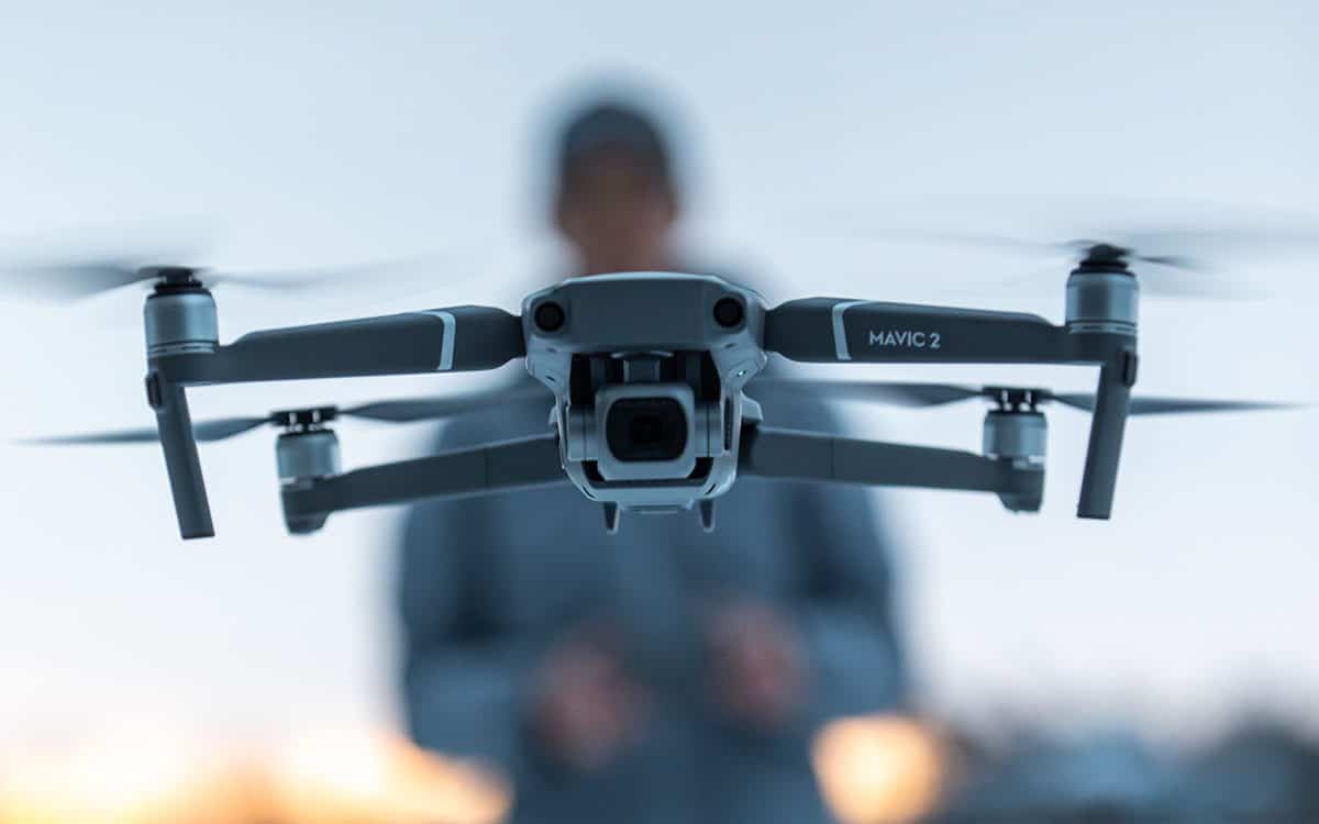
Our pilots fly your location
FlyGuys makes capturing video, imagery, and data via drones simple.
- Our pilots fly your location
- We capture high-resolution imagery and data
- We deliver actionable insights
Put our drones to work and save time and money while improving safety.
Expertise Across Industries
Request a Drone Service Quote
“We needed a quick turnaround on a substantial LiDAR project. FlyGuys responded and arranged the service quickly. The work was performed professionally and we received high-quality assets. We will be working with FlyGuys for the foreseeable future.”
William Hayes

“FlyGuys offered wonderful data and service at a great value point. Easy navigation of their online platform, quick coordination about needs and offerings, and professional collection and sharing of products made for a fantastic resource in developing our projects.”
John Handley

“FlyGuys performed an aerial LiDAR collection that was used to create a topographical map for our client. Their team helped us achieve a fast, accurate result over a large and densely vegetated area.”
Jeff Collins, P.S.

Diverse Capabilities
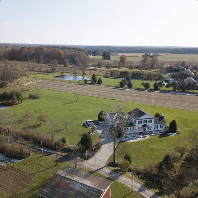
HD still and video imagery
Aerial imaging generates interest and excitement in your audience and prompts action: more vacation bookings or high-end homes sold. A better fan experience. Quicker and more efficient inspections. The panoramic aerial vantage point is sure to amaze and inspire action.
Stunning HD aerial still and video imagery can be used for TV or movies, sporting or concert events, or corporate/brand marketing.
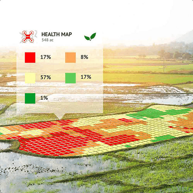
Thermal / Infrared (Multispectral) Imaging
Anything with a temperature above absolute zero emits infrared radiation. A thermal imaging camera capitalizes on this to illuminate otherwise imperceptible temperature variations, providing visual insight to an environment even without light.
A powerful tool with many applications, aerial thermal imaging provides safety personnel with the critical insight needed to fight active wildfires. In construction environments, it’s used to detect water leaks or energy loss.
In precision agriculture, thermal or near-infrared aerial imagery is used to boost crop production through assessment of soil, location of weed outbreaks, and evaluation of crop consistency.
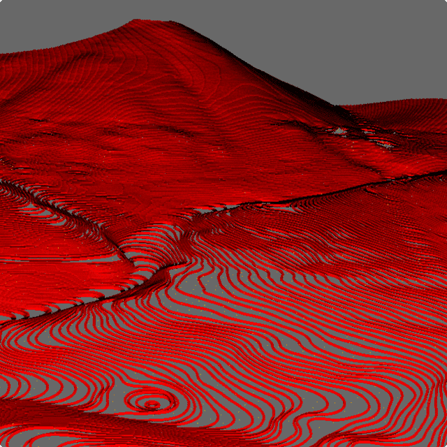
Topographical Imagery
LiDAR-capable drones serve as another powerful tool to map land formations or bodies of water, giving scientists and surveyors a significant edge through precision topographical imagery.
Among its many applications, topographic imagery provides data for geographic information systems used for emergency response. In civil engineering, contractors also use drone technology to support land development projects at a fraction of the cost of manned aircraft.
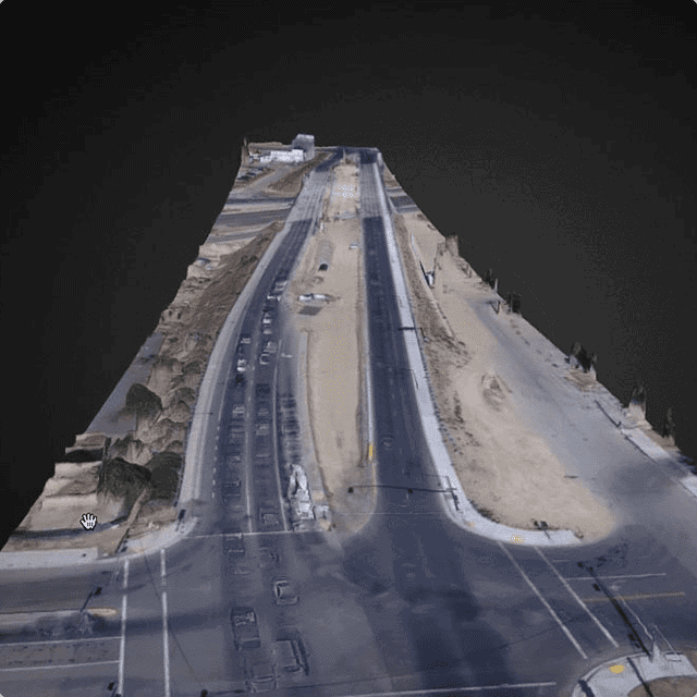
3D / Volumetric Models
Multiple images can even be combined to create a detailed photographic map, geometrically corrected to remove any distortion – far superior to a conventional 2D map. Combining a series of aerial images with modeling software to create 3D or volumetric models enables professionals to quickly and affordably evaluate topography, monitor progress of projects, or keep an eye on soil erosion.
Reach for the Sky
From mines and quarries to precarious structures and remote locations, many environments present logistical difficulties and safety hazards that present obstacles to traditional solutions. Fortunately, drones can fly where larger aircraft can’t, as well as to sites where it’s unsafe to send people. Drone-based aerial imaging also provides more comprehensive insights into your assets and projects. With drone technology, even the sky is not the limit; the only limit is your imagination.
Located across the United States, FlyGuys drone pilots are professionally certified, fully insured, and FAA-compliant.